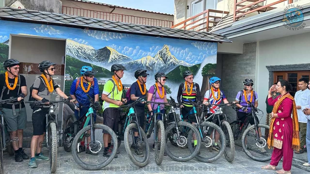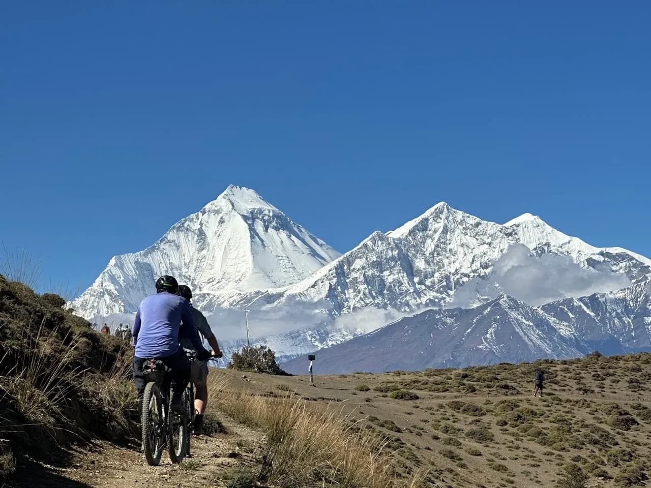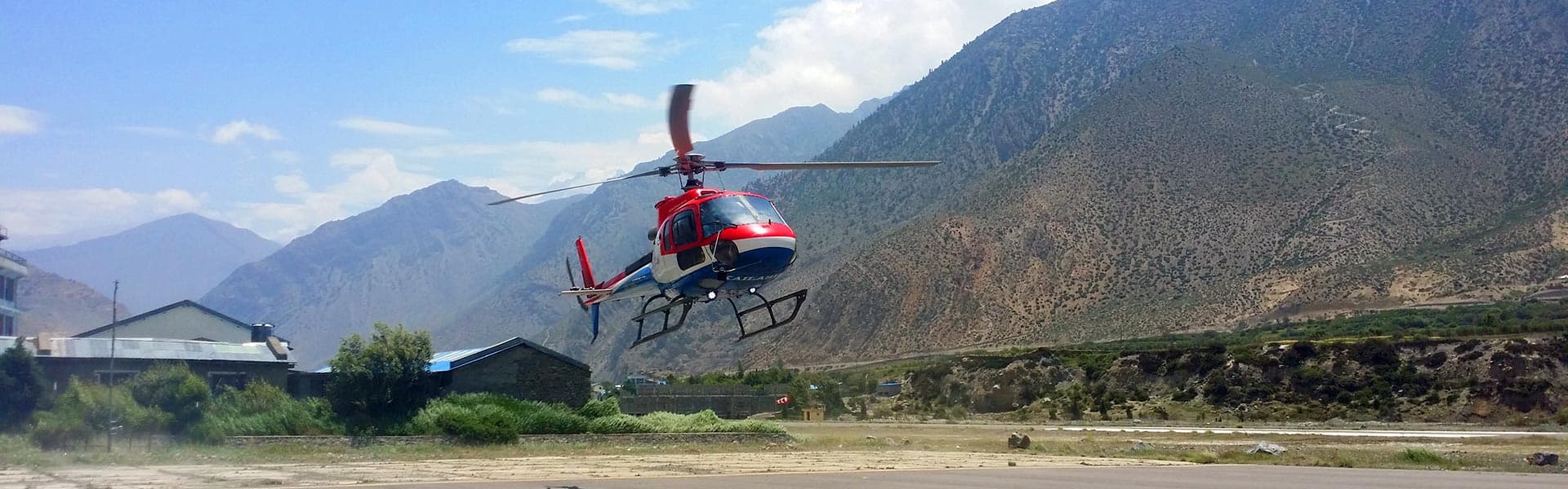



Lower Mustang is one of Nepal's best-known mountain biking regions. It is a high desert valley in the north of the country, sitting behind Dhaulagiri and Annapurna in their rain shadow. Riders fly into Jomsom on a twenty-minute flight, climb to the temple at Muktinath, and then spend the following days descending through the deepest valley on earth to the hot springs at Tatopani and out to the road head at Beni.
Hundreds of riders come here every year, and most arrive knowing very little about it. The practical information a rider actually needs- how hard the trails are, which permit applies, what bike suits the ground, how the altitude behaves, why the wind picks up at ten every morning- is scattered and hard to find in one place.
We have guided this valley since 2004 and scouted every trail described below ourselves. This guide is what we would tell a friend who was planning to ride here. You do not need to book anything to use it.
Where Lower Mustang is, and what makes it different to ride
Mustang is a district in north-central Nepal, between the Annapurna range to the east and the Dhaulagiri range to the west, running north to the Chinese border. The whole district drains into one river, the Kali Gandaki, so everything runs north to south along a single corridor.
The district splits in two, and the split is administrative rather than scenic. Lower Mustang is everything south of the village of Kagbeni. It is open to anyone holding a conservation permit. Upper Mustang is everything north of it, and that is a restricted area needing a separate permit and a licensed guide.
Why it looks like Tibet
The Annapurna and Dhaulagiri walls block the monsoon. Clouds move north from India, hit those two eight-thousand-metre barriers, and drop their water on the southern side. What spills over the top is dry.
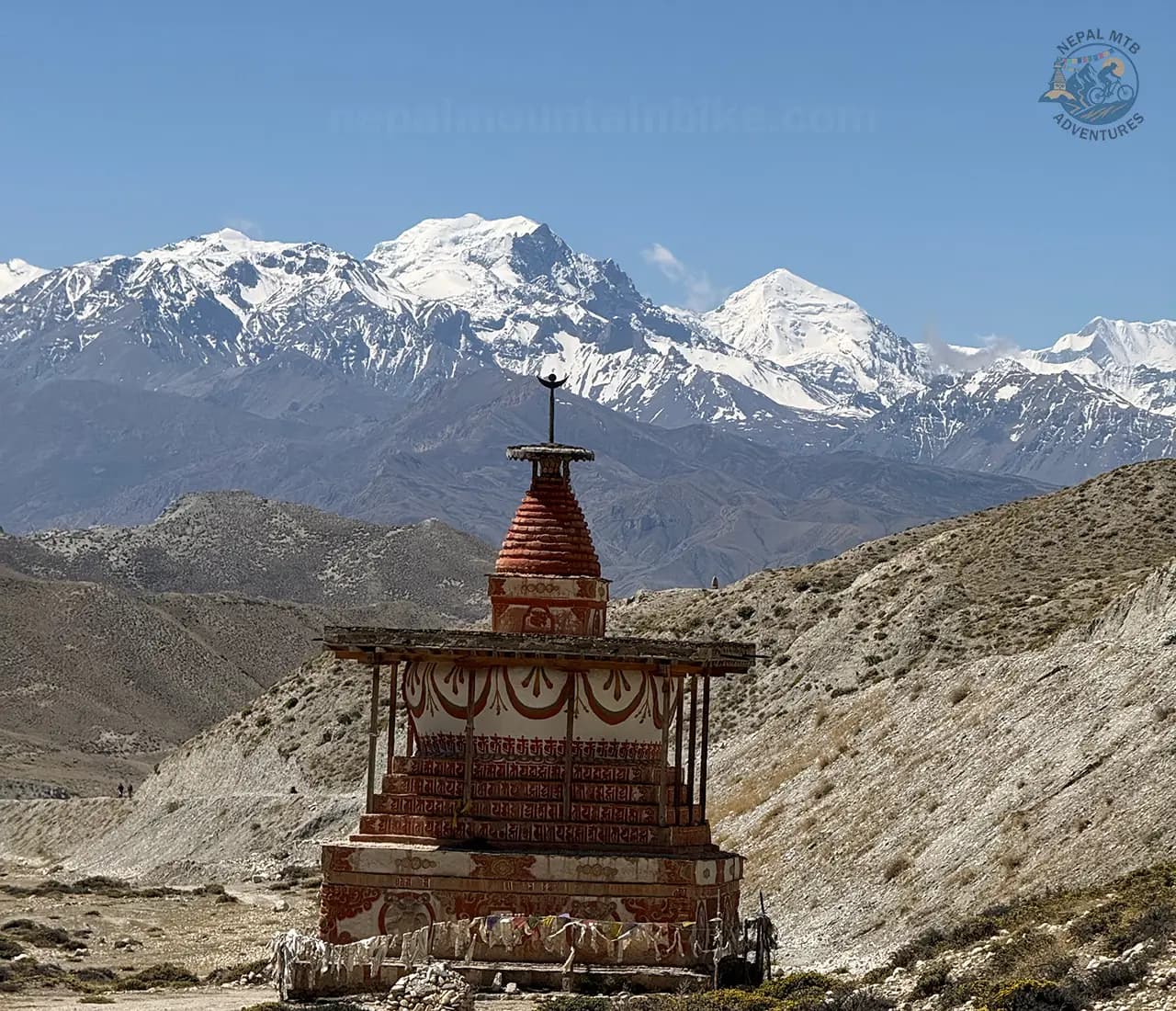
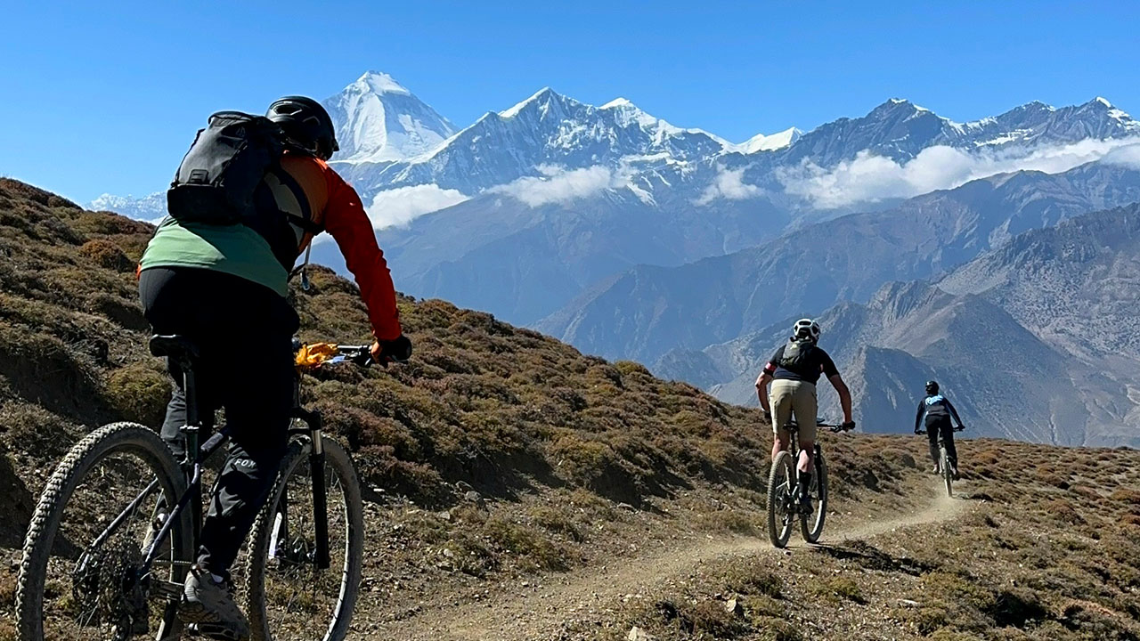
So the southern end of the valley around Ghasa and Lete is still green pine forest, and by the time you are north of Marpha the hillsides are bare ochre and grey, cut into cliffs and gullies, with nothing growing except irrigated barley and apple orchards where a village has channelled a stream. You ride through that entire transition in a single day.
What makes it good riding
Four things, and they are worth understanding because they are why this region works for bikes when a lot of the Himalaya does not.
It is dry. No mud, almost no roots, and a long season. The ground is compacted gravel, dust over hardpack and shattered rock.
It is asymmetric. There is essentially one climb on the whole route and then days of descending. You gain your altitude in an aircraft and lose it under your tyres.
There are two parallel networks. A road runs up the valley floor, and a network of centuries-old walking trails runs above it and around it, linking the same villages by better lines.
A vehicle can reach most of it. That sounds unromantic, and it changes everything. It means climbs can be shuttled, riders of different strengths can split and meet up, and a mechanical or an altitude problem does not end your trip.
Altitudes along the route
Place | Altitude | What it is |
Ranipauwa | around 3,760 m | The lodge village where you sleep at Muktinath |
Muktinath temple | 3,710 m | The high point of a normal ride |
Jharkot | around 3,550 m | Fortified village on the Muktinath climb |
Dhumba Lake | around 2,830 m | Sacred lake near Thini, above Jomsom |
Kagbeni | 2,810 m | Gateway village, and the restricted area line |
Jomsom | around 2,720 m | Airstrip, district headquarters, the hub |
Marpha | around 2,670 m | Apple village |
Tukuche | around 2,590 m | Old salt trade town |
Kalopani and Lete | around 2,530 m | Pine forest, the greenest riding |
Ghasa | around 2,010 m | The tree line, the end of the desert |
Tatopani | around 1,190 m | Hot springs |
Beni | around 850 m | Road head, the exit |
Muktinath is worth being precise about, because two figures circulate and both are correct. The temple sits at 3,710 metres. Ranipauwa, the lodge village where you actually sleep, is a little higher at around 3,760 metres.
The route: Jomsom, Kagbeni, Muktinath and the gorge
Almost every Lower Mustang ride is built from three pieces. Understanding them makes any itinerary you read, including your own, much easier to judge.
The valley floor, Jomsom to Kagbeni. Twelve to fifteen kilometres north along river terraces and gravel bars, gaining about 150 metres. Flat, open, exposed to the wind, and technically easy. This is where you spend your first hours at altitude.
The Muktinath climb, Kagbeni to Ranipauwa. Eighteen to twenty kilometres east and uphill into the Jhong Khola side valley, about 1,000 metres of climbing for a net gain of 950. This is the only significant climb on the route, and it is mostly on sealed road now.
The descent: Muktinath back down to Tatopani. Everything after Muktinath goes downhill. It runs through the Lupra side canyon, back onto the valley floor, then south down the Kali Gandaki through Marpha, Tukuche, Kalopani and Ghasa to the hot springs at Tatopani. From 3,710 metres to 1,190 metres, more than 2,500 metres of net descent spread across several days.
How many days do you actually need?
Riding days | Total trip, including travel | |
The core route, Jomsom to Beni | 5 | 8 days from landing in Kathmandu to leaving it |
Core route plus an acclimatisation day at Jomsom | 6 | 9 days |
The above plus two shakedown days riding around Pokhara | 8 | |
The above plus the Thorong Phedi option and a spare weather day | 10 | 13 days |
The five riding days are fixed. Everything beyond that is padding you choose: an acclimatization day, a couple of days riding around Pokhara to get used to your bike, and at least one spare day for a cancelled flight or a closed road.
Trail surface: how much is singletrack and how much is road
This is the question that decides whether you enjoy the week, so it is worth being clear about.
The corridor from Beni to Jomsom to Kagbeni is a road, rough and unpaved for much of its length and being blacktopped in stages. A ride that only followed that corridor would be a week on a dirt road with buses on it.
So the route is really a series of decisions about when to leave the road. Across a normal week, the surface breaks down roughly like this:
Surface | Share of a normal week | Where |
Singletrack and old walking trail | 30 to 40 percent | Lupra, the Jhong and Jharkot lines, Thini and Dhumba, the pine forest around Lete and Kalopani |
Jeep track and dirt road | 35 to 45 percent | The Muktinath climb, links between villages, much of the gorge |
Riverbed and gravel bar | 10 to 15 percent | The Kali Gandaki bed between Jomsom and Kagbeni |
Tarmac | 10 to 15 percent | The Muktinath road, and the blacktop creeping north from Beni |
Those are ranges because it genuinely depends on the group. A confident group takes more singletrack; a mixed group takes more road. If you want to know how we grade what you end up riding, the trail grading system we use in Nepal explains the scale.
What the surface feels like
Dry, loose, rocky, and grippy in an unusual way. Almost no mud and almost no roots, which makes it completely different from riding around Pokhara or Kathmandu.
What it does have is loose rock on steep gradients, sandy runouts, and long stretches where the trail is a single line cut across a slope with a lot of air on one side. Riders arrive braced for thin air and get caught out by how little the ground holds on to a tyre.
Lower Mustang trails: distances, drops and what to expect
These are the named lines that make up the riding here, with what to expect on each. Lupra in particular turns up on most lists of the best Himalayan trails in Nepal, and it earns the place.
Jomsom to Kagbeni, along the river terraces
12 to 15 km - about 150 m of gain - easy, exposed, windy
River terraces and gravel bars heading north, with the valley opening out and the wind starting to make itself known. Nothing here is technical. Its job is to let your body meet the altitude while your legs do very little.
Thini, Dhumba Lake and the Yhara Zho viewpoint
Around 900 m of descent - the best singletrack near Jomsom
Thini is one of the oldest villages in Thak Khola, on the terrace above Jomsom. Above it is a viewpoint local guides call Yhara Zho at around 3,700 metres, and below it lies Dhumba Lake, a small green lake at about 2,830 metres held sacred by Buddhists and Hindus alike, with Nilgiri standing behind it.
Kagbeni to Muktinath, the one climb
18 to 20 km - about 1,000 m of climbing for a net gain of 950 m - 4 to 6 hours - sustained, mostly sealed, at altitude
The crux of the route. You leave Kagbeni at 2,810 metres and arrive at Ranipauwa at around 3,760 metres. The road is sealed for much of it now, which sounds easy and is not, because the air at the top holds about 64 percent of the oxygen you are used to.
The Jhong and Jharkot lines
Village trails, ruins, moderate technical
There are two ways up and several ways down. The Jharkot line runs through a fortified village on a ridge with an old fort, a red-walled gompa and a Tibetan herbal medicine centre. It is the natural tea stop. The Jhong line runs higher, past a ruined fort and a cave complex cut into the cliff, and the trails around it are the better technical riding on the plateau.
Lupra, the signature descent
900 to 1,000 m of descent - the most technical riding in Lower Mustang
From the Muktinath plateau, the trail climbs briefly to the Lupra Pass, where Dhaulagiri and the Annapurnas stand across the main valley, then drops into a narrow side canyon.
The upper section is loose and steep with switchbacks over shale. The middle section is why people come: grippy, flowing singletrack along the canyon wall above a stream, with eroded rock towers standing over the trail. It runs out at Lupra village, and the last stretch follows the streambed to Ekle Bhatti on the main valley floor, a short pedal from Kagbeni or Jomsom.
The Jomsom View Tower descent
600 to 800 m of descent - fast, exposed, big views
A climb or vehicle uplift to the tower on the ridge above Jomsom, then a descent to the valley floor and on towards Marpha. From the top you look straight down the trench, with Nilgiri and Dhaulagiri filling opposite ends of the view.
The trail is open hillside rather than canyon. Wide, fast, dusty, with the line braiding across the slope, and enough loose rock in the upper third that carrying speed is the wrong instinct for the first two minutes.
Marpha to Tatopani, via Kalopani and the Thasang climb
44 to 49 km - about 1,880 m of loss - long, mixed, four climate zones
The longest day of the route and the one that goes through the deepest part of the gorge. You leave Marpha in apple orchards and desert light, cross suspension bridges over the Kali Gandaki, climb towards Thasang, then descend along the river as the vegetation changes completely underneath you.
The fatigue on this day is not from climbing. It is accumulated braking, vibration, and concentration.
Tatopani to Beni
45 to 50 km - warm, green, fast
Below Ghasa, the walls close in and the trail runs on ledges and old stone steps above the river, with the water loud enough that you stop hearing the bikes. Then it opens out. Pines give way to banana and orange trees, the air goes thick and warm after four days of thin, dry cold, and you pass rice terraces and schoolchildren instead of yaks and chortens.
Thorong Phedi and Thorong La
Up to 1,700 m of descent - a mountaineering day with a bike on your back
An option rather than part of the normal route. You push and carry from Muktinath towards Thorong Phedi at around 4,450 metres, or if you are strong and properly acclimatised, all the way to the pass at 5,416 metres, then ride the whole thing back down. Horses can carry bikes on the way up.
The hike to the pass is around six hours of ascent at extreme altitude with a bike. It belongs to riders who have already spent several days above 3,500 metres, and it is not something to attempt on your second day in the valley.
How difficult is Lower Mustang mountain biking?
Moderate for a rider with a season of off-road experience behind them. It is not an expert-only region, and it is not a beginner's first mountain bike trip either.
The riding itself is not the hard part. The daily distances are modest, and most of the route goes downhill. What makes it demanding is the combination of altitude, a loose surface that does not grip predictably, and several long descent days in a row.
The clearest way to judge it is the table below, which breaks the route down section by section rather than giving you one word for the whole week. It uses the same grading language we apply across Nepal.
Where the difficulty actually sits
Section | Difficulty | Why |
Jomsom to Kagbeni | Easy | Flat, wide, no technical features. Wind is the only factor |
Kagbeni to Muktinath | Hard, but not technical | 1,000 m of climbing at altitude on a sealed road |
Jhong and Jharkot lines | Moderate | Village trails, some loose sections, nothing severe |
Lupra descent | Technical | Steep loose upper section, exposed singletrack, the crux |
Marpha to Tatopani | Moderate but long | 1,880 m of descent. Difficulty is duration, not features |
Tatopani to Beni | Easy | Fast and mostly good surface |
Thorong Phedi option | Very hard | Hike a bike at extreme altitude |
The honest summary is that one trail on the route is genuinely technical and everything else is moderate or easier. If you can handle the Lupra descent, or you are content to walk two or three short sections of it, the rest of the region is well within reach.
The three things riders underestimate
Altitude. Everything above Jomsom is over 2,700 metres, and Muktinath is 3,710 metres. Your usable power drops noticeably.
Consecutive descent days. One big descent day is fun. Four in a row, with the vibration and braking load of loose rock, tires the parts of you that do not get tired on a road ride. Hands, forearms and shoulders go long before legs do.
That descending is work. Losing 1,880 metres over 49 kilometres of loose rock is one of the more physically demanding things you can do on a bike.
How fit you need to be, and what skills the trails demand
These are two different questions, and they have opposite answers here.
The fitness bar is lower than most riders expect, because you climb once and then descend for days. The skills bar is higher than most riders expect, because the ground is loose, dry, and exposed, and it punishes a bad line far more than a forest trail does. Riders who arrive fit and cautious have a better week than riders who arrive strong and confident.
How fit you need to be
You do not need to be an athlete. If you can ride three to four hours on mixed terrain at home, on consecutive days, without dreading the third day, you are fit enough.
Daily distances look like this:
Day type | Distance | Riding time |
Short and acclimatisation days | 12 to 20 km | 1 to 2 hours |
A typical riding day | 28 to 34 km | 3 to 4 hours |
The Muktinath climb | 18 to 20 km | 4 to 6 hours |
The two long gorge days | 44 to 50 km | 5 to 6 hours |
If you want to train for it specifically, the two things that pay off are back-to-back riding days rather than single long ones, and any climbing you can find at a steady, sustainable effort. Descending fitness is harder to train for at home, but time on rough ground with your hands on the bars is the closest thing.
Riding skills
Skills matter more than fitness here, because the consequence of a mistake on an exposed desert trail is worse than the same mistake in a forest.
You should be comfortable with:
Loose rock under your tyres, including on a gradient
Keeping your weight back on steep sections
Controlled braking on a surface that does not grip predictably
Exposure, meaning a trail with a drop on one side
Getting off and pushing when a line does not suit you
You do not need jumps, drops, or bike park experience. There is almost nothing on this route that requires you to leave the ground.
Altitude on the route, and how to manage it
Lower Mustang is a moderate altitude region. Muktinath at 3,710 metres is high enough to matter and low enough that serious altitude illness is uncommon. That combination is what makes people careless.
What it does to you
At Jomsom, at 2,720 metres, you have roughly 73 percent of the oxygen available at sea level. At Muktinath, it is roughly 64 percent.
On a bike that means a higher heart rate for the same effort, slower recovery between efforts, worse sleep on the first night at a new altitude, faster dehydration because the air is dry, and duller judgement on technical trails when you are working hard.
Why the same route is harder on a bike than on foot
Altitude illness is driven by the altitude you sleep at and how quickly that number rises, not by the highest point you touched during the day.
A walker going from Kagbeni to Muktinath takes most of a day to gain 950 metres of sleeping altitude. A rider does it in three or four hours, and a vehicle does it in one. So the same route is a gentler exposure on foot than it is on wheels. The general guidance above 3,000 metres is to raise sleeping altitude by no more than about 500 metres a night, and the Kagbeni to Muktinath day exceeds that.
It is manageable at this altitude for most people, which is why the standard route works. It is also why some riders feel rough on their first night at Ranipauwa. The same problem gets considerably harder north of Kagbeni, where you sleep above 3,500 metres for days at a time, and our Upper Mustang guide works through that version of it.
How to pace it
1. Sleep at Jomsom or Kagbeni first. Do not push on to Muktinath on the day you arrive in the valley.
2. Ride the short Jomsom to Kagbeni day. Twelve to fifteen kilometres with about 150 metres of gain, so your first hours at altitude cost you almost nothing.
3. Add the Thini and Dhumba ride if you have a spare day. It takes you towards 3,000 metres and back down, which is the ideal pattern before the climb.
4. Sleep one night at Muktinath, not two, unless you feel wrong.
5. Descend the next day. After Muktinath the whole route goes down, and descending is the treatment.
The Kali Gandaki wind, and how it shapes your day
The wind matters more than the altitude here, and it is the thing riders most often say nobody warned them about.
Why it happens
The Kali Gandaki is a deep, straight, north-to-south trench between two enormous walls. In the morning, the sun heats the high desert to the north. Hot air rises off it, cooler air from the south gets pulled up the valley to replace it, and because the valley is narrow and steep-sided, that air accelerates like water forced through a hose.
The result is closer to a daily timetable than to weather.
Time | The valley |
Dawn to about 10:00 | Calm, cold, still. Aircraft fly. The best riding of the day |
10:00 to midday | Wind builds, blowing up the valley from the south |
Midday to sunset | Strong and sustained, full of dust and grit |
After sunset | Drops away again |
The best season to ride Lower Mustang
Lower Mustang rides all year round. The rain shadow keeps the monsoon off the northern half of the valley, and the altitude is low enough that winter never closes it. There is no month you cannot ride here, which almost nowhere else in the Nepali Himalaya can say.
So the question is not when it is open. It is what you want from the ride, because what changes month to month is the mountain views, the temperature, how busy the lodges are, and how reliable the Jomsom flight is.
Autumn, October and November: the best window
Clear, stable and dry, with the sharpest mountain views of the year once the monsoon has washed the haze out of the air. Trails are in prime condition, days are comfortable and nights are cold. This is peak season, so lodges are busier and the Jomsom flights book out. Plan three to six months ahead.
Winter, December to February: cold, quiet and underrated
Skies are usually clear, the peaks carry fresh snow, and the trails and lodges are close to empty. Days are cold but perfectly rideable and the sun at this altitude is strong.
Nights are genuinely cold. One rider measured seven degrees Celsius inside their room at Muktinath on a clear calm night. Another pair rode over Christmas and New Year and had clear skies every day with the mountains to themselves.
Spring, March to May: warm and bright
The second classic season. Trails are dry, days get progressively warmer and the light is good. The drawback is haze, because dust and agricultural burning across the Indian plains soften the mountain views in April and May in a way October does not. April is busy.
Monsoon, June to early September: the window nowhere else has
Monsoon riding here is genuinely possible, and it can also be genuinely awkward.
Lower Mustang sits in the rain shadow of two eight-thousand-metre peaks, so while Pokhara is being drenched the valley from roughly Marpha north stays comparatively dry, and the trails around Jomsom, Kagbeni, Lupra and Muktinath stay rideable. Very few places in Nepal can say that, and it is the reason to come.
So watch the forecast in the week before you travel and keep your plan loose. Base yourself in Jomsom, ride the northern trails out and back rather than committing to the full corridor, and build in spare days at the end. If you are riding with us we track conditions daily and reorder the itinerary as the weather goes. Tell us your dates and we will tell you honestly what that month is likely to look like.
Our guide to the best time to mountain bike in Nepal sets this valley against Pokhara, Kathmandu and the Annapurna Circuit across the same calendar, and Lower Mustang is the outlier on it.
Temperatures to pack for
These are the figures our guides plan clothing around rather than official station data, so treat them as working numbers. Muktinath at 3,760 m runs roughly 6 to 8 degrees colder than Jomsom at every point in the year.
Season | Jomsom day | Jomsom night | Muktinath night |
Autumn | 15 to 20 C | 0 to 5 C | Around freezing, sometimes below |
Winter | 8 to 14 C | Minus 8 to minus 2 C | Well below freezing |
Spring | 18 to 24 C | 2 to 8 C | 0 to 3 C |
Monsoon | 20 to 25 C | 10 to 14 C | 4 to 8 C |
Two things those numbers do not show. The swing within a single day is the real story: a 06:00 start in November can be near freezing, and the same day can be shirt sleeves by ten. And the sun is far stronger than the air temperature suggests at this altitude, so a cold morning still burns you.
Quick reference
Season | Trails | Views | Crowds | Watch for |
Autumn, Oct to Nov | Excellent | Sharpest | Busiest | Book flights and lodges early |
Winter, Dec to Feb | Good, snow up high | Clear | Empty | Cold nights, some flights suspended |
Spring, Mar to May | Excellent | Hazy by April | Busy in April | Haze, warm afternoons |
Monsoon, Jun to early Sep | Rideable in the north | Variable | Very quiet | Flights suspended, landslides, wet gorge |
Permits for Lower Mustang
Permits here are simple and cheap, which is one of the region's real advantages. You need two, and neither is the expensive restricted permit people associate with Mustang.
The Annapurna Conservation Area Permit, or ACAP. Lower Mustang sits inside the conservation area, so everyone entering needs one. It is a single fee rather than a daily charge, so adding days to your ride costs nothing extra in permits.
You can now buy it before you travel through the official NTNC e-permit portal, pay by card, and have it emailed to you. That is the easiest route, and it removes an errand from your first day in Pokhara.
A TIMS card, which registers you so there is a record of who is in the hills if a rescue is needed. Unlike ACAP, you cannot get this one yourself. Under current rules, it is issued through a government-registered trekking agency, which submits the form and payment for you. Any agency or bike shop in Pokhara will do it for a small handling fee. Nepal Tourism Board's TIMS page sets out the process.
Fees change, so check the current rates on those two official pages rather than on any operator's blog, this one included.
What you do not need
No Restricted Area Permit. This is the biggest practical difference between Lower and Upper Mustang. The restricted zone begins north of Kagbeni, and every route in this guide stops short of it. The Upper Mustang permit costs several hundred dollars per person on top of ACAP, so this is a meaningful saving as well as a simpler process.
There is also no minimum group size and no liaison officer, and riding solo is legal.
Which bike to ride, and how to set it up
Hardtail or full suspension
Full suspension, if you have the choice.
This is different from the advice for the Annapurna Circuit, where a hardtail's efficiency over long climbing days has a real argument behind it. Lower Mustang is the opposite kind of route. You climb once and descend for days, on loose shattered rock that batters your hands and your rear wheel. A trail bike with 130 to 150 millimetres of travel is the right tool.
A rider who did the route in September put it plainly:
> "A dual suspension is recommended for lower Mustang as the trails are very loose and rocky."
Setup that suits this ground
Tyres. Reinforced casing, and this is the single most important choice you make. The rocks are sharp, and a lightweight cross-country casing will cut. Run tubeless with sealant.
Pressure. Run 2 to 4 psi above your normal home pressure on the same tyre and casing, because the impacts here are sharp-edged rather than rolling. If you run 22 front and 25 rear at home, 25 and 28 is a reasonable starting point. Check each morning again, because cold overnight drops it.
Brakes. Four-piston with 180 millimetre rotors as a minimum. You are doing 1,880-metre descents. Small rotors will fade, and your hands will be finished by the bottom.
Dropper post. Worth more here than an extra 20 millimetres of travel, because the gradient changes constantly.
Gearing. A wide-range cassette. The Muktinath climb at altitude will make you want a gear you never normally use.
Suspension setup. Check your sag again in Jomsom. A fork set at 820 metres in Pokhara behaves differently on a freezing morning at 3,700.
Renting or bringing your own
Both work. The trade-offs:
Renting locally | Bringing your own | |
Airline cost | None | Bike fees both ways, often USD 150 to 400 |
Risk | A deposit and a damage policy, so ask what you are liable for | Damage or delay in transit, and no bike for the rest of your holiday |
Fit | Close, not your exact setup. Give your height when you book | Perfect |
Spares | Held by the shop or the support vehicle | Yours to carry, including a hanger for your frame |
Hassle | None | Boxing, transfers, Twin Otter cargo limits |
For a trip of this length, most riders are better off renting in Pokhara unless they are particular about their setup or riding at a level where the difference genuinely matters. Pokhara rental fleets run from entry-level hardtails up to full suspension trail bikes. Ours includes Scott Genius full suspension bikes, Trek Marlin hardtails, and Bergamont e-MTBs with Bosch motors.
Riding Lower Mustang on an e-bike: what assist does and does not fix
Assist is more common here every season, and it changes one thing dramatically and several things not at all.
What it fixes
The Kagbeni to Muktinath climb, which drops from four to six hours of work to about ninety minutes of easy pedalling. This is the whole argument for an e-bike here
Riding as a group with different fitness levels, because nobody has to sit in a jeep
Getting a second run at a descent instead of waiting on a shuttle
What it does not fix
The technical difficulty of the Lupra descent, which is about line choice, not power
Your need to acclimatise. The altitude does not care how you got up there
Braking load on long descents, which actually increases, because an e-bike is heavier and carries more speed
Our wider e-MTB guide for Nepal covers the bikes and the rules in more depth.
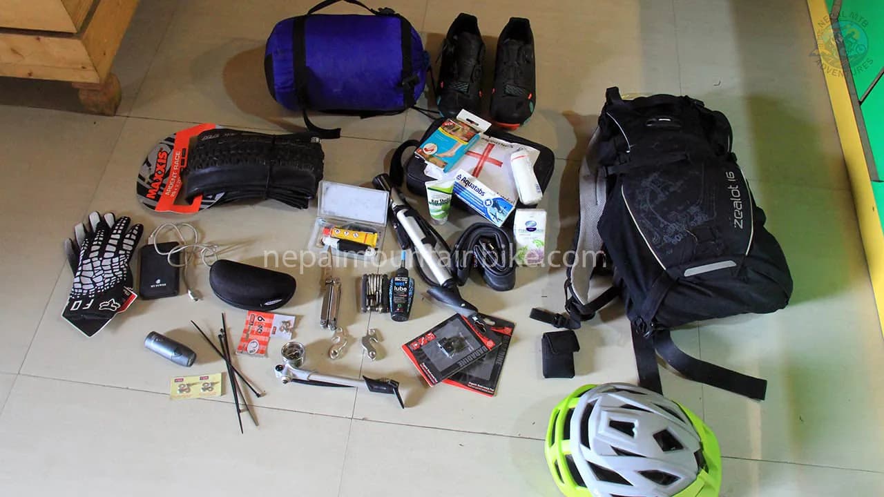
What to pack
The temperature swing here is bigger than most riders expect. A freezing 06:00 start and a hot, bright 11:00 are the same day. Our general Nepal mountain biking checklist covers the basics, and what follows is what this valley adds to it.
Riding kit
A layering system: base layer, insulated mid layer, and a genuinely windproof outer shell
Riding shorts plus leg warmers or light trousers for cold mornings
Two pairs of gloves, one light and one warm. Fingers go numb on early descents
Knee pads for the technical days
A helmet, and consider a full face if you are focused on the descents
Glasses with clear or low light lenses, because the best riding is at dawn and the wind is full of grit
A buff or face cover for dust
Warm hat that fits under a helmet
The two things riders forget
Sun cream, factor 50, reapplied at lunch. The burn here does not come from above. It reflects off pale ground and off snow, and it catches the backs of your hands and the underside of your chin and nose, which is exactly where nobody puts cream. Take a lip balm with sun protection too.
Something warm to sleep in. Rooms are not heated. At Muktinath, a clear night can be close to freezing indoors.
Where you sleep and what you eat
Lower Mustang is comfortable by Himalayan standards. This is not an expedition. It is a valley with a road, electricity, phone signal and lodges that have hosted travellers on the salt route for centuries.
Lodges
Teahouses and family-run lodges in Jomsom, Kagbeni, Ranipauwa, Marpha, Tukuche and Kalopani. Expect a twin room, a shared or attached bathroom depending on the lodge, a hot shower most nights and plenty of blankets. Standards here are better than in most Nepali trekking regions, because the road means supplies arrive by jeep rather than on a mule.
Rooms are not heated. The dining room has a stove, and that is where everyone sits in the evening. Bring a warm layer to sleep in and ask for an extra blanket, they always have them.
Booking ahead is unnecessary outside autumn and April, and sensible during them, especially at Ranipauwa.
Food
This is the Thakali homeland, and Thakali dal bhat here is the best version of Nepal's staple meal that exists. Rice, black lentil soup, a dry vegetable curry, a spiced potato dish, greens, pickle and often a meat curry, all on one plate and all refillable. It is what local guides eat every day.
Beyond that, buckwheat grows here and turns up as pancakes and dhindo, and apples are everywhere from Marpha north. Marpha apple brandy and the Tukuche distillery are the local specialities, and Marpha apple pie is an institution.
The villages along the route
Jomsom, 2,720 m. The administrative centre of Mustang and the hub of every ride. Not ancient and not pretty in a postcard way. It is a working town of government offices, lodges, motorbike mechanics and a small army camp, sitting on both banks of the river with the airstrip on the eastern side. What it is, is functional: where bikes get built, where the ATM is, where signal works, and where a vehicle can reach you.
Thini. One of the oldest settlements in Thak Khola, on the terrace above Jomsom, with a gompa and traditional houses. The launch point for the best singletrack near Jomsom, with Dhumba Lake below it.
Kagbeni, 2,810 m. The most atmospheric village on the route. It sits where the Jhong Khola meets the Kali Gandaki, built as a medieval fortified settlement of mud brick alleys, tunnels running under the houses, and irrigated barley fields that stand out shockingly green against grey desert. It has been a customs and toll point on the salt route for centuries.
At its centre stands the fifteenth-century Red Monastery, named for its ochre rammed earth walls, built thick to resist both earthquakes and attack.
Kagbeni is also the boundary. The checkpoint at the northern edge is where Upper Mustang begins, and you can see the road running north into the restricted zone.
Jharkot, around 3,550 m. On the Muktinath climb, a fortified village along a ridge with the ruins of an old fort, a red walled gompa and a Tibetan herbal medicine centre. It looks the way people imagine Mustang looks, and it is the natural tea stop on the climb.
Ranipauwa, around 3,760 m. The lodge village below Muktinath. A strip of guesthouses, shops and pilgrim accommodation, busy with Hindu pilgrims arriving by jeep.
Lupra, around 2,900 m. A small Bon village in a side canyon, covered in its own section below.
Marpha, around 2,670 m. Whitewashed stone houses, flagstone alleys, a gompa above the village and apple orchards on every terrace. The tidiest village in Mustang, a caravan stop on the old salt route, and the place to stop for apple pie.
Tukuche, around 2,590 m. Once the most important trading town in the valley, where salt from Tibet was exchanged for grain from the lowlands. The old trading mansions still stand, larger and grander than anything else here, and they are a direct record of how much money moved through. Today it is quiet, with a distillery and a handful of lodges. The doorframes and window carvings here are the best surviving woodwork in Mustang, so slow down through it.
Larjung, Kalopani and Lete, around 2,530 m. The pine forest belt, where the desert ends and Nepal starts again. This is the only forest riding on the route and it deserves more attention than it usually gets. After three days of bare rock and hard light the trails here are soft, shaded and quiet, and the surface actually grips. Titi Lake sits above Larjung.
Ghasa, around 2,010 m. The tree line proper, and a permit check post. Below it the valley narrows and steepens and the gorge feels most like a gorge. The Rupse waterfall spills off the Dhaulagiri side just below.
Tatopani, around 1,190 m. Hot springs beside the river in a warm subtropical valley with orange trees. The correct place to finish four days of descending on loose rock.
Riding guided or independently
Lower Mustang is one of the few Himalayan regions you can legally ride without a guide, so this is a genuine decision rather than a formality.
Riding independently
What works in your favour. Permits are cheap and easy. Lodges are frequent, so you do not need to carry camping gear or much food. Signal covers most of the corridor. There is a road the whole way, so a vehicle can reach you almost anywhere. Villages are close enough together that you are rarely more than a couple of hours from a bed.
What to plan for. Three things.
Navigation and trail knowledge. This is the big one. The road is obvious, and the good trails are not. Public mapping of this region is thin, so without local knowledge or good GPX files you will end up riding more road than you wanted. Ask an operator in Pokhara for tracks before you go up.
Riding with a guide or support
What it buys you. Line choice, which is the main thing. Someone who knows which of the parallel trails is worth taking, and which one suits how you are riding that day. Beyond that: a vehicle for shuttling climbs or carrying luggage, mechanical backup, permit and lodge logistics, and someone whose job it is to notice altitude symptoms before you do.
Who benefits most? First-time visitors to the region, mixed ability groups, riders on a tight schedule who cannot afford to lose a day to a mechanical, and anyone who wants the technical lines rather than the road.
A middle path
Plenty of riders rent a bike in Pokhara, get GPX tracks and advice from a local shop, and ride the valley on their own. It is a good option if you are experienced, self-sufficient, and not in a hurry.
Lower Mustang compared with Upper Mustang and the Annapurna Circuit
These three get confused constantly, and they are quite different rides.
Lower Mustang | Upper Mustang | Annapurna Circuit | |
Permit | ACAP and TIMS | Restricted permit, several hundred dollars, plus ACAP | ACAP and TIMS |
Guide required | No | Yes, legally | No |
Riding solo | Allowed | Not allowed | Not Allowed |
Typical length | 5 to 9 riding days | 10 to 14 riding days | 12 to 18 riding days |
High point | 3,710 m | Above 4,000 m repeatedly | 5,416 m at Thorong La |
Character | One climb, then days of descent | Sustained altitude, many passes | A full circumnavigation with a pass crossing |
Hardest part | The Lupra descent | Altitude and remoteness | Thorong La, a hike a bike at extreme altitude |
Season | Close to year round | Spring, autumn, monsoon window | Spring and autumn |
Choose Lower Mustang if you have under two weeks, you want descending more than mileage, you are riding as a mixed group, you want to ride in July, or you would rather not pay a four figure permit.
Choose Upper Mustang if what you want is the place itself: Lo Manthang, the sky caves, and a valley that was closed to foreigners until 1992.
Choose the Annapurna Circuit if you have three weeks, you are a strong rider, and crossing Thorong La is the point rather than the price.
Wildlife along the route
Lower Mustang is not a wildlife destination the way Chitwan is, and any page promising you snow leopards is selling fiction. What you will genuinely see:
Himalayan griffon vultures and lammergeier, with wingspans approaching three metres, riding the valley thermals. On the Lupra and Muktinath descents, you will often be looking down at one. The lammergeier, or bearded vulture, is the one that drops bones onto rock to break them.
Blue sheep, or bharal, on the steeper slopes above the trails, most reliably around Muktinath and in the side canyons. Grey-brown rather than blue, and remarkably good at standing on nothing.
Himalayan foxes, marmots and pika in the high desert sections, and yaks and goats in the higher pastures.
Mule and horse trains, which are the most common large animal you will meet, on the trail, at speed, with a driver behind them. They have absolute priority, and the way to handle them is in riding responsibly.
A useful trick our guides use. The vultures start soaring when the thermals build, which is roughly when the valley wind starts. If you are watching griffons circle and gain height while you are still a long way from your lodge, you started too late.
The road, and how it is changing the riding
The Kaligandaki Corridor will eventually run 202 kilometres from Maldhunga, north through Beni, Jomsom and Kagbeni to the Chinese border at Kora La. Roughly 90 of those kilometres were blacktopped by mid 2026, and the Jomsom to Kagbeni section is being upgraded now.
Aspect | Details |
What It Costs Riders | More of the valley floor is sealed every year, and tarmac brings more jeeps, buses and dust. Sections that were rough jeep tracks five years ago are now paved. |
What It Gives Riders | Parallel walking trails remain unaffected and become quieter as traffic moves onto the road. Shuttling becomes practical, making this a strong descending region. Evacuation from Muktinath takes hours instead of days. |
What It Means for Planning | Trail information changes quickly. A route description written three years ago may now send you down tarmac. |
So ask about current conditions rather than trusting an old itinerary, including this one.
The same argument already played out on the Annapurna Circuit, where the road took the walking route and handed riders a descent.
Safety, insurance and emergencies
By the standards of Himalayan adventure riding, Lower Mustang is a safe region. The altitude is moderate, there is a road the whole way, mobile signal covers most of the corridor, and a vehicle can reach almost anywhere on the route.
The real risks, in order
A crash on a loose technical trail. The most likely thing to go wrong. Loose rock, exposure, and fatigue on long descents.
Altitude symptoms at Muktinath. Usually mild, occasionally not.
Dehydration. The air is very dry and you lose water while breathing.
Sunburn. Reflected off pale ground, and worse than people expect.
All four are managed by pacing, drinking more than you think you need, using sun cream, and not riding beyond your level on day one.
Medical care and evacuation
There is a health post in Jomsom and a hospital in Pokhara. For anything serious, the answer is descent rather than treatment on the spot, and this region is unusually good for that. Muktinath to Jomsom is under an hour by vehicle, and Jomsom to Pokhara is a day by road or twenty minutes by air.
Helicopter evacuation is available and it is expensive, which is why the next point matters.
Insurance
You need travel insurance that explicitly covers mountain biking and off-road cycling, at altitudes up to at least 4,000 metres, or 5,500 metres if you plan the Thorong La option, and that includes helicopter evacuation.
What cover level to buy. A helicopter evacuation from the Annapurna and Mustang region to Pokhara typically runs USD 2,500 to 4,000, and direct to Kathmandu USD 4,000 to 7,000. Some policies cap helicopter cover at USD 5,000, which can leave you short. Look for at least USD 10,000 of dedicated helicopter and mountain rescue cover, plus separate medical cover.
One practical thing that catches people out: helicopter operators in Nepal generally want a payment guarantee from your insurer before they fly. That is why your policy number and the insurer's 24 hour emergency line need to be somewhere you can read them without wifi, and why somebody else in your group should have them too.
Many standard travel policies exclude cycling as a hazardous activity, or cap covered altitude below what this route reaches. Read the exclusions rather than the summary page.
Riding alone
Legal, and done regularly. If you do it, tell somebody your route each day, ride within your limits on the Lupra descent, and remember there is no phone signal in the side canyons. Riding Lupra genuinely alone is the one thing on this route we would advise against.
Riding responsibly in Lower Mustang
Mountain biking is new here. Trekkers have come for fifty years and pilgrims for centuries, but bikes arrived recently enough that the people who live here are still forming a view of us. You are also a paying guest inside the Annapurna Conservation Area, managed by the [NTNC](https://ntnc.org.np), and part of your permit fee goes back into local conservation work.
None of this is hard. Most of it costs a few seconds.
The trails
Do | Why |
Do not skid | A locked wheel cuts a channel into dry soil, which wind and rain can widen into a new trail. This is the damage locals notice. |
Ride the line, not beside it | Trails widen when riders go around rough sections instead of riding through them. |
Do not cut switchbacks | The zigzag route helps hold the hillside together. |
Do not build | No stacked rocks, dug lips or cleared lines. If a section does not suit you, walk it. |
Sharing the trail
These are working paths. People carry loads on them and children walk to school on them.
Yield to everyone. You are the fastest thing on the trail and the only one with brakes
Mule and horse trains get absolute priority. Stop, get off the trail on the uphill side, and let them pass. An animal that shies on an exposed trail can go over the edge
Walking pace through every village and field. Dust in a doorway or on drying grain is a daily irritation to somebody
Call out early on blind corners, and expect not to be heard over the wind
Say Namaste, and ask before photographing people
Religious sites, and the two rules riders get wrong
Get off the bike. Walk it through or leave it at the entrance
Direction matters. Clockwise around Buddhist chortens, stupas, and mani walls, so they stay on your right. Counter clockwise around Bon sites, which here means Lupra. Most visitors do not know the difference, so getting it right is noticed
Do not climb on mani walls or move the carved stones
Remove your shoes in a gompa, do not point your feet at an altar, and ask before photographing inside
Do not ride through a pilgrim queue at Muktinath
Take nothing out of the river
Shaligram, the ammonite fossils in the Kali Gandaki, are treated as a form of Vishnu and are found only in this river. Removing and exporting them is prohibited under Nepali law, and there have been substantial seizures in Mustang. Photograph them and put them back.
Waste and water
Carry everything out. Wrappers, foil, punctured tubes, worn pads, tape. There is no waste system here that can process any of it, and lodge bin rubbish is often burned or ends up in the river
Refill rather than buy. Use the safe drinking water stations and a filter bottle
Human waste away from water and trails, buried, paper packed out
Wash away from streams, because village water comes off them
Where your money goes
Eat and sleep in the villages you ride through. Buy something in Lupra, which sees plenty of riders and little of the money riding here generates. Tip fairly. Use local guides and operators, so the money stays in the district.
And if you break something, damage a wall or get something wrong at a shrine, stop and apologise. It is almost always taken well, and it does more for the next rider through than anything else on this list.
Frequently asked questions
Is Lower Mustang mountain biking suitable for beginners?
It is not the right first mountain bike trip of your life, but it is far more accessible than most people expect. Riders with a season of off road experience handle it comfortably. What makes it work is that the hard sections are optional: the one big climb can be driven, the technical descents can be walked, and there is a road beside almost every trail. If you are genuinely new to riding, plan a route that avoids the Lupra descent and the Jhong lines, and spend a couple of days riding around Pokhara first.
How many days do I need?
Five riding days cover the core route from Jomsom to Beni. Seven is comfortable and lets you add an acclimatisation day and the Thini and Dhumba trails. Add two days at the start in Pokhara to get used to your bike, plus travel days at either end. Most people end up with a nine- to twelve-day trip including arrival and departure.
Do I need a special permit for Lower Mustang?
No restricted permit. You need an ACAP permit and a TIMS card, and together they are one of the cheapest permit combinations in the Nepali Himalaya. The Restricted Area Permit, which costs several hundred dollars per person, applies only to Upper Mustang north of Kagbeni. ACAP can be bought online and emailed to you through the official NTNC portal. The TIMS card has to go through a registered agency, so ask a Pokhara shop or operator to arrange it. Buy both before you go up the valley, because permit fees are doubled if issued at a check post.
Can I ride a Lower Mustang without a guide?
Yes, it is legal, unlike Upper Mustang. Two practical things to sort. Navigation, because the good trails are not well mapped publicly and the obvious line is the road, so get GPX tracks from a Pokhara operator before you go up, and our piece on guided or self guided riding works through the trade off. And your TIMS card, which under current rules is issued through a registered agency rather than direct to individuals, so you will need an agency or shop to arrange that one document even if you ride alone. Carry a spare derailleur hanger and pads, and ride the Lupra descent with at least one other person.
What does it cost?
Costs on the ground are low. Teahouse rooms run USD 5 to 10 a night, food USD 15 to 25 a day, and both permits together are modest, though check the current rates on the official pages. Getting to Jomsom is the swing: a shared jeep is around USD 13 and takes 8 to 9 hours, while the flight is roughly USD 120 to 160 one way and takes twenty minutes. An independent rider doing the five day route spends around USD 400 to 600 on the ground, before bike hire. Guided prices depend almost entirely on group size, because a guide and a vehicle cost the same for one rider or six, so always ask for the price at your actual group size.
When is the best time to ride?
October and November are the best window, with clear skies and prime trail conditions. March to May is the second classic season, slightly hazier. December to February is cold but often clear and very quiet. Our guide to the best time to mountain bike in Nepal compares this region with the rest of the country. Because the region sits in the rain shadow, the northern trails around Jomsom, Kagbeni, Lupra and Muktinath stay rideable through the June to August monsoon, which almost nowhere else in Nepal does.
Can you really ride here during the monsoon?
Yes, with caveats. The northern half of the valley stays largely dry so the riding is real. But the southern corridor around Ghasa, Lete and Tatopani does get monsoon rain, landslides close the road, and scheduled Pokhara to Jomsom flights were suspended for around three months from late May 2026. Plan a monsoon ride as a Jomsom based out and back with flexible exit days.
How do I get to Jomsom, and what if the flight is cancelled?
Most riders take the twenty minute flight from Pokhara, which runs in the morning only because the valley wind makes later landings unsafe. It is cancelled fairly often for cloud or wind, so have a jeep as a backup. The drive is four to six hours through Beni and Tatopani, and it is actually gentler for acclimatisation than flying.
Should I ride a hardtail or a full suspension bike?
Full suspension if you have the choice. This is a descending region on loose shattered rock and a 130 to 150 millimetre trail bike is the right tool. A hardtail is not disqualifying, it just costs you comfort and rear wheel wear. Whatever you ride, prioritise reinforced casing tyres and four piston brakes with 180 millimetre rotors.
Should I bring my own bike or rent it in Nepal?
For a trip of this length most riders are better off renting in Pokhara, because airline bike fees run USD 150 to 400 each way, there is real risk of damage in transit, and Twin Otter cargo space to Jomsom is limited. Bring your own if you are particular about your setup or riding at a level where it matters, and if you do, bring a spare derailleur hanger for your frame. Our Pokhara rental fleet lists what is available and what it costs. You cannot practically bring your own e-bike, because airlines will not carry a battery that size.
We ride at different levels. Will this work for us?
Yes, and this region handles mixed ability better than anywhere else in the Nepali Himalaya. There is a road beside almost every trail, so a stronger rider can take the technical line while another takes the graded one and you meet at the same lodge. The one big climb can be ridden or driven. If the gap is large, an e-bike for the less strong rider is the most effective single fix.
Can I ride it solo?
Yes, solo riding is legal here. Tell somebody your route each day, be conservative on the Lupra descent, and remember there is no phone signal in the side canyons. Most solo riders find the biggest practical issue is trail knowledge rather than safety.
What should I pack that I would not think of?
Factor 50 sun cream and a lip balm with sun protection, because the burn reflects off pale ground and catches the backs of your hands and under your chin. Clear or low light lenses, because the best riding is at dawn. A buff for dust. A warm layer to sleep in. A power bank. And rupees in cash from Pokhara, because the Jomsom ATM is unreliable.
Can I take a shaligram fossil home?
No. Shaligrams are ammonite fossils from the Kali Gandaki that Hindus treat as a form of Vishnu himself, and they are found only in this river. Removing, selling, and exporting them in quantity is prohibited under Nepali law, and police in Mustang have seized hundreds of kilograms from people trying. Photograph them and leave them.
What insurance do I need?
Travel insurance that explicitly covers mountain biking and off road cycling, at altitudes up to at least 4,000 metres, or 5,500 metres if you plan the Thorong La option, and that includes helicopter evacuation. Many standard policies exclude cycling as a hazardous activity or cap the altitude below what this route reaches.