

Upper Mustang is the only high desert region in Nepal. North of Kagbeni, the green stops, the rain stops, and the country turns to bare sandstone, wind-cut cliffs, and old salt caravan trails that now run as singletrack. At the far end of it stands a walled town that has been lived in since 1380 and was closed to outsiders until 1992.
It is also the most complicated trip we run, and that is worth knowing before you read any further. It is a restricted area, so you cannot ride it alone or arrange it yourself. It is high enough that the itinerary has to be built around where you sleep rather than how far you ride. And there is no bike shop north of Jomsom, so whatever leaves with you is what you have for two weeks.
Upper Mustang at a glance
Category | Details |
|---|---|
Location | Mustang District, Gandaki Province, north-central Nepal, sharing a border with Tibet |
Restricted Zone Starts | Kagbeni, 2,800 m (9,186 ft). Everything north of Kagbeni requires a special permit |
Destination | Lo Manthang, 3,840 m (12,598 ft), a walled capital founded in 1380 and continuously inhabited since |
Highest Riding Point | About 4,210 m (13,812 ft) |
Kora La Border | 4,660 m (15,290 ft) |
Distance | Roughly 250 km (155 miles), with daily stages of about 25–45 km (16–28 miles) |
Duration | About two weeks, including acclimatisation days |
Annual Rainfall | About 250 mm (10 in), which helps keep the region rideable when much of Nepal is wet |
Permits | Restricted Area Permit: USD 50 per person per day; Annapurna Conservation Area Permit: NPR 3,000 |
Permit Requirements | A licensed guide and a registered Nepali agency are required by law |
Getting There | A 20-minute flight from Pokhara to Jomsom, operating in the early morning, or a long drive via the Kali Gandaki |
Difficulty | Red, A3 - technical riding at extreme altitude |
Bike Options | Pedal mountain bike or e-MTB |
e-MTB Requirement | e-MTBs must be local bikes because their batteries cannot be flown |
We are Nepal MTB Adventures, a mountain bike company based in Pokhara. We have been riding this ground since 2004. We file our own restricted area permits, and we maintain our own fleet in our own workshop.
This guide covers permits, altitude, weather, kit, what breaks, and the culture of Lo. It is written for people who ride. If you want the trips themselves, start with riding in Upper Mustang.
Where Upper Mustang is, and where the restricted zone begins
Upper Mustang is the northern half of Mustang district, in Gandaki Province, north-central Nepal. Say the full name once, because Mustang is a car and a horse before it is a Nepali district. The local government unit at the top of the region is Lo Manthang Rural Municipality. Culturally and geologically, this is the Tibetan Plateau. It just sits inside Nepal's border.
The line that matters to a rider is not a scenic one. It is administrative.
The restricted area begins at Kagbeni, at 2,800 m (9,186 ft). South of Kagbeni is Lower Mustang, and no restricted permit is needed there. North of it, a daily fee is charged, and every permit is checked. Kagbeni, sometimes spelled Kag Beni, is also where you walk into Kag Chode monastery, the first monastery most riders go inside on this trip.
Jomsom, at 2,720 m (8,924 ft), is the practical gateway. It has the airstrip.
From Kagbeni, the corridor runs north up the Kali Gandaki through Tangbe and Chhusang. At Chele, also spelled Tsaile, the trail leaves the river and climbs out of the gorge onto the plateau. That is where the country stops looking like Nepal. Lo Manthang, at 3,840 m (12,598 ft), sits near the top of the region. Beyond it, Kora La at 4,660 m (15,289 ft) is the Tibet border. You look at it. You do not cross it.
The shape of the region
The corridor runs north from Kagbeni up the Kali Gandaki through Tangbe and Chhusang.
At Chele, also spelled Tsaile, the trail leaves the river and climbs out of the gorge onto the plateau. That is where the country stops looking like Nepal.
Lo Manthang, 3,840 m (12,598 ft), sits near the top of the region.
Kora La, 4,660 m (15,289 ft), is the Tibet border beyond it. You look at it. You do not cross it.
The eastern side, through Dhi, Yara, and Tangge, is a separate world from the corridor. It is where the region gets properly quiet, and where the Dhechyang Khola cuts down out of the Damodar Himal.
Why it looks like this
All of upper mustang regions sits in the rain shadow of Dhaulagiri, 8,167 m (26,795 ft), and Annapurna I, 8,091 m (26,545 ft). Those two walls take the monsoon out of the air before it gets here, which is why Upper Mustang receives roughly thirteen times less rain than Pokhara, about 100 km away.
The trails exist because of salt. The caravan paths you ride were cut for loaded mules moving between Tibet and the Indian plains, not for tourism.
For the ground itself, in order, see the route, section by section.
Permits and what changed in March 2026
You need two permits to ride north of Kagbeni.
The Restricted Area Permit is issued by the Department of Immigration. It costs USD 50 per person per day, counted from the day you cross the Kagbeni checkpoint. The current fee is published by the Nepal Tourism Board.
The Annapurna Conservation Area Permit, or ACAP, costs NPR 3,000, roughly USD 22 to 25. The conservation area is managed by the National Trust for Nature Conservation. Upper Mustang sits inside the conservation area, so you need this one on top of the restricted permit.
What changed on 22 March 2026
The old structure ended on 22 March 2026. Until that date, the restricted permit was a flat USD 500 for ten days, plus USD 50 for each extra day after that. It is now USD 50 per day from day one.
Pages published before that date still quote the flat USD 500. That gives you a free test of any page you read. If a guide still says USD 500 for ten days, everything else on it is the same age, including its altitudes, its route, and its rules about who can hold a permit.
Solo riders can now hold the permit
The two-person minimum on a single permit application was scrapped on the same date. A solo rider can now legally hold a restricted area permit. That is new, and many published guides have not caught up with it.
Solo does not mean unaccompanied. A licensed guide and a registered Nepali agency are still mandatory. You cannot buy this permit yourself. You cannot buy it online. You cannot buy it at Jomsom or at Kagbeni when you arrive. It is filed before you travel, by an agency registered to file it.
Bring a passport with at least six months of validity, and spare passport photographs. The permit is checked physically at the Kagbeni checkpoint.
How fit and how skilled you need to be
Here is the level, stated once and plainly: intermediate plus, with real handling skill required, not preferred.
How fit you need to be
You already ride two to three times a week, through the year, not only in season.
You can ride four to six hours, then get up and do it again the next day, and again the day after, for about two weeks.
You can handle two to three climbs of 600 to 900 m (1,970 to 2,950 ft) in a single day.
If those three lines describe your riding right now, you are fit enough. If they describe your riding two summers ago, start training and book for next year instead.
The skills this terrain demands
This is the ground, described the way it feels under a wheel:
Loose shale, from golf ball to fist-sized, on climbs as well as descents.
Sand on the inside line of corners, which is where you want your front wheel.
Exposed traverses with the drop on your outside shoulder.
Ruts and braided cattle lines that pick your line for you if you let them.
Short carries of 50 to 100 m (55 to 110 yards) with the bike on your shoulder.
Sustained loose descents where you never get a flat moment to shake out your hands.
None of that is extreme on its own. All of it is relentless, day after day, in thin air.
What Red at A3 means
We grade every trip we sell on one scale: Green, Blue, Red, and Black for terrain, plus a separate altitude band from A1 to A3.
Upper Mustang is Red at A3.
Red means technical riding that demands good bike handling, not just fitness. A3 is our top altitude band: repeated nights above 3,500 m (11,483 ft) and riding above 4,000 m (13,123 ft), where the air becomes the limiting factor instead of your legs. A1 is our low-altitude riding around Pokhara and the Kathmandu Valley. A2 sits between the two.
Ride a Red at A1 day tour in Pokhara before you commit, and you will know which half of this expedition is going to hurt you.
What a hard day actually feels like
Gyu La is roughly 1,100 m (3,610 ft) of climbing in one push. At the top, you get Dhaulagiri, Nilgiri, Tukuche Peak, and Annapurna across one skyline, which is why people put up with the climb.
Marpha to Tatopani drops about 1,850 m (6,070 ft) in a day, from high desert into subtropical green. Your hands will remember it.
Hike-a-bike is normal
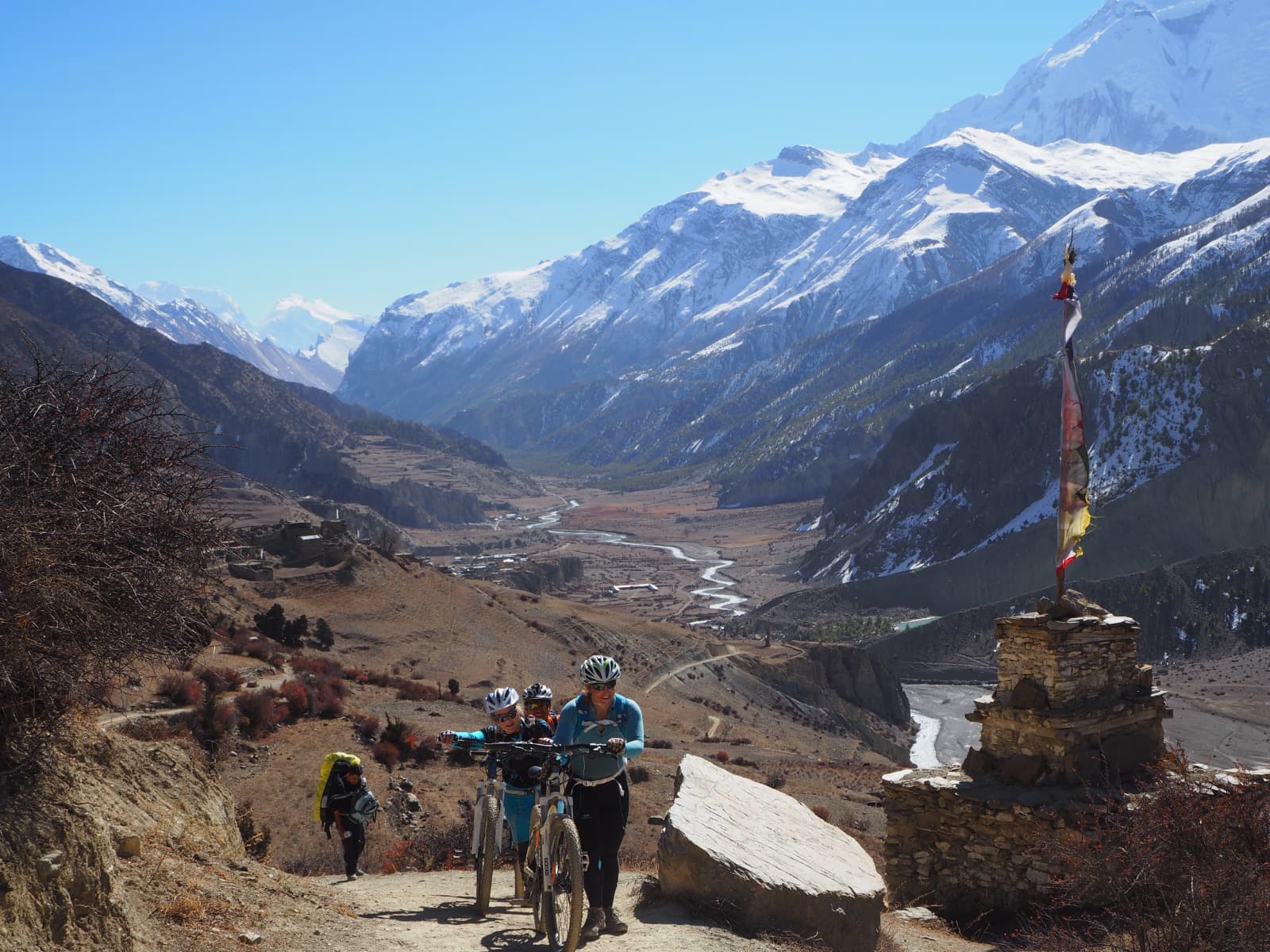
On steep pass approaches, you will push, and sometimes carry. That is not a failure of the route or of you. It is how this terrain works, and how it worked for the traders who cut these paths.
Riders told this in advance enjoy those sections. Riders who are not, resent them for the rest of the trip. Walking a section carries no stigma on our trips. Nobody is timing you.
"Our guide Don was a nice company and was very caring and helpful. He adapted the tour to our fitness and technical capabilities."
-Jos D, April 2023, TripAdvisor
Who should not book this trip?
If you ride mostly flow trail and gravel, and steep, loose ground with exposure is something you avoid rather than seek out, this is the wrong trip. Tell us early. Nepal has better options for that kind of riding, and we would rather put you on one than watch you endure this.
If you want to place yourself more precisely before you commit, our trail grading system explains what Red and A3 actually mean, and it is the same scale we use on every trip we run.
Why altitude is harder on a bike than on foot
Here is the rule your itinerary should be judged against, including ours.
Above 3,000 m (9,843 ft), gain no more than about 500 m (1,640 ft) of sleeping altitude per night, and add an extra night for every 1,000 m (3,281 ft) gained.
That is Wilderness Medical Society guidance from their clinical practice guidelines for acute altitude illness. We did not write it, which is exactly why you can hold us to it.
Sleeping altitude, not the day's high point
What matters is where you sleep, not how high you rode. You can top a 4,000 m pass and sleep at 3,520 m, and that is a good day for your body. You can ride an easy, flat, pleasant stage and sleep 900 m higher than the night before, and that is a bad one. The pass is what you photograph. The bed is what adapts you.
Why a bike gains altitude faster than legs do
A trekking itinerary is self-limiting. A walker can only cover so much ground in a day, so walking speed caps how fast a trek gains altitude. That cap has been quietly protecting trekkers for decades.
A rider covers in three hours what a trekker walks in a day. The cap is gone.
A bike itinerary can gain sleeping altitude far too fast while feeling relaxed, because nobody is tired at the end of it. You arrive early. You feel strong. And your body is 900 m higher than last night with no warning, because nothing felt hard. There is no fatigue signal, because you did not do the work. You just moved quickly.
Cycling itineraries are not self-limiting. That is why altitude planning on a bike has to be built on purpose, and never inherited from a trekking schedule with the walking days squeezed together.
How to check an itinerary before you book
Ask any operator, including us, for the sleeping altitude of every single night. Not the daily distance. Not the elevation gain. The altitude of the bed.
Then check the gain between each pair of consecutive nights against the 500 m rule. If a company cannot produce that list quickly, they did not build the trip around it.
High points against sleeping altitudes
These are the passes on the corridor and the eastern loop. Published elevations for several differ between sources by 20 to 50 m, including between our own pages. Where they disagree, we publish a range, because we will not claim a precision the surveys do not support.
Pass | Approximate Height | Description |
Yamda La | About 3,850 m | Early plateau crossing |
Syangboche La | About 3,800–3,850 m | Sources disagree, so a range is given |
Bhena La | About 3,830–3,860 m | Sources disagree, so a range is given |
Nyi La | About 4,010 m | One of the high crossings on the corridor |
Ghami La | About 3,770 m | Plateau crossing above Ghami |
Lo La | About 3,950 m | Pass with the first view of Lo Manthang |
Paha Pass | About 4,210 m | Highest scheduled riding point |
How our itinerary is paced
The stretch through Samar at 3,650 m, Ghami at 3,520 m, and Tsarang at 3,560 m looks like a route choice. It is not. It is a climb-high, sleep-low pattern that flattens your sleeping profile for three nights before Lo Manthang, and it only reads that way if you built it. The Lo Manthang day is the same trick. It is sold as a culture day, and it is doing physiological work while you look at monasteries.
AMS, HAPE and HACE
AMS, acute mountain sickness: headache, nausea, broken sleep, no appetite. Common, and manageable if you report it early instead of hiding it.
HAPE, high altitude pulmonary oedema: fluid in the lungs, breathless at rest, a wet cough.
HACE, high altitude cerebral oedema: confusion, poor coordination, a rider who cannot walk a straight line.
The last two are emergencies. The one treatment that always works for all three is to descend.
Acetazolamide comes up in every pre-trip conversation. It is a prescription decision for your own doctor, not for us, and it does not replace a correct ascent profile.
Being fit does not protect you from altitude
Altitude is not decided by fitness. Fit riders get into trouble more often, not less, because they climb faster than their body adapts and they are trained to push through discomfort. Here, pushing through is the wrong instinct, and the strongest rider in a group is often the one we watch hardest.
Our lead guides carry Wilderness First Responder certification and the group carries an emergency oxygen cylinder. That is capability, not a boast, and the plan it supports is descent.
Which is the practical close. This route has road access at enough points that going down is always available. That is not true everywhere in Nepal.
Our night-by-night figures sit on the night-by-night altitude profile. Check them against the 500 m rule yourself.
How your bike gets to Jomsom
This is the question almost nobody answers, and it matters if you are bringing your own bike.
The Pokhara to Jomsom flight is a small aircraft on a short mountain strip, and the baggage allowance reflects that. Expect roughly 15 kg of checked baggage plus about 5 kg of cabin baggage, and less again on some aircraft. Excess is charged by the kilo. A boxed mountain bike is over that limit on its own, before you have packed a single item of riding kit.
So the bikes do not fly. On our trips, the bikes and the main luggage travel up by road on the support vehicle while the riders fly, and everything meets in Jomsom.
Two things follow from that. If you bring your own bike, it needs to be packed well enough to survive a long road journey on a rough surface rather than just an airport carousel. And your bike will usually arrive a day either side of you rather than on the same aircraft, which is one more reason the itinerary has a buffer day at the start rather than sending you straight up the valley.
What breaks, and what we carry to fix it
The single most important logistics fact on this page: there is no proper bike shop after Jomsom. Whatever leaves Jomsom with you is what you have for the rest of the expedition.
Here is what actually goes wrong out there, in the order we see it in the workshop.
Sidewall cuts. This is the most common mechanical on the route. The ground is dry, sharp shale, and it slices casings that survive everything you ride at home. Reinforced sidewalls are not an upgrade here. They are the baseline. A lightweight race casing will not last the week.
Sealant. Tubeless sealant dries out faster in dry, thin, high-altitude air. Sealant that would last a season at home can be gone in days up here. Top it up before you go into the zone, and carry more than you think you need.
Brakes. The long descents eat pads. The Lubra Valley Line is about 1,350 m (4,430 ft) of natural switchback singletrack. Marpha to Tatopani drops about 1,850 m (6,070 ft) in a single day. Bring a spare set of pads even though a mechanic travels with the group.
Dust. It gets into the drivetrain and into the suspension seals. Run dry lube, not wet. Wet lube here is a grinding paste by lunchtime.
Derailleur hanger. Bring a spare, specific to your frame. Nobody out there has yours, and a bent hanger ends a riding day in a way a broken chain does not.
If you bring your own bike, have it fully serviced before you fly. A marginal bearing at sea level is a failed bearing at 4,000 m in the cold, and there is nowhere out there to press a new one in.
"We had a choice of bikes when we arrived, all mechanically sound with new tires and brakes, and their guides are very well-trained mechanics, so no fear of mechanical breakdown."
- Ali S, October 2018, TripAdvisor
The bike setup that suits this ground
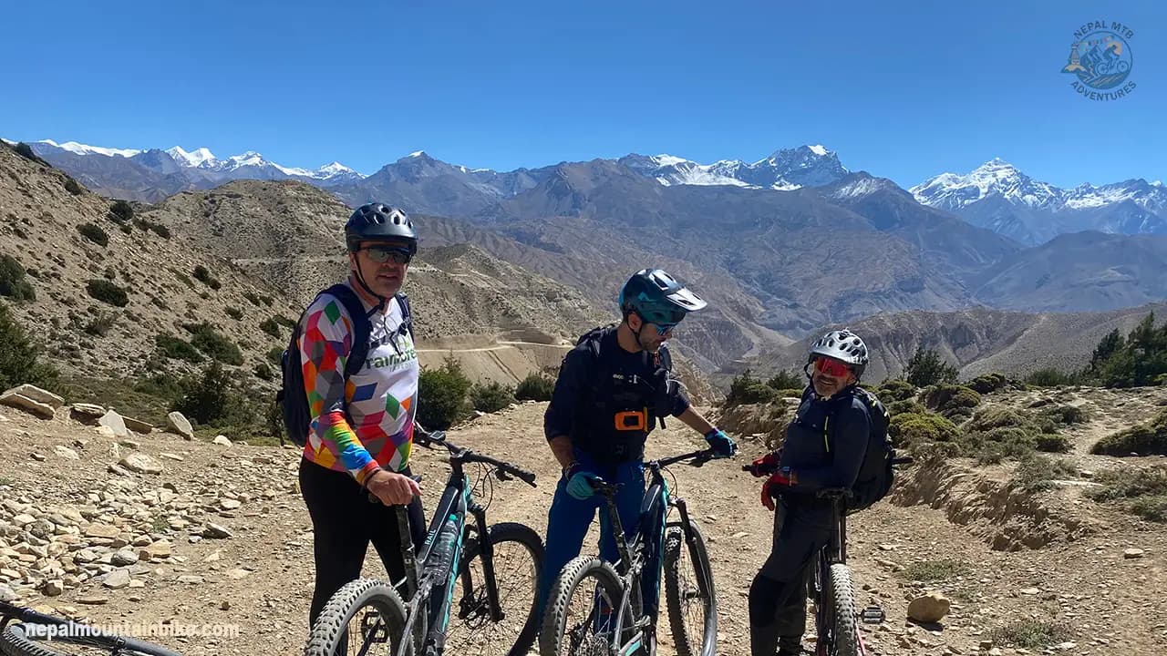
Full suspension with 140-160 mm of travel, a dropper post, 29 or 27.5-inch wheels, and tyres with reinforced sidewalls rather than lightweight race casings. A capable, aggressive hardtail also works here if you are experienced and you can pick a line. What does not work is a light cross-country build. The ground will find it.
What the support team carries
A lead guide, a sweep guide, a master mechanic, 4WD support where the road allows it, and a mobile workshop carrying expedition spares. The common failures out here are wheels, tyres, sealant at altitude, derailleur hangers, and brakes in dust. That list is not a guess. It is a repair log.
If you would rather not fly a bike halfway around the world, our fleet includes Trek, Scott, and Bergamont bikes, maintained in our own workshop in Pokhara. Sizes, models, and full specs are on our Trek, Scott, and Bergamont rental fleet page rather than being repeated here.
Riding Upper Mustang on an e-MTB
Upper Mustang is one of the best e-MTB destinations in Nepal, and we run a dedicated 15-day e-MTB expedition through the same region as our pedal trips. The terrain suits assist well: long sustained climbs on jeep track and old caravan trail, high passes, and very little tight technical singletrack where a heavy bike fights you.
It also has the hardest e-MTB logistics of anywhere we operate. Both of those things are true, so this section covers what assist changes, what it does not change, and the power problem you have to solve before any of it matters.
What assist actually changes here
The pass climbs stop being the whole day. Nyi La, Lo La, and Gyu La are the efforts that define a day on a pedal bike. Gyu La alone is around 1,100 m (3,610 ft) of climbing in one push. With assist, they become a section of the day instead of the point of it.
The big climbing days become repeatable. Stages here carry 400 to 900 m of climbing. Doing that back to back for two weeks is what filters riders out. Assist flattens the difference between day three and day eleven.
You arrive with something left. Reaching Lo Manthang with the energy to walk the town, climb the ladders at Chhoser and sit through an evening is a different trip from arriving emptied.
A mixed group can actually ride together. This is the real reason most e-MTB riders book. The strongest and the least strong rider finish at the same time, on the same route, without either resenting it.
Why you cannot bring your own e-bike
You cannot fly your e-bike battery to Nepal. That is the fact that decides everything else here, so it goes next.
Airlines refuse lithium batteries above 160 watt-hours, in the cabin and in the hold, under the dangerous goods rules published by IATA. E-MTB batteries run from 400 to 750 Wh. Yours is at least two and a half times over the limit, and often more than four times over. There is no exemption for sports equipment, no declaration form that fixes it, and no workaround a check-in desk will accept.
The consequence follows in one line. An e-MTB rider has no bring-your-own option in Upper Mustang, and no self-supported option either. Riding here on an e-bike means riding a local fleet with vehicle support, or not riding here on an e-bike. Almost nobody says that out loud, so riders reach the question late, usually after they have already decided they want the trip.
Who the e-MTB actually suits
The downside is weight. Hike-a-bike is normal on the steep pass approaches here, and an e-MTB is heavier to push and much heavier to carry than the bike you ride at home. Nobody enjoys that part.
So the e-MTB is not the easy option. It is the option that lets riders of different strengths travel together and finish the day at the same time. That suits mixed pairs and mixed groups, riders coming back from injury or a long break off the bike, and riders who are short on time and want a bigger route in fewer days. If that is your situation, our 15-day e-MTB expedition is built around this exact problem, and the wider choice between the two is covered in mountain bike or e-MTB in Nepal.
Before you book an e-MTB trip in this region, ask three questions: how many spare batteries travel with the group, where each one gets charged, and who pays for it. Anyone who cannot answer all three has not run the trip.
Is your insurance valid at 4,200 metres?
Most standard travel policies cap medical cover at 2,500 or 3,000 m (8,200 or 9,800 ft). Above that limit, the medical section goes void unless you have bought a high-altitude extension. Plenty of riders find that out after a claim rather than before one.
This route reaches about 4,210 m (13,810 ft) at its highest riding point and sleeps at 3,840 m (12,600 ft) in Lo Manthang. Both numbers sit above the standard cap. For most policies bought off the shelf, this trip is simply not covered as sold.
There is a second trap. Many policies exclude mountain biking as an activity even when they cover trekking. Trekking cover is not riding cover. The two are priced differently because the claims are different.
Four things your policy needs to say, in plain words:
Medical cover to at least 4,500 m, or a stated high-altitude extension that reaches it.
Mountain biking named as a covered activity, off-road, not just general cycling.
Emergency medical treatment in Nepal, and helicopter evacuation.
Trip delay. That one matters here because of the Jomsom flight and the weather that closes it.
Get the altitude limit and the mountain biking position confirmed in writing by the insurer. A phone call summary is not a policy, and a call centre agent is not the person who decides your claim. Then send your policy number and the emergency assistance number to your operator before you leave home.
For policy wording, exclusions and how rescue cover works across the country, see the mountain biking checklist for Nepal.
How cold it gets, and what you actually wear
Start with two numbers from the same village, because they reverse an assumption most riders arrive with.
Nights at Lo Manthang, 3,840 m, run about 8 to 11C (46 to 52F) in August. In October, they run about minus 8 to minus 3C (18 to 27F). Season by season across the whole country, we set that out in when to mountain bike in Nepal.
Read that again. The season everyone recommends is roughly fifteen degrees colder at night than the season almost nobody sells, and August is one of the calmer months for wind here. That is the short version of why the monsoon window works here. The long version is a separate post, and we will leave it there.
Riders do ride here in the summer months, and have for years.
"The plan was to complete a round-trip from Pokhara to Lo-Manthang over 10 days during the monsoon season, including over 7,000 m of climbing and 240 km of total travel."
- Lorenz M, September 2017, TripAdvisor
Spring days at Lo Manthang sit around 15 to 22C (59 to 72F). Pleasant in the sun, cold the moment you stop.
The swing is what you dress for, not the low. You can start below freezing at dawn and be in full sun at 4,000 m by mid-morning. Layers you can shed while moving beat one warm jacket you have to stop and dig out of a pack.
Be clear about one thing: the lodges are not heated the way western visitors expect. There is usually one warm room, and it is warm in the evening. Your bedroom is close to the outside temperature. Your sleeping kit does the work here, not the building.
Wind is the other constant. The Kali Gandaki wind rises around 11:00 every day, in every season. A thin windproof shell earns its place every single day. A heavy insulated jacket does not, because you only wear it standing still.
What you actually want:
A layering system you can change on the bike, not off it.
One insulated jacket, for evenings and early starts.
A windproof and waterproof shell.
Warm gloves as well as riding gloves. Hands and feet are what suffer on the long descents.
A warm hat for the dawn hours.
A buff. Dust is constant here, wind or no wind.
Sun and grit are safety kit, not comfort kit. The sun at this altitude is fierce in every month, including the cold ones, so sun cream and lip protection go on before you ride, not when you notice. Eye protection has two jobs: UV and grit. Carry clear or low-light lenses as well as dark ones, because you are riding at first light and the dust is already up.
We are not going to reprint the whole kit list here. The full kit list sits on the trip page, item by item.
Where you sleep, eat, and find water, cash, and power
Where you sleep
North of Kagbeni you sleep in teahouses and village guesthouses. They are basic by Western standards, and there is no point pretending otherwise. Comfortable is the wrong word. Warm, fed and dry is the right one, and on that measure they do the job well.
The room: simple, twin beds, heavy blankets, and in most places a shared bathroom
Hot water: not guaranteed every night. Where showers exist, they are usually paid and solar heated, so they work in the afternoon and not at dawn. Be clean when you arrive, not when you leave.
Heating: there is usually one warm room, and it is warm in the evening. Your bedroom sits close to the outside temperature, so your sleeping kit does the work, not the building
The reward at the end: hot springs at Tatopani on the way out. After two weeks of solar showers, that lands harder than it sounds
What you eat
The cooking changes as you ride north, and it changes twice. Knowing what is worth ordering where is one of the small pleasures of this route.
In the corridor, around Jomsom, Marpha and Kagbeni, you are in Thakali country. The Thakali people are from this valley, and their khana set is the most respected regional meal in Nepal. If you eat one memorable thing on this trip, make it a Thakali set in Marpha or Jomsom.
Dish | What It Is |
Thakali Khana Set | A traditional meal with rice or dhido, dal tempered with jimbu, seasonal vegetable curries, gundruk, pickles, papad, and ghee. Refills are unlimited and are part of the traditional dining style. |
Dhido | A thick buckwheat porridge traditionally eaten with your fingers. |
Ghoken | A traditional buckwheat flatbread. |
Marpha Apples | Apples grown in the orchards around Marpha and extending down toward Tangbe. |
North of Kagbeni, you cross into barley country, and the food turns Tibetan. Barley grows on the terraces you ride past, and it ends up in almost everything.
Dish | What it is |
Tsampa | Roasted barley flour mixed into butter tea until it makes a dough. The traditional breakfast here: dense, quick, and it travels |
Thukpa and thenthuk | Noodle soup that will rescue a cold afternoon. Thenthuk is the hand-pulled version |
Tsak sha | Barley stew with yak meat and vegetables |
Khapse | Fried bread, mostly around festivals |
Yak and sheep | The meat this far north, boiled, stewed or roasted |
Chhurpi | Hard dried cheese that locals keep in a cheek for an hour at a time |
Momo | Everywhere, always |
What you drink
Butter tea: salted and rich, and it divides visitors completely. Give it three cups before you decide, because it makes far more sense at 3,800 m than at home
Chhaang: the local barley beer, mild and slightly sour, often served in a wooden bowl
Marpha brandy: distilled in Marpha itself by Thakali families, from apples, apricots and pears, at around 42 percent. A genuine local product.
Our advice on the last two: leave them until the trip is coming down. Alcohol makes acclimatisation worse and hides the early symptoms of altitude sickness. On our trips, the Marpha brandy belongs to the last night, not the high ones.
Three food rules for riders
Take the refill even when you think you are done. Your calorie demand at altitude is higher than you expect, and the second plate is what makes tomorrow morning's climb honest.
Vegetarians are easy to look after everywhere on this route.
Eat the greens while the valley is still giving them to you. Fresh vegetables get scarcer the further north you go.
Water, cash, power and signal
The reality | What to do | |
Water | Scarce, and most of it is carried. No bottle collection exists, so every bottle you buy stays in the region | Treat or filter, and refill |
Cash | No ATM past Jomsom | Draw all your rupees for the restricted section before you go north. Small notes beat large ones |
Power | Usually available. Usually solar, slow, paid per device, and shared with everyone in the lodge | Carry a power bank and fill it whenever mains appears, so you are not queueing behind six phones for a camera battery |
Signal | Patchy, with real dead stretches during the day. | Tell people at home before you go, not after they start worrying |
That power reality is the same one behind the e-bike battery problem covered earlier. A lodge that can trickle charge a phone overnight cannot put 500 Wh back into a battery in four hours. Same villages, same supply, completely different demand.
Lo Manthang, the walled capital
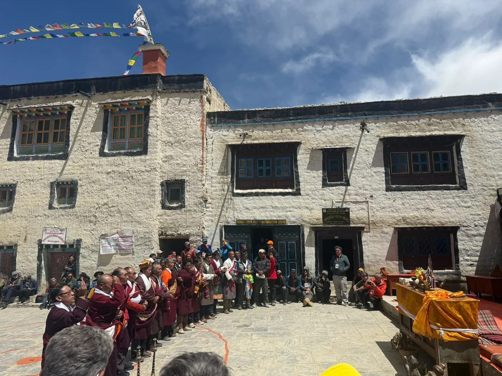
Lo Manthang sits at 3,840 m (12,600 ft). It is a walled town, not a ruin and not a museum. The walls still stand, and people live and work inside them. Children walk to school, monks cross to the assembly hall, motorbikes come in through the gate. All of it inside a wall built to keep an army out.
It was founded in 1380 by Ame Pal, a warrior from western Tibet, who established the Kingdom of Lo. Twenty-five generations of kings followed him. The royal title formally ended in 2008 when Nepal's monarchy ended, and the last king, Jigme Dorje Palbar Bista, died in 2016. The kingship is gone. The community, the language, and the religious calendar are not. The town sits in Lo Manthang Rural Municipality now, and the people here are the Loba, who speak a Tibetan dialect and practise Tibetan Buddhism.
The region was closed to outsiders entirely until 1992. That one fact explains more than any other why so much of this place survives intact.
The King's Palace stands in the middle of the town, and the streets were laid out around it.
Three monasteries stand inside the walls, and each is a different kind of building.
Jampa Lhakhang is the oldest, raised in the 1440s. Inside it, a clay figure of Maitreya, the future Buddha, rises through three storeys, so you climb the building to see the same statue from the feet up to the face. The walls around it carry 108 mandalas painted on gold ground.
Thubchen is the great assembly hall. One vast room under a forest of carved wooden pillars, dark and cold, with the light dropping in from high up.
Chode is the working monastery. Its monks keep the ritual calendar, and it is Chode's monks who stage the Tiji dances.
Just outside the town stands Namgyal, which was historically the judicial seat as well as a religious one. Disputes in Lo were settled there. That is not a role most monasteries anywhere have ever held.
The sky caves and the cave monasteries
The cliffs here are perforated with thousands of man-made caves, cut high into vertical sandstone, many with no visible way up. They were homes, burial sites, and meditation cells. Nobody fully agrees on why so many were cut, or how people reached the highest ones. You ride underneath them for days.
The three worth your time
Site | Where | What it is | Access |
Shija Jhong | Chhoser, north of Lo Manthang | A five-storey sky cave you climb inside | Internal wooden ladders |
Luri Gompa | Eastern side, near Yara | Cave monastery in a sandstone spire, 15th-century wall paintings | Short climb, then a ladder |
Ghar Gompa, also Lo Gekar | 3,931 m (12,900 ft) | Built in the 8th century under Padmasambhava, older than most monasteries in Tibet | Optional singletrack line, not the road |
Shija Jhong, the one you go inside
Five storeys up inside the cliff, chamber to chamber on wooden ladders. Be honest with yourself before you start up: it is dark, steep and tight, and the drop is under you the whole way. A head for heights helps. It is an experience rather than a view.
Luri Gompa, the one almost nobody reaches
A monastery built into a cave inside a sandstone spire. The wall paintings inside are among the oldest surviving in the region. Very few people get there in a year. If you have energy to spend on one thing off the bike, spend it here.
Ghar Gompa, where the good line and the old monastery are the same choice
Local tradition says Padmasambhava hid sacred texts there, known as terma, left for someone to find in a later age. What makes it a riding section rather than a sightseeing list is the access: you reach it by an optional singletrack line instead of the road. The best trail and the 8th-century monastery happen to be the same decision, and that does not happen often.
You also pass Namgyal on the northern side. The eastern villages of Dhi and Yara, above the Dhechyang Khola, and Konchok Ling are the way into the quiet country where much of this sits, covered in the eastern loop through Dhi, Yara and Tangge.
The legends behind the places you ride past
Everything in this section was told to us in the villages it belongs to, by the people who live there. Our guides have been riding this corridor since 2004, and these are the explanations we have been given over the years by villagers, lodge owners, and monks along the route. We have written them down the way they were told to us. Where a story is a local telling rather than a documented history, we say so.
Dhakmar: why the cliffs are red
The Dhakmar cliffs are red because a demoness was killed there. That is the local telling, and it is the answer you will get from anyone who lives nearby. Tradition names the figure who killed her as Padmasambhava, also called Guru Rinpoche, in the 8th century. Her blood soaked into the rock, and the cliffs above the village have been red ever since.
Lubra: the descent, and what waits at the bottom
Lubra is the place riders get wrong. Ask a rider what Lubra is, and you will hear that it is the bottom of about 1,350 m (4,430 ft) of natural switchback singletrack. That is true, and it is the best descent on the route. It is also one of the last Bon villages in Nepal. Bon is a tradition older than Tibetan Buddhism itself, and there are very few working Bon communities left anywhere. So you finish the descent riders talk about afterwards by rolling into a village that has quietly held one of the oldest religions in the Himalaya. Both things are true at once, and you should know the second one before you arrive.
Muktinath: two religions, one courtyard
Muktinath at 3,760 m (12,340 ft) is sacred to Hindus and Buddhists at the same time. Buddhists know it as Chumig Gyatsa. There are 108 water spouts shaped like cow heads set into a wall behind the temple, and pilgrims walk the whole line taking the water on their head and shoulders. Inside the shrine, the Jwala Mai flame burns on water, fed by natural gas seeping out of the ground. Shared sites are common enough in Nepal. What is unusual here is that neither tradition treats itself as a guest. Hindus count Muktinath among their most important shrines to Vishnu. Buddhists hold the same ground as a place of Padmasambhava. Two religions, one courtyard, both at home.
The smaller places along the way
The smaller places carry history too. Kagbeni has Kag Chode monastery, which is the first monastery most riders actually walk into on this trip. Tangbe has whitewashed lanes, buckwheat fields and apple orchards. Tsarang, also spelled Charang, holds palace ruins, a monastery and an old manuscript library, and it is worth more than a quick stop on the way past.
How to pass mani walls and chortens
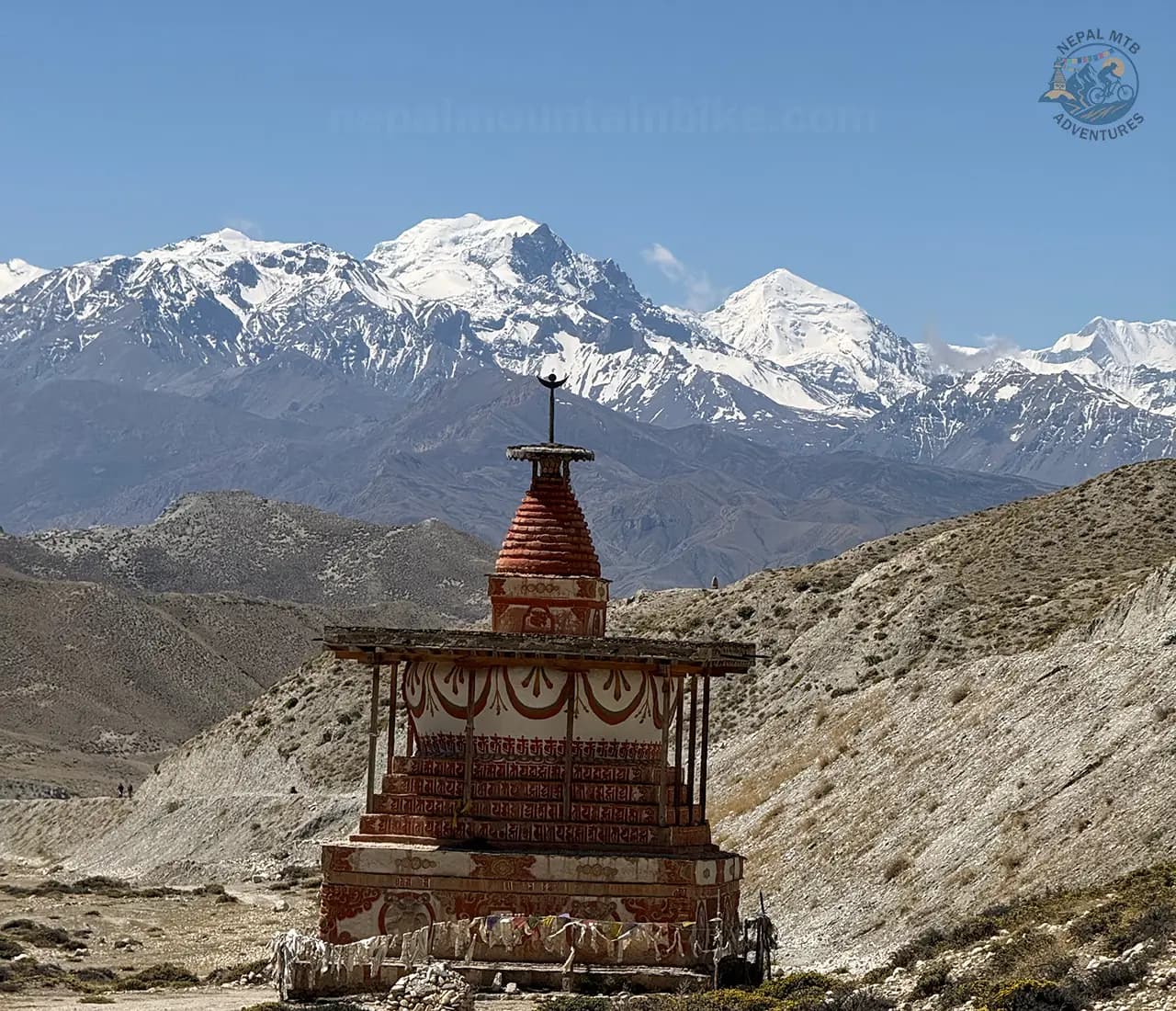
One practical thing before you ride any of it. Mani walls and chortens are passed with the structure on your right. On a bike that means picking your line thirty metres out rather than swerving at the last second. The section on riding responsibly in a restricted area covers the rest of it.
The Kali Gandaki gorge and its 140 million-year-old fossils
You ride the length of this gorge on the way in and the way out. Two things about it are worth knowing.
Why it is called the deepest gorge on earth
It is measured from the riverbed to the summits on either side, not from a rim straight down
Those summits are Dhaulagiri, 8,167 m (26,795 ft) to the west and Annapurna I, 8,091 m (26,545 ft) to the east
Measured that way, nothing else on earth comes close. Measured as a canyon, you get a different list. Both are honest; they answer different questions
The odd part: the river was here first. It cut down as fast as the range pushed up, so the gorge is older than the mountains that make it deep
Shaligram, and why you leave them where they are
Shaligrams are black ammonite fossils, roughly 140 million years old, from when this ground was seabed
The Kali Gandaki is the only place on earth they are found
They are worshipped as manifestations of Vishnu, sacred to Hindus and Buddhists, and carried from this riverbed to temples across the subcontinent
The rule: look, photograph, put it back. Collecting and exporting shaligram is restricted. A stone you pick up out of curiosity is, to a great many people, not a stone
Why the trail exists at all
This gorge was the trans-Himalayan trade corridor: salt coming south out of Tibet, grain going north. The caravan trails you ride were cut for those loads, not for scenery. Above them, the skyline runs Nilgiri, Tukuche Peak and the Damodar Himal, with Dhaulagiri and Annapurna I anchoring both ends.
Festivals and events: Tiji, Yartung and the April race
Two festivals and one race shape the calendar here. Both festivals fall inside the dry summer window, which is not a coincidence, and it matters if you are choosing a month.
Tiji: Held in late May or early June, with the 2027 dates set for 1 to 3 June, this three-day festival features masked dances by the monks of Chode monastery, and the name means prayer for world peace. It takes place inside the walls of Lo Manthang.
Yartung: Held on the Janai Purnima full moon in August or September, this end-of-summer festival features horse racing, archery, and a great deal of celebrating in Lo Manthang and Muktinath.
Mustang Trail Race: Held in April, this eight-stage, 170 km (106 miles) running race runs from Kagbeni to Lo Manthang to Yara and out via Muktinath, covering the corridor and the eastern loop.
Tiji festival in Upper Mustang
The dances tell the story of Dorje Jono defeating a demon and driving it out of the country. It is not staged for visitors. It is the ritual year of a working monastery, and the whole town organises itself around it. Check our guide to the Tiji festival in Upper Mustang; travel with Nepal MTB Adventures for the Tiji festival 2027.
Tiji follows the Tibetan calendar, so the dates move every year and are confirmed by Chode monastery's own astrological calculations, usually months ahead. We check them each year and update this page.
Why the date matters for riding. Early June puts Tiji right at the front of the summer window, when Lo Manthang is mild at night and calmer than autumn for wind. The festival and the good conditions are not two separate reasons to come. They are one reason. The conditions behind that are covered in riding Nepal through the monsoon months.
Yartung
Horse racing and archery at the end of summer, and like Tiji, it moves with the calendar each year. It sits at the other end of the same dry window.
The April race, and why we mention it
The Mustang Trail Race is a running race, not a bike race, and we would not want anyone turning up expecting one. We mention it for a single reason: an eight-stage foot race needs trail, not jeep road. That the race has run this ground for years is independent evidence that a real off-road network exists here away from the road, and that it is long established rather than something invented for a brochure. For what that means under your wheels, see how much of the route is road and how much is trail.
If you want to ride around a festival
Lo Manthang is a walled town with a fixed number of rooms, and a bike group also needs somewhere secure to put ten or twelve bikes overnight, which is a harder ask than rooms alone
Book months ahead, not weeks, for either festival
Tell us early, and we will build the dates around it. Contact us.
Wildlife you can expect to see
This is a desert, so there is less wildlife than in the forested parts of Nepal, but what is here is easier to spot because there is nothing to hide behind.
What you are likely to see
Animal | Where you see it | How likely |
Blue sheep, also called bharal | High slopes, especially the eastern side around Yara, Tangge and Chhoser | Common, most riding days |
Himalayan griffon | Overhead, from mid-morning as the thermals build | Common |
Lammergeier, the bearded vulture | Overhead, often alone | Regular |
Kiang, the Tibetan wild ass | Northern plateau toward the border | Occasional, pure luck |
Yaks, horses and mule trains | The trails and villages, all day | Guaranteed |
Snow leopard | Present in the wider region | Rarely seen |
How the region is changing: water, climate and the border
It is tempting to describe Upper Mustang as a place where nothing has changed for six hundred years. That is the version in most travel writing, and it is not true. Two things are changing fast, and both are visible from the saddle.
Riding responsibly in a restricted area: Upper Mustang
The rules you are actually riding under
Restricted status is not a formality, and it is worth knowing exactly what it asks of you before you arrive. In practice it comes down to five things:
Approved routes only. Your permit covers a declared route. Drifting off it because a ridge looked good from below is not a small thing, and it is the guide who answers for it.
Permits carried, not filed away. They are checked physically, and you need them on you rather than in a bag on the support vehicle.
A licensed guide, always. This is a legal requirement in a restricted area, not a service we are upselling you.
A registered agency behind the permit. The permit cannot be issued to you directly, and it cannot be bought at the trailhead.
No wild camping or wandering off to sleep somewhere scenic. You stay where the itinerary says you stay.
Access here has been controlled since the region opened in 1992, and that control is a large part of why the place is still intact. The rules are the reason there is something worth riding to.
The ground toward Kora La at 4,660 m (15,290 ft) on the Tibet border is politically sensitive, and it is no longer the quiet frontier it was. The crossing reopened in November 2023, first for Upper Mustang residents, and an immigration office and customs post now operate there. Commercial trade runs through it. The Chinese side has a paved two-lane road and a modern customs building. The Nepal side does not. For a rider, this is a look at it point rather than somewhere to wander. Instructions from your guide are not open to discussion, and this is the one part of the trip where improvising has consequences for people other than you. For why this region has to be ridden guided at all, see why Upper Mustang has to be guided.
Monasteries, mani walls and caves
Pass mani walls and chortens with the structure on your right. Do it on the bike as well as on foot.
Monasteries are in daily use. Some chambers do not allow photography at all, and the response to that is to put the camera away rather than to negotiate. The caves are the same. They are places people still use and still store things in, not ruins, so take nothing out of them. Not a fragment, not a stone, not a scrap of cloth.
Ask before photographing people, monks, or interiors, and accept no as an answer without a second attempt from further away.
Water and waste
Water is scarce in a desert, and most of it is carried. Treat and refill rather than buying bottled water. There is no waste collection out here at all, so everything that comes in goes out with the support vehicle, including tyre packaging, gel wrappers and old sealant. We do that because there is genuinely nowhere else for it to go, not as a gesture.
Drones are sensitive here. Not near monasteries, not at festivals, not over people, and absolutely not near the border.
Where your money goes
Spend where it lands. Teahouses, village shops, local guides, local staff. The money that stays in these villages is the argument for keeping these trails open to riders at all.
Our guides carry the relationships in these villages, which is why we are the ones asking you to do all of this. When a group rides badly through here, it does not cost that group anything. It costs the next ten groups, and it costs the people who vouched for them.
Why a mountain bike company, not a trekking company
Most Upper Mustang trips are sold by companies whose main business is trekking. That is not a criticism; it is just what the market looks like here. Trekking is the industry this region grew up around, and a bike itinerary is often added to a catalogue that was built for walkers.
We only do this one thing. Nepal MTB Adventures has been running mountain bike trips since 2004, and we own a bike shop, a rental fleet, and a workshop in Pokhara. Here is where that actually shows up on a trip, in the order you would notice it.
The route is chosen for riding
A trekking route and a riding route are not the same line, even between the same two villages. Walkers can take a stepped path that a bike has to be carried down. Riders want the contour trail that walkers find boring, and the descent that drops the right way.
The difference on this route is where the itinerary leaves the jeep road. The road to Lo Manthang made a two-week expedition possible, and it is also the least interesting surface in Mustang. Knowing which side trails connect, which climbs are rideable and which are a push, and which descents are worth the extra day, comes from riding them repeatedly. It does not come from a map.
"We cycled from Jomsom to Lo Manthang over 5 days, and although some days were very tough, the scenery was amazing, and the overnight stops were awesome. The return leg of the journey was much more dramatic as we left the roads behind and travelled more by singletrack."
- Craig L, November 2025, TripAdvisor
The bike is ours, and so is the mechanic
A master mechanic travels with the group, with a mobile workshop and expedition-level spares. There is no bike shop past Jomsom, so once you are north of there, the only workshop in Upper Mustang is the one your group brought with it.
That matters more than it sounds. A rear derailleur hanger, a torn sidewall, or a wheel out of true is a minor inconvenience at home and a trip-ending problem four days from a road. A trekking guide, however experienced in the mountains, is not going to rebuild a wheel at 3,800 m.
"The benefits of going with a local company were apparent every day with our encounters with people in each village. It even enabled us to find new trails that were known only to the residents of these villages."
- Dustin Eells, May 2022, TripAdvisor
The grading is a riding grade
We grade this route Red at A3 on our own system, which separates technical difficulty from altitude. That tells a rider two useful things: how hard the ground is, and how high the ceiling is. Phrases like moderate to strenuous do not tell you either, because they were written for walkers, and walking difficulty and riding difficulty are not the same thing at all.
The pacing is built for how fast a bike moves
This is the one that actually affects your safety. A rider covers in three hours what a walker covers in a day, so a cycling itinerary can gain sleeping altitude far faster than a trekking itinerary without anyone noticing. A walking schedule is self-limiting. A riding schedule is not.
An itinerary designed around walking days and then handed to riders will move you up too quickly. Ours controls sleeping altitude rather than daily distance, which is why some stages look short on paper.
The support is set up for bikes
A lead guide and a sweep guide, so nobody rides alone at the back. A 4WD support vehicle carrying luggage, spares and water. Guides who ride, and who can look at a rider on a loose descent and tell whether they are fine or getting tired in a way that is about to cause a crash.
For the e-MTB trips, it goes further, because battery logistics are their own problem. Spare batteries travel with the group, since a lodge that can trickle charge a phone cannot put 500 Wh back into a battery overnight.
Who reviews this route, and how often
This itinerary was designed for mountain biking rather than adapted from a walking route, and it is reviewed by our senior guiding team instead of being left to age on a website.
Reviewed by:
Laxman Sunar, Senior MTB Guide. Upper Mustang field experience: 15 years.
Sophiya Biswakarma, MTB Guide. Trail, field, and mountain biking experience: 7 years.
What the review covers: route suitability, riding difficulty, terrain, altitude exposure, bike setup, logistics, support access, and alternative routing.
What riders say about this route
The quotes on this page are from riders who did this trip. You can read all of them, unfiltered and including any that are not flattering, on TripAdvisor. We would rather point you at the whole list than pick the best ten and print those.
What to ask any operator before you book
This is a checklist to take to anybody selling you an Upper Mustang bike trip, including us. Ask all ten. The answers, and how fast they arrive, tell you more than any page of copy.
Does the itinerary leave the jeep road, and where exactly? A road runs to Lo Manthang. Ask which days are off it and which are on it, by name.
What is the sleeping altitude for every night? Not the daily distance. If nobody can produce that list, the trip was not built around altitude.
Who is with the group on the trail? Ask specifically whether there is a sweep guide as well as a lead guide, and whether a mechanic rides with the group.
What spares travel, and who can fix a wheel at 3,800 m? There is no bike shop past Jomsom, so whatever answer you get is the whole answer.
What happens if the Jomsom flight does not go? Ask what the alternative is, and whether the schedule has room to absorb a lost day.
What happens if a rider gets altitude sickness? Ask about descent options, oxygen, and what the guides are certified in.
Is the company a registered Nepali agency that files the restricted area permit itself? Only a registered agency can file it at all.
Are the permits included, or added later? The restricted area permit is charged per day inside the zone, so this is a real number and not a small-print item.
What bike is supplied, and who maintains it? Ask who services it, where, and how often.
What is the minimum group size, and does the trip still run if numbers are low? A trip with a minimum can be cancelled on you after you have booked flights.
Our answers, without decoration. A lead guide and a sweep guide on every departure. A master mechanic with the group, plus 4WD support and a mobile workshop carrying expedition spares. Our own Trek, Scott and Bergamont fleet, maintained in our own workshop in Pokhara. A registered Nepali agency that files its own restricted area permits, with the Restricted Area Permit and ACAP included. Guides have Wilderness First Responder certification, and emergency oxygen is carried by the group. Guides include Laxman Sunar and Sophiya Biswakarma, and a team that has ridden this region since 2004. You can read about Jagan Bishwokarma and the guide team before you ask us any of it.
Frequently asked questions
Is Upper Mustang open to foreigners?
Yes. The region has been open since 1992, after decades of being closed to outsiders completely. Open does not mean unrestricted, though. It is a restricted area, which means you need a Restricted Area Permit, an Annapurna Conservation Area Permit, a licensed guide, and a registered Nepali agency before you go north. You cannot simply arrive at Kagbeni and ride on. The permit is checked physically at the Kagbeni checkpoint, and without it you are turned around at the desk.
Do I still need a guide now that solo permits are allowed?
Yes. The rule that changed on 22 March 2026 was the two-person minimum on a single permit application. Before that date, one rider could not legally hold a restricted area permit at all. Now one rider can. What did not change is everything around it: a licensed guide and a registered Nepali agency are both still mandatory. Solo here means one permit holder, not riding alone and not arranging it yourself. You still cannot buy the permit personally; you cannot buy it online, and you cannot buy it at Jomsom or Kagbeni.
Can I ride to the Tibet border at Kora La?
You can reach the area near the border at about 4,660 m (15,290 ft), subject to permits and to conditions on the day. You cannot cross it. This is politically sensitive ground, and the rules there are enforced by people who have no interest in your itinerary. Treat your guide's instructions as fixed, keep drones packed away, and be careful about what you photograph. It is a look-and-turnaround point, and the ride up to it is the reward rather than the border itself.
How many days do I need inside the restricted zone?
The Restricted Area Permit costs USD 50 per person per day, and the clock starts when you cross the Kagbeni checkpoint, so trip length is partly a budget decision. Since 22 March 2026, the charge is purely per day. Under the old rule, it was a flat USD 500 for the first ten days, so at 10, 12, or 14 days inside the zone, the cost is exactly what it always was. Only trips shorter than ten days got cheaper. The tension is real: fewer days cost less and acclimatises you worse. ACAP is separate, at NPR 3,000, roughly USD 22 to 25.
Is there mobile signal or wifi?
It is patchy, with real dead stretches. Some villages have a usable signal, some hold nothing, and it can drop out for hours of riding at a time. Wifi exists in some teahouses, is usually slow, and is shared with everyone else in the lodge. Plan on being genuinely offline for parts of most days, and tell people at home that before you leave, so an unanswered message does not turn into a problem for somebody in another country.
Can I charge a camera or a phone?
Yes, in most places. It is usually solar, usually paid per device, and usually a queue, because everyone in the lodge wants the same sockets at the same time in the evening. Bring a power bank and charge it during the day so you are not waiting on a socket at 8 pm. What that supply will not do is charge an e-bike. An e-MTB battery needs a stable mains supply for four to six hours, which is a completely different order of demand. You also cannot fly your own battery into Nepal in the first place, because airlines refuse lithium batteries above 160 Wh, and e-MTB batteries run 400 to 750 Wh.
Is there a hospital?
There is a health post at Jomsom, and that is the level of medical care available in the region. Anything serious goes to Pokhara. Jomsom is the practical edge of services in every other sense too: it holds the last ATM and the last bike shop, and there is nothing of either past it. Everything you need in rupees for the whole restricted section has to come in with you. This is also exactly why descent is the primary plan for altitude problems and why a helicopter is the backup rather than the first move.
When is Tiji, and can I ride and see it?
Tiji is three days of masked dances at Lo Manthang, performed by the monks of Chode monastery. It follows the Tibetan calendar, so the dates move every year, and in 2027 it falls on 1 to 3 June. That is early in the summer window, which is the mildest and calmest riding of the year up there, so a Tiji trip and a good-conditions trip turn out to be the same trip. The catch is beds. Lo Manthang is a walled town with a fixed number of rooms, and a bike group needs secure bike storage as well as beds. Plan months ahead, not weeks.
Are the sky caves open to visitors?
Shija Jhong at Chhoser, sometimes written Jhong Cave, is the one you go inside, and it is five storeys connected by internal ladders. It is dark, steep and tight rather than scenic, and stiff-soled riding shoes make the ladders harder than they need to be, so carry something else to change into. Luri Gompa on the eastern side is also reached by ladder. Some sites need a monk present to open them, so opening hours are a genuine constraint on the day. Take nothing out of any of them.
Can I ride Upper Mustang on an e-MTB?
Yes, and we run a dedicated 15-day e-MTB expedition through the region. The terrain suits e-MTBs, because most of the climbing is sustained rather than tight and technical. Two things to understand before you commit. You cannot bring your own e-bike, because airlines refuse lithium batteries above 160 Wh, and e-MTB batteries run 400 to 750 Wh, so it has to be a local bike with vehicle support and spare batteries. And assistance does not help you with altitude at all, since you sleep at the same heights and acclimatise at the same rate, so the itinerary is paced the same way. What it does change is the pass climbs, the back-to-back big days, and the ability of a mixed-strength group to ride together.
Is Upper Mustang harder than the Annapurna Circuit?
Different rather than simply harder. The Annapurna Circuit has the higher single point. Upper Mustang has more consecutive days on loose, dry, exposed ground with less recovery between them, plus a permit clock running the whole time. Daily stages of 25 to 45 km (15 to 28 miles) read easy on paper and are not, because you ride them mostly between 3,500 and 4,210 m (11,500 to 13,810 ft). We grade it Red at A3, and hike-a-bike on the steep pass approaches is normal rather than a sign that something went wrong. Riders who have done the Circuit are usually ready for this one. If you cannot choose between them, there is a 22-day trip that rides the Circuit and then continues north into Mustang.
What happens if I get altitude sickness at Lo Manthang?
You go down. Descent is the only treatment that always works, and this route has road access at enough points to make that practical, which is not true everywhere in Nepal. Symptoms get reported early on our trips for exactly that reason, because a decision made at breakfast has options that the same decision made at dusk does not. A helicopter is the backup, not the plan, and it is weather-dependent for the same reason the flights are: once the valley wind rises around 11:00, aircraft stop. Check that your travel insurance covers you above 3,000 m before you come, because many policies cap there and become void above it.