

 Tripadvisor
 Google
 Facebook
 Trustpilot
 hard
hard5(36 reviews)
Upper Mustang Mountain Biking Guided Expedition
Upper Mustang16 days
$ 3850
Price may vary according to your plan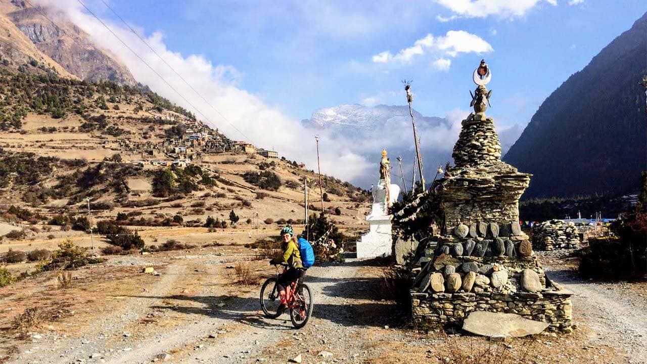
Travel with other adventurers on scheduled departures.
Start From
01 Oct 2026
End At
15 Oct 2026
Start From
17 Oct 2026
End At
31 Oct 2026
Start From
03 Nov 2026
End At
17 Nov 2026
Don't see a suitable departure?
Reserve the trip privately and choose your own travel dates.
The Annapurna Circuit has entered a new era. Once known for backcountry dirt tracks, this historic trekking route is now one of the world's premier high-altitude mountain biking frontiers, and this is a 15-day guided expedition that rides it properly.
We route this expedition away from dusty, traffic-heavy jeep roads, linking ancient singletrack, mule paths and suspension bridges. You climb the Marsyangdi valley through Gurung villages, pine forest and apple orchards to Manang, cross Thorong La at 5,416 m on foot with your bike, then descend past Muktinath and down the Kali Gandaki. The journey combines rugged jeep tracks, historic mule routes, natural mountain trails, technical alpine singletrack and a serious high-altitude hike-a-bike crossing before descending more than 1,600 vertical meters towards Muktinath.
This is a demanding backcountry expedition for experienced riders with solid aerobic fitness, strong bike handling, and a practical mindset at altitude. Designed and operated by Nepal MTB Adventures
Everything is handled: premium bikes, a first-aid-trained guide, a dedicated mechanic, hotels in Kathmandu and Pokhara, teahouse stays, all meals on route, and permits. A 4x4 support vehicle runs up to Manang and resumes at Muktinath, with local porters for the pass crossing.
Detail | Information |
Destination | Annapurna Conservation Area, Nepal |
Duration | 15 days, 14 nights, Kathmandu to Kathmandu |
Total riding distance | Approximately 279–300 km depending on route variations and optional riding |
Highest point | Thorong La Pass, 5,416 m / 17,769 ft |
Total elevation gain | Approximately 5,000 m across the riding days |
Average daily riding | 4 to 6 hours, depending on terrain and conditions |
Trail composition | Approximately 35% rugged jeep track, 35% alpine singletrack, 15% flowing dirt trail and 15% paved road |
Planned Rideability | Approximately 90–95% under favourable conditions, depending on snow, trail conditions and rider ability |
Difficulty | Advanced/Challenging |
Recommended Rider Level | Fit intermediate to advanced mountain bikers with meaningful off-road experience |
Highest Overnight | Thorong Phedi at approximately 4,450 m or High Camp at approximately 4,880 m, depending on the overnight plan |
Support Team | WFR-certified Local MTB professional lead guide, assistant guides, bike mechanic, 4WD support where road access permits, satellite communication and high-altitude porter support |
Best seasons | Autumn (late September to November), spring (March to May) |
Start and end | Kathmandu / Kathmandu, via Pokhara |
This is a fully supported point-to-point expedition with a local MTB company, Nepal MTB Adventures. It is not a self-guided route pack, nor is it subcontracted.
You are never riding this route alone or unsupported.
Lead guide. Licensed, first aid trained, and an experienced mountain biker from these valleys. Sets the group pace, makes altitude calls, and has authority to turn any rider around.
Assistant guides. Scaled to group size to keep a safe guide-to-rider ratio at altitude. If the group splits, one assistant stays with the descending rider while the rest continue.
Dedicated bike mechanic. Travels with the group, full route, with tools and spares. Handles daily checks, tyre pressure adjustments, and brake pad swaps before major descents.
High altitude porters. Local and experienced, the reason the pass day works. They carry bike frames over the steepest sections between Thorong Phedi and Thorong La.
4x4 support vehicle. Runs up to Manang and picks up again at Muktinath. Carries luggage, spares, medical oxygen and mechanic's kit, and serves as the fast evacuation route on the lower circuit.
Meet the team:
Jagan Biswakarma - Founder, lead guide and expedition logistics
Laxman Sunar - Senior MTB guide, 15+ years of experience on the Annapurna route
Dhan Magar - Senior mountain guide and high-altitude logistics, 20+ years
Anil B.K. - MTB guide and competitive rider, 9+ years
Suman B.K. - Senior guide, technical descending specialist, 10+ years
Santaram - Senior lead mechanic and trailside support, 20+ years
Mangal Chantyal and local mountain staff - trail, logistics and operational support, 12+ years
Every guide, mechanic and porter is hired directly from the region, paid a fair wage, insured, and supported through professional certification.
The right line, not the road. Knowing where old walking trails run alongside the jeep road takes years of local knowledge.
An ascent profile built to acclimatise you. The Manang rest day, the climb-high-sleep-low hike, and short 11 km and 7 km stages above 4,000 m all help manage altitude.
Twice-daily medical monitoring. From Day 5, heart rate and blood oxygen are checked morning and evening, so problems are caught early.
A mechanic and a spares kit. There's no bike shop above Besisahar. A broken hanger, torn tyre or worn pads can end a trip without one.
The frame carries over the pass. Hauling your own bike up frozen switchbacks from 4,450 m to 5,416 m takes everything you have. Our porters carry the frames over the worst of it.
Evacuation that already exists. Vehicle access to Manang, a Pokhara office linked to helicopter rescue, and guides with the authority to call it.
Permits, lodges and logistics handled. ACAP permit, TIMS card, every bed, transfer and on-route meal arranged.
The Annapurna Circuit circles one of the world's greatest mountain ranges in about two weeks, taking you through a wide variety of landscapes.
Five climate zones in fifteen days
Humid subtropical river valley at 800 m
Terraced Gurung farmland and waterfalls
Blue pine and alpine forest
High Tibetan-influenced plateau above the treeline
Rain shadow desert on the far side of the pass
The pass itself
Thorong La at 5,416 m, reached under your own power
The prayer flag crossing is the moment riders remember for years
A genuine Himalayan achievement.
The descents, which are the real payoff
1,600 vertical metres in one continuous drop from the pass to Muktinath
Two more days of descending through the Kali Gandaki gorge
Among the longest scenic descents available anywhere on a bike
The surface breakdown for the whole route, so you know what you are riding before you book.
Surface | Share of Route | What It Means |
Rugged jeep track | 40% | Loose rock, water bars, ruts and braided lines. Rough, not smooth road. |
Technical alpine singletrack | 35% | Bench-cut trail chiselled into the slope, exposed, tight switchbacks, thin air. |
Flowing dirt trails | 15% | Fast mule paths and village trails, rolling and grippy. |
Sealed roads | 10% | Short connections and the climb through Besisahar. |
The circuit is not one culture. In two weeks you pass through three distinct peoples, each with its own language, religion and history, and the change happens under your tyres.
Days | Community | Location | What Defines Them |
3–6 | Gurung (Tamu) | Lower Marsyangdi Valley | Known for their Buddhist and shamanic traditions, as well as their long history of Gurkha military service. |
6–8 | Manangi (Nyeshang) | Six villages of Upper Manang | People of Tibetan origin, historically famous as trans-Himalayan caravan traders with royal trade privileges. |
12–13 | Thakali | Kali Gandaki Valley (Thak Khola) | Traditionally controlled the Himalayan salt trade and established many of the teahouses that still serve trekkers and riders today. |
Indigenous to the hills and high valleys ringing the Annapurna massif
Religion blends Tibetan Buddhism with older shamanic traditions, still led by Pachyu and Khlebri priests
Known worldwide as Gurkha soldiers, serving in the British and Indian armies for more than two centuries
What you see from the bike: terraced farmland, stone villages, waterfalls falling across the trail
This route was not originally made for tourism. For centuries, this was a working trade corridor, one of the main arteries between the Tibetan Plateau and the plains of India, and almost every village you sleep in exists because of it. The Kali Gandaki valley in particular carried Tibetan salt south and Nepali grain north on horse and mule caravans, and the wealth that moved through it built the stone villages and the inns that became today's teahouses.
The timeline in short:
For centuries: Tibetan salt and wool travel south, Nepali rice and grain travel north, carried by yak, horse, and mule caravans through the Kali Gandaki and over the high passes.
The Kali Gandaki route mattered because of geography. The passes here are among the lowest and most direct crossings through the main Himalayan range, which made this the most important trade link between Tibet and the kingdoms of central Nepal.
The Thakali became the middlemen and grew wealthy on it, building the villages, lodges and flagstone lanes that still stand at Marpha, Tukuche and Lete.
The Manangi worked the same system from further east, but with royal trade privileges that let them carry high-value goods duty-free.
1950: China annexes Tibet. Trade patterns begin to shift.
1962: The Sino-Indian War closes the old cross-border rhythm for good. Salt caravans become redundant within a few years.
1977: The Annapurna region opens to foreign trekkers for the first time, after the government resolves the Khampa guerrilla conflict that had been running out of this area into Tibet.
The original circuit took around 23 days on foot, and it quickly became one of the most famous long treks in the world.
From about 1980 onward: road construction began, and over the following decades a jeep road pushed deep into both the Marsyangdi and the Kali Gandaki valleys.
Today: the old walking lines, mule paths and bench cut trails still exist alongside the road. Riding them rather than the road is the whole basis of this itinerary.
This route is a pilgrimage road as much as a trade road, and for two religions at once. You will ride past chortens, mani walls, and prayer flag lines every single day above Chame, and most riders pass them without knowing what they are looking at.
The sites you actually pass, in route order:
Braga monastery, Day 7. One of the oldest monasteries in the Manang district, built in stacked white chapels directly into the cliff face above the village.
Chortens and mani walls, Days 6 onward. The stone structures on the trail are reliquaries and prayer monuments. The custom is to pass them on your left, clockwise, and it is an easy courtesy to observe on a bike.
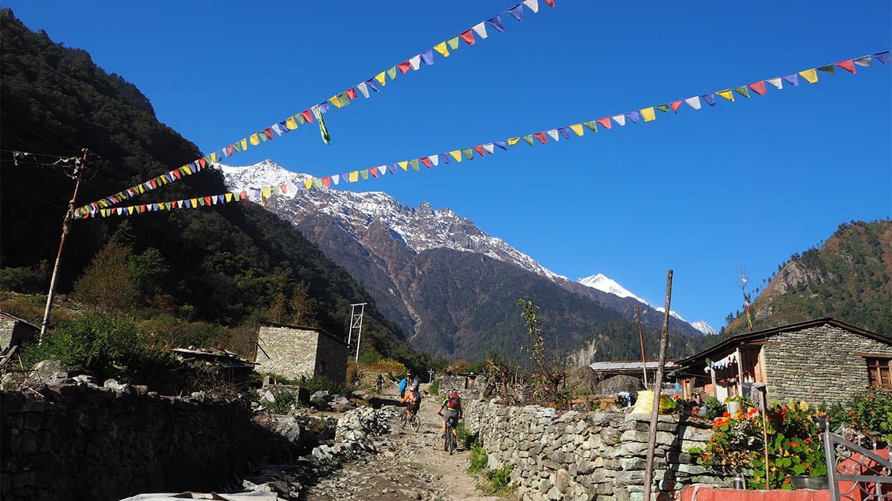
Prayer flags, everywhere above Chame. Five colours in a fixed order, representing sky, air, fire, water and earth. They are printed with mantras and are understood to carry the prayers on the wind as they fade.
Thorong La, 5,416 m, Day 11. "La" is Tibetan for "pass," and in Tibetan Buddhist tradition, high passes mark a threshold between worlds. The prayer flags at the top are a mass of tied-off crossings.
Muktinath, Day 11. Sacred to Hindus and Buddhists simultaneously. For Hindus, it is one of the 108 Divya Desams, dedicated to Vishnu as Sri Mukti Narayana, and the name means place of liberation. For Buddhists, it is Chumig Gyatsa, meaning hundred waters, linked to Padmasambhava, who is said to have meditated here.
The 108 spouts: Muktinath. Bull-headed spouts curve in an arc behind the temple. Pilgrims bathe under every one. Hindus understand it as washing away the accumulated sins of past lives, Buddhists as cleansing the 108 defilements of the mind.
Jwala Mai, below the main temple. A shrine holding flames that burn continuously on a natural gas seep beside spring water. Fire and water in the same place is the reason the site is considered extraordinary.
Lubra Monastery, Day 12 Lupra option. The first Bonpo monastery founded in Nepal and the only surviving one in Mustang.
The Kali Gandaki riverbed, Days 12 and 13. This is the single most significant detail on the route, and almost no rider is told it. The river is the only known natural source of shaligram in the world: black ammonite fossils, marine creatures from the sea that existed here before the Himalaya rose.
A note on riding respectfully: dismount or slow right down through village temple areas and monastery courtyards, pass chortens and mani walls on your left, and ask before photographing people at prayer. Your guide will flag the moments where it matters.
This trip is challenging in itself. You do not need to be a professional or a racer, but you do need to be a strong regular mountain biker who is comfortable on rocky trails and can handle long days back to back.
Two things make this trip demanding, and they are not the ones people expect.
The first is altitude. You ride above 4,000 m for several days, and you sleep at 4,450 m or 4,850 m before the pass. Aerobic fitness at sea level is what makes the thin air manageable, so put the training hours in.
The second is the pass itself. Getting a bike over 5,416 m mostly means carrying and pushing it up frozen switchbacks. Our porters take the frames over the worst sections, but you are still walking uphill at extreme altitude for several hours.
Your guide sets a safe group pace and the Manang rest day is built in for acclimatisation, not as a filler day. If someone in the group is not adapting, we have a support vehicle and a helicopter network, and we use them.
Your safety is our priority. Altitude at 5,416 m carries real risk, and this itinerary is built around managing it, not just reacting to it.
Medical tracking. From Day 5 onward, guides monitor and record heart rate and blood oxygen saturation for every rider, twice daily. A trend across three days tells us far more than a single reading.
Field trauma kits. Every departure carries a complete wilderness first aid kit, broad-spectrum medical supplies and emergency oxygen cylinders.
Acclimatisation built into the route. The Manang rest day, the climb high and sleep low hike, and the deliberately short 11 km and 7 km stages on Days 9 and 10 are all altitude management.
Helicopter evacuation. Our Pokhara office coordinates directly with the domestic helicopter rescue networks. This is exactly why your travel insurance must cover helicopter evacuation to 5,416 m.
Guides trained to turn people around. Every lead guide is empowered to descend a rider who is not adapting. That decision is never negotiated with the group.
One night in Kathmandu, two nights in Pokhara and eleven nights on the trail.
City hotels are premium boutique class on the Standard package and 4 or 5 star on Premium, twin share with breakfast.
On the trail we use the established network of family-run, locally owned teahouses, which is how the money reaches the valleys you ride through. Rooms are simple, clean twin share setups with solid mattresses and heavy blankets. Bathrooms generally have Western-style flush toilets and hot showers, either gas- or solar-heated, and they get more rustic above 4,000 m, which is honest rather than apologetic. Single supplements are available on request where the lodge can accommodate it.
Evenings happen around the central stove in the dining hall, burning wood lower down and yak dung higher up. It is the best place on earth to dry riding kit, and it is where the group properly gels.
Himalayan riding at altitude burns a serious amount of fuel. Teahouse food is fresh, carb-heavy, and cooked to order.
Dal bhat is the core fuel of this trip: lentil soup, rice, wild greens, and curried vegetables, and it is completely all you can eat. Refills keep coming until you stop them. On a big climbing day, eat two servings.
Beyond that, menus offer eggs, porridge, pasta, potatoes in every form, and garlic soup, which is a genuine altitude staple. Fresh local apple pie appears from Chame onward and gets excellent in Marpha.
We regularly manage vegetarian, vegan, and gluten-free requirements at every stop on the loop. Tell us in advance, and we brief the lodges ahead of the group.
Boiled, filtered and purified drinking water is provided and included. We actively discourage plastic bottles, which are expensive at altitude and a real waste problem inside a conservation area.
You ride the entire route inside the Annapurna Conservation Area, Nepal's first and largest protected area at 7,629 square kilometres. Your ACAP permit fee goes directly into managing it. In fifteen days, you climb through five climate zones, and each one has its own wildlife.
Zone | Days | Wildlife You May See | Vegetation |
Subtropical & Lower Temperate (500–2,700 m) | 3–5 | Rhesus macaque, grey langur, common goral, barking deer | Sal, chestnut, alder, terraced rice, and millet |
Temperate & Alpine Forest (2,700–3,600 m) | 5–7 | Himalayan tahr, musk deer | Blue pine, hemlock, oak, and rhododendron (in spring) |
High Alpine & Trans-Himalayan (3,600–5,416 m) | 8–11 | Blue sheep, Himalayan marmot, pika; snow leopard and Tibetan wolf (rarely seen) | Dwarf juniper, alpine cushion plants, sea buckthorn |
Mustang Desert & Kali Gandaki Gorge | 12–13 | Blue sheep, Himalayan monal, and other pheasants (Lete forest) | Thorny scrub, apple orchards of Marpha and Jomsom |
Blue sheep are the animal you are most likely to actually see, in loose herds on the slopes above Ghyaru and Ngawal, around Yak Kharka, and on the scree below Thorong Phedi.
The big birds are the highlight. The Himalayan griffon, an enormous pale vulture, is visible daily from Chame onward. The Lammergeier, or bearded vulture, has a wingspan approaching three metres and often comes along a ridge at eye level while you ride. The golden eagle is the resident eagle of the upper Manang valley.
Component | Recommended Approach |
Suspension Travel | Approximately 140–160 mm for a trail-oriented full-suspension setup |
Drivetrain | Reliable 1×11 or 1×12 with a sufficiently low climbing gear |
Example Gearing | Around a 30T chainring with a wide-range cassette such as 10–52T, adjusted for rider strength and wheel size |
Brake Rotors | 160 mm minimum, 180 mm or larger where the build allows |
Dropper Post | Strongly recommended for steep and technical descents |
Our fleet is modern, professionally maintained cross-country, all-mountain, and enduro full-suspension bikes from Trek, Scott, and Giant. Every bike is set up specifically for rugged Himalayan terrain:
Powerful hydraulic disc brakes, minimum 160 mm rotors and 180 mm where the build allows, because Day 11 alone is a 1,600 m descent
Wide-range 1x12 drivetrains, because the climbing here is long and you want the bailout gear
Durable tubeless tyres with reinforced casings, since the sharp slate and river stone on this route destroy thin sidewalls
Spares, tools and a dedicated mechanic travel with the group
The Standard package includes a premium hardtail. The Premium package includes a dual-suspension all-mountain or cross-country bike.
E-MTB is available on request. We run mid-drive Bosch Performance Line CX and Shimano EP8 systems. The support vehicle carries a mobile charging hub and spare battery packs, and batteries are charged every evening at the teahouses. The vehicle reaches up to Manang and picks the group up again at Muktinath, which covers the sections where charging is hardest. On the pass crossing, our porters carry the heavier e-bike frames over the steepest hiking sections. Pony hire is also available along the route if you need it.
Plenty of riders do, and that is completely fine. Bring it in a bike bag or box, and we will store the bag in Pokhara while you ride.
What we insist on: two matching spare derailleur hangers for your exact frame model. There is no bike shop in Manang that stocks your hanger, and a snapped hanger with no spare ends your expedition on Day 7. Also bring three inner tubes, tubeless tyre plugs, two pairs of matching brake pads and a high-volume hand pump. Two pairs of pads is not overkill. The Thorong La descent and the Kali Gandaki days will eat a set.
Pre-trip bike checklist. Before travelling, check: brake pad wear, lever feel and hydraulic system condition; chain, cassette and derailleur condition; smooth and reliable shifting; suspension sag and rebound; fork and shock seals for leaks or damage; tyres, spokes and rim condition; headset, bottom bracket and hub bearings; model-specific parts that may be difficult to source in remote Himalayan villages.
Autumn, late September to November. The best window. Clearest skies, the best mountain views of the year, and firm, dry trails after the monsoon has washed the dust away. October is the peak season. If you want the Kali Gandaki raptor migration as well, late October into November is the time to be riding on Days 12 and 13.
Spring, March to May. The second-best window. Warmer, with the rhododendron forests in full bloom on the lower sections. April is particularly good. Slightly more haze than autumn, so mountain views can be softer.
Monsoon, June to August. Not recommended. Rain, deep mud, leeches on the lower trails, and cloud sitting on the mountains you came to see. Mustang sits in the rain shadow and stays rideable, which is why our Mustang trips run in summer, but the full circuit does not work.
Deep winter, around January. Not recommended. Snow closes Thorong La and the high teahouses shut. A crossing cannot be guaranteed.
Protection: We provide premium helmets. Lightweight knee pads and full finger gloves.
Apparel: Two to three pairs of good padded chamois shorts, two to three breathable riding jerseys, and durable trail shorts or pants.
Footwear: Sturdy mountain bike shoes with sticky high-traction soles, either flats or walkable clipless. This matters more than usual, because you will be hiking uphill in them on Day 11 on frozen ground.
Layers: A packable down jacket, fleece mid layers, and good thermal base layers. Merino wool is ideal because it keeps working when damp.
Shells: Windproof and waterproof jacket and pants for the high pass, where the weather changes fast.
Accessories: A warm beanie that fits under a helmet, a neck buff, and high UV protection sunglasses. UV at 5,000 m is brutal, and so is glare off snow.
Sunscreen with high SPF and lip balm with UV protection, a small hydration pack, a reusable water bottle, a headlamp with fresh batteries for the 4 am pass start, personal medication, altitude medication if your doctor advises it, toiletries, your passport, your insurance documents including the policy number and emergency line, and Nepali rupees in cash for drinks, tips and anything you want to buy on the trail.
Nepal MTB Adventures handles the permits and route registrations required for the expedition, including the ACAP permit and TIMS card.
Travel insurance is essential. Your policy should explicitly cover:
Mountain biking
High-altitude travel appropriate for the maximum elevation of the expedition
Emergency medical treatment
Emergency evacuation, including helicopter evacuation where medically necessary and available
Bring Your Own Bike. Save USD 200 on the Standard Package or USD 300 on the Premium Package.
Full-Suspension Bike Upgrade. Upgrade to a full-suspension mountain bike on the Standard Package for USD 550 for the entire expedition.
E-MTB Upgrade. Upgrade to an E-MTB on either package for USD 750 for the entire expedition.
Single Room Supplement. A private-room supplement is available for USD 450, subject to availability. Private rooms are generally easier to secure in Kathmandu and Pokhara, while availability is more limited in remote high-altitude villages.
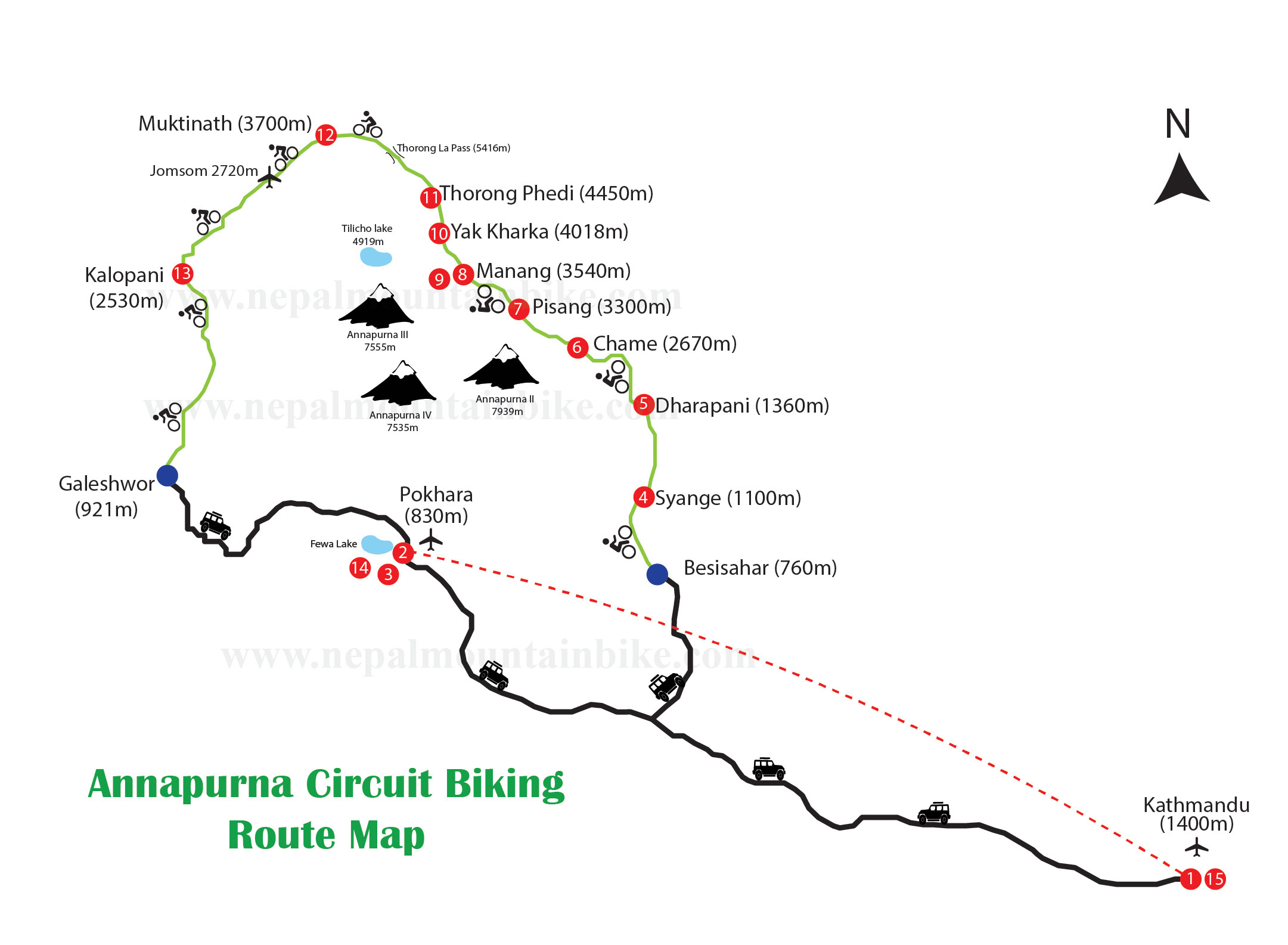
Below the map, place the 15-day elevation profile with Thorong La marked at 5,416 m.
Written by: Jagan Biswakarma, Founder of Nepal MTB Adventures and Himalayan MTB expedition specialist.
This Annapurna Circuit Mountain Bike Tour itinerary was prepared based on practical route planning and mountain biking experience developed through operating guided MTB expeditions in Nepal.
Route information reviewed by: Laxman Sunar, Senior MTB Guide and Trail Expert with more than 15 years of experience. Laxman reviewed the route descriptions, trail conditions, technical riding sections, route variations, and the high-altitude crossing of Thorong La.
Last reviewed: August 2026. Mountain conditions can change, and daily route decisions may be adjusted according to weather, snow, trail conditions, safety, and group requirements.
Ready to ride the Annapurna Circuit? This is a bucket-list trip, and our autumn and spring departures fill up quickly. Contact us with your dates, and we will match you to the right package and sort your bike, permits, and plans.
Arrival in Kathmandu(1,400 m)
Welcome to Nepal. Our team meets you at Tribhuvan International Airport and transfers you privately to the team hotel in Thamel.
The evening is when the expedition actually begins. We run a thorough trip briefing covering the route, the altitude plan and how the pass day works, then go through bikes. If you have brought your own, we inspect the setup and check it over. If you are riding ours, this is where we dial in fit, saddle height, cockpit and tyre pressure so nothing needs fixing on the trail.
What happens today
Airport meet and private transfer to Thamel
Full trip briefing on route, altitude plan and pass day
Bike setup inspection, or rental fitting and adjustment
Group dinner with the team
Overnight: Premium boutique or 4/5 star hotel in Thamel, Kathmandu, 1,400 m
Meals: Dinner
Kathmandu to Pokhara (822 m)
We travel from the capital to Pokhara, the hub of our mountain biking operations, either by road or on a short domestic flight depending on the group and the day. Pokhara is where the expedition is actually run from. The afternoon is yours: rest off the travel, take a short spin along the lake to loosen your legs, wander the town, or come to our workshop for a final gear check. Anything that needs sourcing, swapping or adjusting gets sorted today, because from tomorrow morning the nearest bike shop is a long way behind you.
Transit time | Riding |
|---|---|
6 hours by road or 25-minute domestic flight | No riding today |
Overnight: Lakeside boutique hotel, Pokhara, 822 m
Meals: Breakfast, lunch, dinner
Pokhara to Sundar Bazar via the Royal Trails
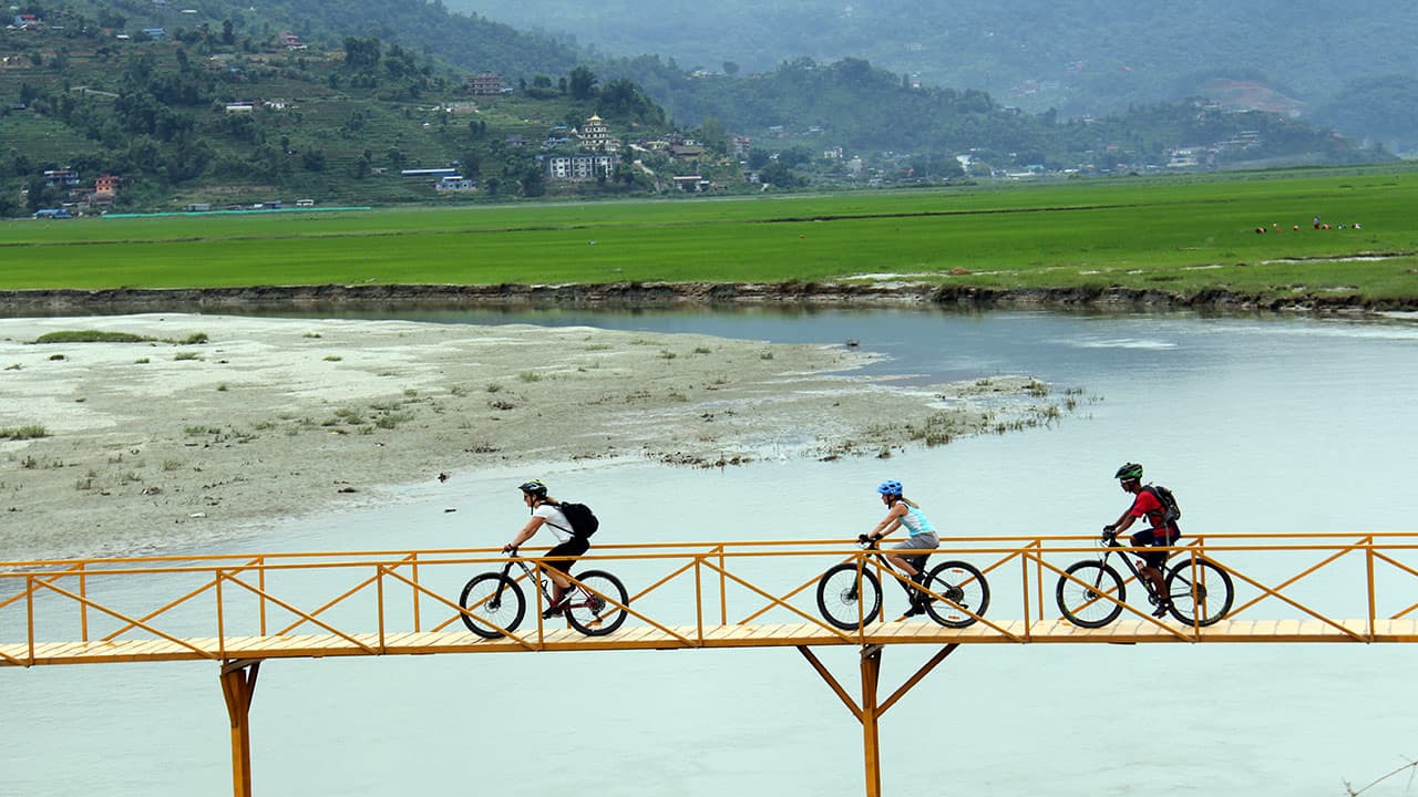
The first day on dirt, and we skip the highway tarmac entirely. Instead, we drop straight onto the historic Royal Trek tracks by way of Begnas Lake and Bhorletar. This is humid, low-altitude riding and it is the friendliest terrain of the whole trip. Rolling dirt paths, punchy short climbs that are over before they hurt, and singletrack cutting through terraced Gurung and Brahmin farmland.
The 65 km reads big on paper, but the gradients are forgiving and the day is really about waking your legs up and getting your bike set up properly under load before the valley narrows and the real climbing starts.
You are in Gurung country from here until the high valley, riding through the terraced hillsides and stone villages that define this part of the Annapurna foothills.
Distance | Ride time | Elevation gain | Elevation loss |
|---|---|---|---|
65 km | 6–7 hours | +857 m | Minimal |
Key points along the way
Begnas Lake and Bhorletar
The historic Royal Trek tracks, ridden instead of the highway
Terraced Gurung and Brahmin farmland
The biggest distance day of the trip, on the gentlest gradients
Terrain: Subtropical dirt tracks, singletrack, short climbs
Overnight: Mountain lodge, Sundar Bazar
Meals: Breakfast, lunch, dinner
Sundar Bazar to Syange
We start from Sundar Bazar and take a brief asphalt climb up to Besisahar, the traditional gateway to the circuit and the point where most riders and trekkers formally start the loop. From Besisahar, the topography changes character fast. The valley closes in, the surface turns to raw rocky dirt, and we track upstream along the Marsyangdi River gorge with the water running hard below the trail. The waterfalls through this section are large enough that on some of them the spray reaches the track. The climbing figure is modest, but the ground is rough and constantly changing, and this is the day the trip stops feeling like a bike ride in the hills and starts feeling like an expedition into a gorge.
Distance | Ride time | Elevation gain | Elevation loss |
|---|---|---|---|
45 km | 4–5 hours | +430 m | −150 m |
Key points along the way
Besisahar, the traditional gateway to the circuit
The Marsyangdi River gorge, ridden upstream
Massive waterfalls falling beside and across the trail
The first genuinely rugged surface of the trip
Terrain: Rugged doubletrack, waterfalls, river gorge paths
Overnight: Riverside mountain lodge, Syange
Meals: Breakfast, lunch, dinner
Syange to Chame (2,670 m), The Great Ascent
The biggest climbing day of the expedition, and the one riders remember in their legs. You gain 1,800 vertical metres, and there is almost no descent to recover on, so this is five to six hours of sustained upward work.
The reward is watching the world change around you as you climb. You start in humid valley air and finish in crisp alpine pine forest, crossing the 2,000-metre threshold along the way. The trail asks for steady, patient power rather than bursts: rocky switchbacks, steep doubletrack ramps that pitch up without warning, and exposed cliffside ledges where the drop is on one side, and the rock wall is on the other. The day finishes under the view of Lamjung Himal, which is the first time the high mountains properly announce themselves.
Starting today, guides will record heart rate and blood oxygen saturation twice daily for every rider. This is not a formality. A trend across three days is what tells us how you are adapting, and it starts here because from now on you are gaining real altitude every day.
What makes today hard
The biggest single climbing day of the expedition at +1,800 m
Almost no descent to recover on
You cross the 2,000 metre threshold
Exposed cliffside ledges and steep doubletrack ramps
Medical monitoring starts today and runs to the end of the trip
Terrain: Rocky river stones, damp pine roots, slate switchbacks
Overnight: Mountain lodge, Chame, 2,670 m
Meals: Breakfast, lunch, dinner
Distance | Ride time | Elevation gain | Elevation loss |
38 km | 5 to 6 hours | +1,800 m | Minimal |
Chame to Upper Pisang, The Pine Forest Singletrack
A deliberately shorter day, and after yesterday you will be glad of it. The altitude is now doing real work on your body, so the itinerary eases off in distance while still gaining height. The riding is some of the most pleasant of the whole trip. Natural pine needle singletrack and old mule trails run through the pine forest above Chame, and the surface is soft, quiet and grippy underneath the tyres, which is a genuine change from the rock and slate of the last two days. Three to four hours in the saddle leaves plenty of the afternoon at the lodge, which is exactly what your body needs at this stage.
Distance | Ride time | Elevation gain | Elevation loss |
|---|---|---|---|
20 km | 3–4 hours | +630 m | −110 m |
What to expect
A short day by design, to let altitude adaptation keep pace
Soft pine needle singletrack, quiet under the tyres
Old mule trails through pine forest
An early finish and a long afternoon to rest
Terrain: Natural pine needle singletrack, old mule trails
Overnight: Authentic alpine lodge, Upper Pisang
Meals: Breakfast, lunch, dinner
Upper Pisang to Manang (3,540 m) via the Ngawal High Trail
This is the day people book the trip for. Rather than taking the easy valley floor road, we climb onto the technical high trail through Ghyaru and Ngawal.. The climb out of Pisang is a series of tight switchbacks in thin air, and it is honest work, but what it buys you is the best singletrack in Nepal. Bench-cut trail chiselled directly into the mountain slope, narrow, exposed in places, running for kilometres with the full wall of the Annapurna range standing across the valley from you the entire way. It is the kind of riding you plan a trip around.
It is also the smartest acclimatisation on the itinerary, because the high line takes you well above your sleeping altitude and then brings you back down to Manang for the night, which is the climb high and sleep low principle applied to a day of riding rather than a rest day hike.
You are now entering the Nyeshang valley, the six villages of upper Manang whose trading history is set out further up this page. Keep an eye on the slopes above the trail here too, because this stretch and the Ngawal plateau are two of the more reliable places on the circuit to spot blue sheep.
Distance | Ride time | Elevation gain | Elevation loss |
|---|---|---|---|
22 km | 4–5 hours | +480 m | −240 m |
Why this day matters
The high trail through Ghyaru and Ngawal, not the valley floor road
Bench cut singletrack chiselled into the mountain slope, exposed and narrow
Uninterrupted views across the Annapurna range for kilometres
Doubles as active acclimatisation, taking you high and bringing you back down to sleep
One of the best chances on the route to see blue sheep
Terrain: Bench cut alpine singletrack, thin air switchbacks
Overnight: Traditional teahouse, Manang, 3,540 m
Meals: Breakfast, lunch, dinner
Manang Rest and Altitude Adaptation Day
An essential rest day, and it is not padding. At 3,540 m, your body needs time for its blood chemistry to catch up with where you have put it, and the days above this point are the ones that decide whether you get over the pass.
We follow the climb high, sleep low protocol with a light hike on foot, either up to Gangapurna Glacier Lake or higher onto the Ice Lake trail, then come back down to sleep in Manang. Walking rather than riding is deliberate, because it loads your lungs without draining your legs.
The rest of the day is bike work and briefing. The mechanic goes through every bike in the group, tyre pressures come down for the looser ground ahead, and worn brake pads get swapped now rather than halfway down a 1,600 metre descent. Then we walk through the pass day in detail: the 4:00 am start, how the frame carry works, and the criteria under which a rider gets turned around.
What happens today
Light acclimatisation hike on foot to Gangapurna Glacier Lake or Ice Lake
Full bike hardware check by the mechanic
Tyre pressures dropped for the ground ahead, brake pads swapped where needed
Detailed briefing for the pass day, including turnaround criteria
Overnight: Traditional teahouse, Manang, 3,540 m
Meals: Breakfast, lunch, dinner
Manang to Yak Kharka (4,110 m)
Today you break past 4,000 metres into high alpine tundra. The trees are behind you now, and the landscape opens into bare ridge, rock, and grazing land.
Eleven kilometres is the shortest riding distance of the trip so far, and it will take you four to five hours. That gap between the number and the time is the clearest lesson in what altitude does to a rider: the terrain is not especially technical, the climb is not especially steep, and it is still slow, hard work. The trail narrows into steady exposed singletrack tracing high mountain ridges above the valley floor, past yak pastures still in use.
The discipline you show today is what gets you over the pass in two days. Keep your heart rate under control, pace your breathing rather than chasing the person in front, and let the guide set the rhythm. Riders who race this stage tend to be the ones struggling at Phedi.
What to expect
You cross 4,000 metres today
Only 11 km, but it takes four to five hours at this altitude
Narrow exposed singletrack along high mountain ridges
Grazing yak pastures on the climb
Pacing matters more today than fitness does
Terrain: Narrow high-line singletrack, alpine ridge trails
Overnight: High alpine teahouse, Yak Kharka, 4,110 m
Meals: Breakfast, lunch, dinner
Yak Kharka to Thorong Phedi (4,450 m) or High Camp (4,850 m)
Seven kilometres, four to five hours, and one of the heaviest days on the trip. The distance is almost meaningless up here; what counts is the terrain and the thin air. The main obstacle is a major loose scree slope field where the trail is a narrow cut across ground that genuinely moves under you. It demands complete focus, and it is not a place to be rushing or distracted. From there the route drops across the Jarsang Khola bridge, then turns upward into a steep, grinding climb to Phedi at 4,450 m.
Where you sleep tonight is decided on the day, not in advance. Depending on the weather forecast, the group's oxygen saturation readings and how everyone slept, we either stop at Phedi or push the extra height up to High Camp at 4,850 m. High Camp makes tomorrow's climb shorter, but it is a harder night to sleep through, so it is a judgement call the guide makes with the group.
Distance | Ride time | Elevation gain | Elevation loss |
|---|---|---|---|
7 km | 4–5 hours | +400–800 m | −50 m |
What to expect
A major loose scree slope field that demands complete focus
The Jarsang Khola bridge crossing
A steep, thin-air climb to Phedi at 4,450 m
The guide decides on the day whether the group pushes on to High Camp at 4,850 m
The last night before the pass, and the highest you will sleep on the trip
Terrain: Loose scree fields, steep mountain singletrack slopes
Overnight: Alpine mountain refuge, Thorong Phedi 4,450 m or High Camp 4,850 m
Meals: Breakfast, lunch, dinner
The Pass Day, Thorong Phedi over Thorong La (5,416 m) to Muktinath (3,800 m)
The biggest day of the expedition, and the reason most riders come. The climb. A 4:00 am alpine start, by head torch, to get over the top before the fierce mid-morning ridge winds come up. There is no riding in this section and there is no pretending otherwise: it is a rhythmic hike-a-bike effort up steep frozen switchbacks, in the dark, at the thinnest air you will breathe on this trip.
Distance | Ride time | Elevation gain | Elevation loss |
|---|---|---|---|
19 km | 6–7 hours | +966 m | −1,616 m |
Our local porter team carries the bike frames over the toughest stretches, which is the single thing that decides whether you arrive at the top wrecked or arrive with something left. Reaching the prayer flags at 5,416 m is a profound moment for almost everyone who does it, and there is time built in to stand there.
The descent. Slam your dropper post. Ahead of you is 1,600 vertical metres of continuous high-altitude alpine descent, which is more sustained downhill than most riders will do in a year. The top section is loose shale and, early and late in the season, snow, so it starts as a technical, deliberate ride. Further down it opens out and transitions into quick, flowing, high desert singletrack running onto the dry plains of Muktinath. By the time you roll into the village, the landscape, the air, and the light are nothing like the valley you left this morning.
You arrive at Muktinath, which is one of the most significant shared Hindu and Buddhist sites in the Himalaya, covered in the sacred sites section above.
How the day breaks down
4:00 am start by head torch, to get over before the ridge winds build
Hike a bike up steep frozen switchbacks, with no rideable sections on the climb
Porters carry the bike frames over the toughest stretches
Prayer flags at the 5,416 m summit, the highest point of the trip
Then 1,600 vertical metres down: loose shale and snow at the top, fast high desert singletrack lower down
Finish at Muktinath at 3,800 m, a drop of over 1,600 m from the pass
Terrain: High alpine scree and snow hike-a-bike, then a massive descent
Overnight: Mountain lodge, Muktinath, 3,800 m
Meals: Breakfast, lunch, dinner
Muktinath to Marpha, Mustang Desert Trails
One of the expedition's most rewarding riding days, and completely different in character from everything before the pass. You are now in the Himalayan rain shadow, so the greenery is gone and the light, the colour and the scale all change. From Muktinath we descend through the dramatic Jomsom Valley with Nilgiri, Dhaulagiri and the surrounding peaks filling the sky.
The riding is volcanic ruts, high desert singletrack and stretches of riverbed sand, which is a surface most riders will never have ridden before. With 1,380 metres of descent and only 250 of climbing, today is largely a gravity day.
You choose your line on the morning:
Option | Character | Who it suits |
Lupra Valley | Rocky desert trails and natural mountain terrain through a narrow side valley | Riders looking for technical singletrack |
Zhong and the salt mine route | Open Mustang landscape along the historic salt route | Anyone preferring a smoother, less technical ride |
The Lupra line is the better ride and the harder one, and it takes you past Lubra, the Bon village described in the culture section above. The Zhong line follows the old salt road and is the right choice if the pass took more out of you than expected. There is no wrong answer, and nobody judges the call.
Both options converge toward Marpha, where the day finishes among traditional whitewashed stone houses, apple orchards and narrow flagstone lanes. Marpha is Thakali country, and the village is the surviving architecture of the salt trade that built this valley.
Terrain: Volcanic ruts, high desert singletrack, riverbed sand
Overnight: Traditional lodge, Marpha
Meals: Breakfast, lunch, dinner
Distance | Ride time | Elevation gain | Elevation loss |
35 km | 4 to 6 hours | +250 m | -1,380 m |
Marpha to Tatopani via the Lete Singletrack, then drive to Pokhara
The last day of riding, and it is a good one. We leave Marpha's apple orchards and descend the western flank of the valley into Lete's fast pine forest singletrack and technical rock gardens. After days of open desert and bare alpine ground, dropping back into trees at speed is a genuine change of pace.
Distance | Ride time | Elevation gain | Elevation loss |
|---|---|---|---|
41 km riding + 4.5-hour jeep transfer | 3–4 hours | +150 m | −1,500 m |
Through this section, the trail pinches down between the vertical walls of Dhaulagiri at 8,167 m and Annapurna I at 8,091 m, two eight-thousand-metre peaks standing on either side of you while you ride the floor between them. This is also the stretch of riverbed where shaligram are found, described in the sacred sites section above.
After a final run down old stone staircases, we reach Tatopani and its natural hot springs, which is exactly what thirteen days of Himalayan riding wants. Then we load the bikes onto our private 4x4 support vehicles for the rugged drive back to Pokhara.
How the day breaks down
Descend the western flank of the valley from Marpha
Lete's fast pine forest singletrack and technical rock gardens
The gorge narrows between Dhaulagiri, 8,167 m, and Annapurna I, 8,091 m
A final run down old stone steps into Tatopani
Soak in the natural hot springs, then a 4.5-hour jeep transit to Pokhara
Terrain: Technical stone steps, fast pine forest singletrack
Overnight: Lakeside boutique hotel, Pokhara, 822 m
Meals: Breakfast, lunch, dinner
Rest and Lakeside Exploration in Pokhara
A much-needed recovery day in Nepal's outdoor capital, and after eleven days on the trail, it is earned. Relax at a lakeside cafe, book a massage, sleep in, or do nothing at all.
For anyone whose legs somehow have more in them, our guides can lead an optional afternoon ride out to the local singletracks around Begnas Lake or into the technical root lines of Rani Ban, the Queen's Forest, on the ridge above town. It is entirely optional, and plenty of riders sensibly skip it.
Tonight we hold the official farewell dinner, which is usually where the trip properly sinks in for people.
Optional afternoon rides
Local singletracks around Begnas Lake
The technical root lines of Rani Ban, the Queen's Forest
Overnight: Lakeside boutique hotel, Pokhara, 822 m
Meals: Breakfast, dinner
Pokhara to Kathmandu and Departure
Following breakfast, we take the 25-minute domestic flight back to Kathmandu. The route traces the southern edges of the Annapurna and Manaslu massifs, so on a clear morning you get to look down on the entire loop you just rode around, which is a fitting way to end it.
You arrive in Kathmandu for your international connection home or onward travel.
Meals: Breakfast
No reviews yet — be the first to share your ride.
It is a Challenging, high-altitude expedition. Over 15 days, you ride more than 200 km, climb to 5,416 m, and push your bike over the Thorong La pass on foot. Riding days are roughly three to eight hours. It suits fit riders with good off-road confidence, not beginners.
hard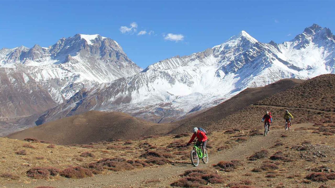 hard
hard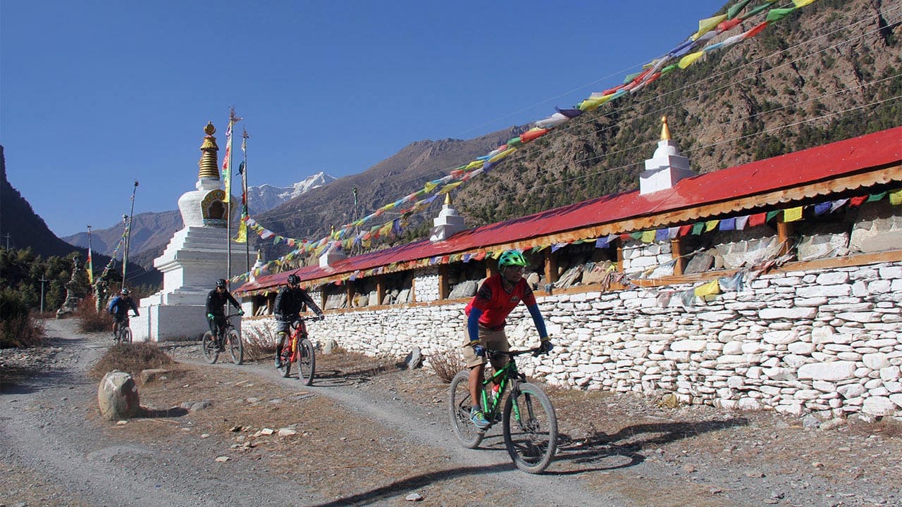 challenging
 easy
easy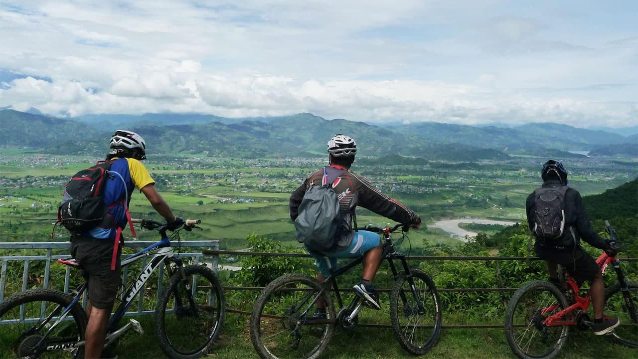 moderate
 moderate
Get trail updates, riding tips, and exclusive tour offers straight to your inbox