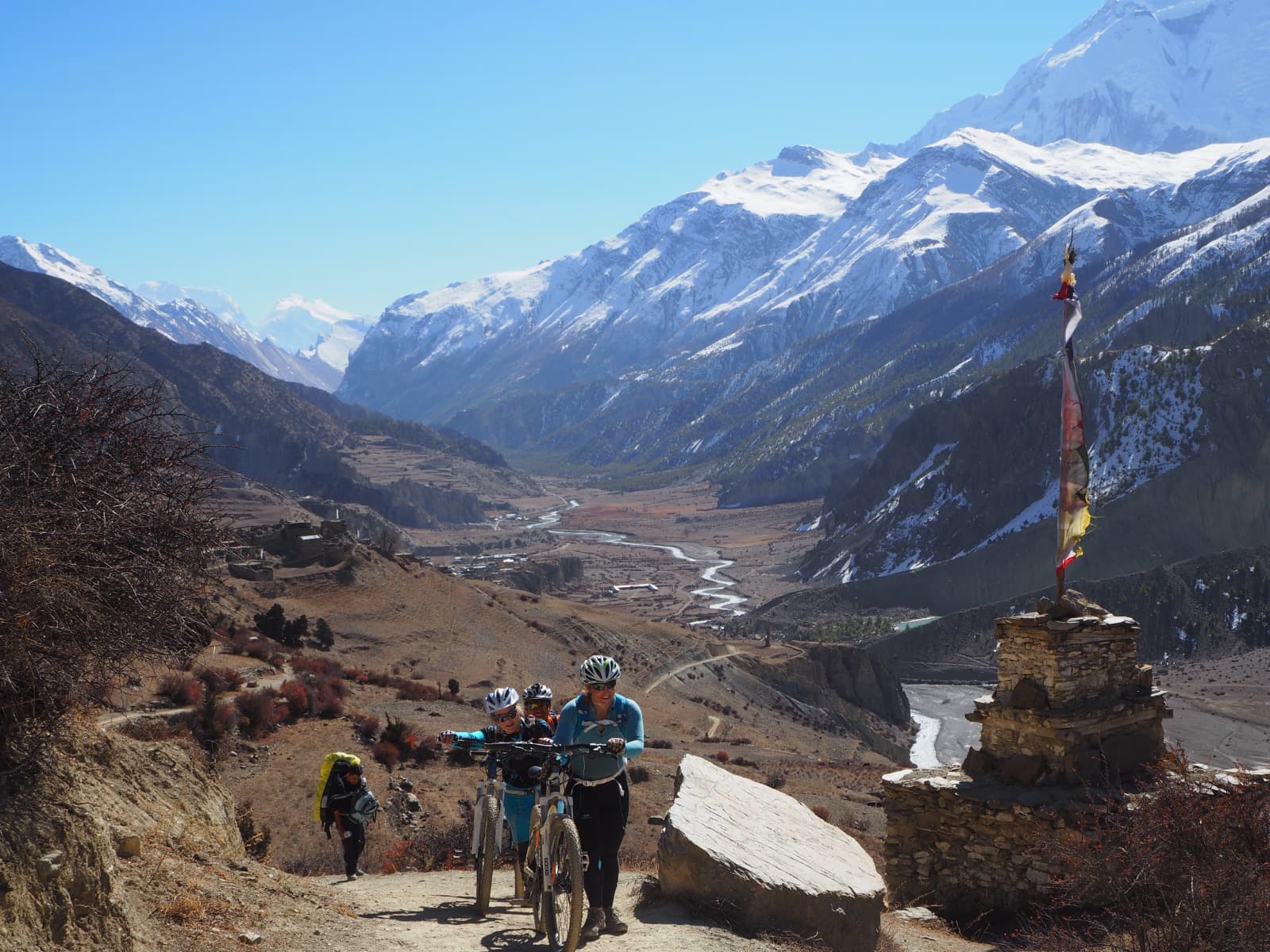


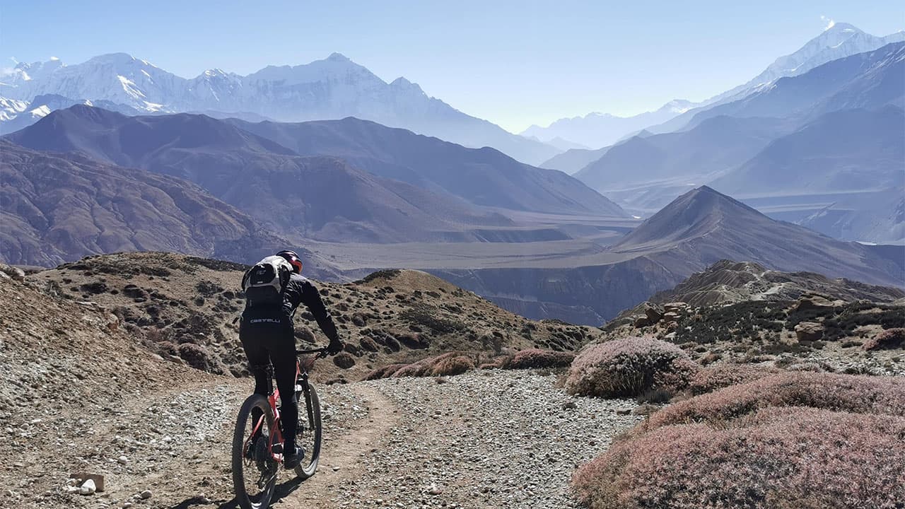
Upper Mustang is the most remote, most demanding, and most visually singular mountain biking destination in Nepal. Most riders who go describe it in the same way: there is nowhere else like it on earth. A high-altitude desert sitting in the rain shadow of the Annapurna and Dhaulagiri ranges, Upper Mustang receives just 250mm of rain per year. While the rest of Nepal floods during monsoon season, Upper Mustang stays dry. While other regions close for two months, the trails here stay open and rideable through June, July, and August.
The riding is not easy. Passes cross above 4,200 metres. Daily elevation gains reach 1,300 metres on the hardest segments. The altitude affects breathing, judgment, and recovery in ways that flat-country riders are not prepared for. But the riders who come back from Upper Mustang talk about the route with a kind of reverence that does not attach to easier trips. The landscape, the culture, the remoteness, and the physical challenge combine into something that most riders only experience once.
This guide covers every segment of the Upper Mustang mountain biking route: the trails, the terrain, the key villages and cultural landmarks, the permit requirements, the best seasons to ride, and exactly how to prepare your body and your bike for the trip.
The Route at a Glance
Total Riding Distance: 200 to 300 kilometres across 14 to 17 days
Altitude Range: 2,800m (Kagbeni entry) to 4,280m (Chogo La pass)
Lo Manthang: 3,840m — the walled medieval capital of the former Kingdom of Lo
Starting Point: Jomsom (via 15-minute flight from Pokhara) or direct drive 222km from Pokhara
Trail Composition: Approximately 50% technical singletrack, 40% jeep track, 10% black-top road
Difficulty: Advanced overall, with intermediate segments on the lower valley approach
Support Vehicle: 4WD truck carries luggage and gear throughout the route
Upper Mustang lies in the northern section of Mustang District in Gandaki Province. Its northern boundary meets the Tibetan Autonomous Region of China at Kora La Pass (4,660m). The entire upper section from Kagbeni northward is a restricted area requiring special government permits. This is not a trail you enter independently.
Permits Required for Upper Mustang
Upper Mustang is a restricted zone. Three separate permits are required for any foreign national entering the region north of Kagbeni.
Restricted Area Permit (RAP)
Cost: USD 50 per person per day (updated March 22, 2026)
Who issues it: Department of Immigration, Nepal
Processing time: 5 to 7 business days if applying independently; faster through a licensed operator
Covers: All areas north of Kagbeni within Lomanthang Rural Municipality
The permit fee changed in 2026. The previous structure was a flat USD 500 for 10 days. The new per-day rate of USD 50 means the permit cost for a typical 4- to 5-day restricted area stay comes to USD 200 to 250.
This permit cannot be obtained independently at the trailhead. It must be arranged through a licensed Nepal trekking or tour operator before departure. Nepal MTB Adventures handles the permit process as part of all Upper Mustang MTB tour packages.
Annapurna Conservation Area Permit (ACAP)
Cost: NPR 3,000 (approximately USD 30)
Who needs it: All foreign nationals; Upper Mustang falls within the Annapurna Conservation Area boundary
Obtainable: ACAP office in Pokhara or through a registered operator
Getting to Upper Mustang
The route begins at Kagbeni, a traditional village at 2,800 metres where the Upper Mustang restricted zone starts.
Most common access route:
1. Fly Pokhara to Jomsom (15-minute mountain flight, one of the most scenic short flights in Nepal)
2. Ride from Jomsom to Kagbeni — 10 to 15km, 2 to 3 hours, following the Kali Gandaki river valley on a mix of jeep track and riverbed
The Pokhara to Jomsom flight gives riders a view of the Annapurna and Dhaulagiri ranges from the air before the route begins at ground level. Flight schedules are weather-dependent and morning departures are standard since afternoon winds in the Kali Gandaki valley make afternoon flying unreliable.
Alternative: Drive from Pokhara to Jomsom (155km, 6 to 8 hours on mountain road). Some riders prefer this for acclimatisation and to avoid flight uncertainty.
From Kathmandu: Fly to Pokhara (1 hour) or drive (approximately 200km, 8 to 10 hours), then proceed as above.
The Upper Mustang MTB Route: Segment by Segment
The route runs north from Kagbeni to Lo Manthang, then returns south via a different line that includes the biggest single descent on the entire route. Each segment is described with its terrain, technical demands, and what riders see along the way.
Segment 1: Jomsom to Kagbeni
Distance: 10 to 15km
Elevation Gain: 250m
Difficulty: Moderate
Terrain: Kali Gandaki riverbed, dusty jeep track, some black-top road
The ride out of Jomsom follows the Kali Gandaki river north. This is technically the world's deepest gorge, flanked by the Dhaulagiri massif (8,167m) to the west and the Annapurna range to the east. At river level, the scale is difficult to comprehend. The mountains above are enormous, and the valley floor is wide, flat, and covered in grey river stones.
Segment 2: Kagbeni to Chele
Distance: 17 to 20km
Elevation Gain: 1,000 to 1,100m
Difficulty: Moderate
Terrain: Mix of black-top road and jeep track, 100% rideable
The trail climbs steadily from Kagbeni through Chuksang to Chele at 3,050m. This section is more rideable than what comes later and is often used as an acclimatisation day. The gradient is consistent rather than brutal, and the surface is mostly firm.
Segment 3: Chele to Samar via Gyu La Pass
Distance: 29km
Elevation Gain: 1,300m / 1,200m descent
Difficulty: Advanced
Terrain: Technical singletrack, climbing to 4,066m
This is the first advanced segment and the one where the character of Upper Mustang riding becomes clear. The Gyu La Pass sits at 4,066m. The climb to the pass on loose, rocky singletrack with 1,300m of elevation gain is the hardest day for most riders on the northbound leg. At altitude, the effort feels amplified. Breathing requires more concentration. Rest stops become longer.
Segment 4: Samar to Ghami
Distance: 28km
Elevation Gain: 1,100m / 900m descent
Difficulty: Advanced
Terrain: Ridge line riding, fast singletrack
The Samar to Ghami segment is the one most riders name as the most enjoyable of the entire route. The ridge riding sections run along high open ground with views across the plateau in both directions. The singletrack on the descent sections is fast and flowing compared to the technical climb of the previous day. This is not technical in the sense of demanding bike handling at low speed. It is technical in the sense that you are moving fast on a narrow trail at 3,500 to 3,800m with significant exposure on the ridgeline.
Segment 5: Ghami to Charang (Tsarang)
Distance: Varies by line taken
Elevation Changes: 1,050m (five passes, all above 3,800m)
Difficulty: Advanced
Terrain: Five passes including Bhena La (3,860m), Yamdo La (3,860m), Syanboch La, Nya La, and Ghami La (3,765m)
This segment crosses five separate passes. The cumulative climbing and descending across all five puts this among the most demanding days on the route. Each pass requires a distinct climb and descent, and the rhythm of the day becomes repetitive in a way that tests mental endurance as much as physical. The landscape on this section turns more intensely red. The Dhakmar red cliffs, named for the colour of the exposed sandstone, are a landmark section that many riders photograph. The rock formations here look unlike anything in lower Nepal.
Segment 6: Charang to Lo Manthang
Distance: 21 to 25km
Elevation Gain: Up to 1,050m
Difficulty: Moderate to Advanced
Terrain: Mixed
The final approach to Lo Manthang is the destination segment of the northbound leg. Lo Manthang appears across the plateau as a compact walled enclosure of pale clay. From a distance it looks impossibly ancient, which is accurate. The walls of Lo Manthang are 856 metres of continuous clay construction, 6 metres high and 1 metre thick, built over 640 years ago and continuously inhabited since. The former royal palace sits at the centre of the walled city.
Segment 7: Lo Manthang to Yara
Distance: 17km
Difficulty: Moderate
Terrain: Plateau singletrack, monastery loop
The loop from Lo Manthang north and east to Yara is an exploration day rather than a transit day. The terrain flattens somewhat relative to the climb-heavy segments south. Yara is a small village near a high-altitude lake and the Luri Gompa cave monastery, one of the most dramatically situated monasteries in the region. The cave temple is carved into a cliff face and has a series of painted rooms accessible by a long ladder.
Segment 8: Yara to Tangbe
Distance: 18km
Difficulty: Advanced
Terrain: High plateau singletrack
The Yara to Tangbe segment crosses the high plateau and is the final northern point of most Upper Mustang MTB itineraries. The riding here is exposed singletrack at sustained altitude above 3,800m. The landscape has no trees and few landmarks. Wind from the northwest is common on the plateau, and afternoon winds can be strong enough to affect steering. Starting early is not optional on this segment.
Segment 9: Tangbe to Chuksang
Distance: 25 to 26km
Elevation Change: 1,200m vertical descent
Difficulty: Advanced
Terrain: Technical singletrack descent
The Tangbe to Chuksang descent is the largest single descent on the entire Upper Mustang route. 1,200 metres of vertical drop on technical singletrack is a significant amount of descending under any conditions. At altitude, with tired legs and reduced oxygen, the margin for error is smaller than it would be on a lower-altitude trail of equivalent technical difficulty.
Segment 10: Chuksang to Muktinath
Distance: 25km
Difficulty: Moderate to Advanced
Terrain: Kali Gandaki valley descent
The return ride south through the Kali Gandaki valley moves from Chuksang back down toward the Muktinath shrine at 3,800m. Muktinath is one of the most sacred sites in Nepal, venerated by both Hindus and Buddhists and visited by thousands of pilgrims annually. The flame that burns continuously at the Muktinath temple comes from a natural gas seep, one of the few places in the world where fire, water, and earth appear to be in permanent coexistence.
Segment 11: Muktinath to Pokhara
Distance: 117km across two days
Difficulty: Moderate (long road descent)
Elevation Drop: 5,000m cumulative descent over the two days
The return from Muktinath to Pokhara via Kalopani and Beni is a long road descent over two days. After the technical demands of the Upper Mustang circuit, this section is relatively straightforward, but the distance requires sustained output. Riders finish back in Pokhara with approximately 5,000m of cumulative descent in their legs over the two days.
The Best Time to Visit Mustang for Mountain Biking
To make the most of your mountain biking adventure in Mustang, it is crucial to choose the right time to visit. The ideal months for biking in Mustang are during the spring (March to May) and autumn (September to November). During these seasons, the weather is pleasant, with clear skies and moderate temperatures. The trails are dry and accessible, allowing you to enjoy the stunning landscapes without any hindrance.
Season | Months | Trail Conditions | Notes |
|---|---|---|---|
Spring | March to May | Dry and firm, clear skies | Best mountain views; rhododendrons below; can be cold in early March |
Monsoon | June to August | Dry due to rain shadow, vibrant vegetation | Unique window when other Nepal routes are closed; daytime temperatures 10–15°C |
Autumn | September to November | Optimal – firm trails, clear air | Best overall conditions; warmest daytime temperatures |
Winter | December to February | Very cold; some passes may have snow | Not recommended for most riders |
Unveiling the Wonders of Upper Mustang's Landscapes
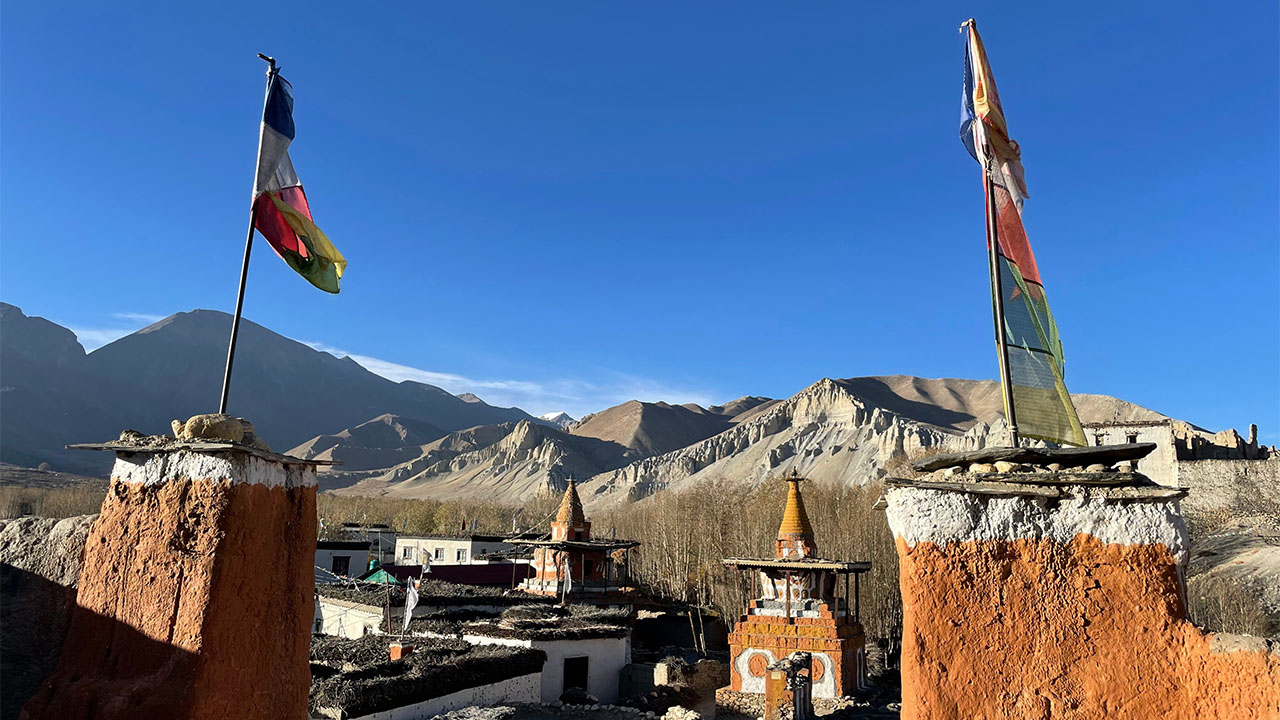
Upper Mustang's landscapes resemble a dried-out ocean, boasting unique formations of hills and mountains that are unparalleled worldwide. From your toes to the sky, vibrant colors delight the senses. The powerful winds that sweep through the Kali Gandaki River valley have carved caves and breathtaking scenery over centuries. This rain shadow area allows for mountain biking adventures with minimal rainfall. Prepare to be awestruck by Upper Mustang's extraordinary beauty and thrilling outdoor opportunities.
Prepare to be mesmerized by the extraordinary beauty of Upper Mustang's landscapes. With its mystical formations, vibrant hues, and a thrilling playground for outdoor activities, this hidden gem is sure to leave you spellbound.
The red cliffs and canyon formations near Dhakmar are the most photographed feature of the route. Sandstone eroded into gullies, ridges, and isolated pillars creates a landscape that looks like a different planet at altitude.
The Kali Gandaki Gorge is technically the world's deepest gorge when measured from the base of the river to the summit of the peaks on either side. Riding along its floor between Dhaulagiri and Annapurna gives a physical sense of scale that is hard to process rationally.
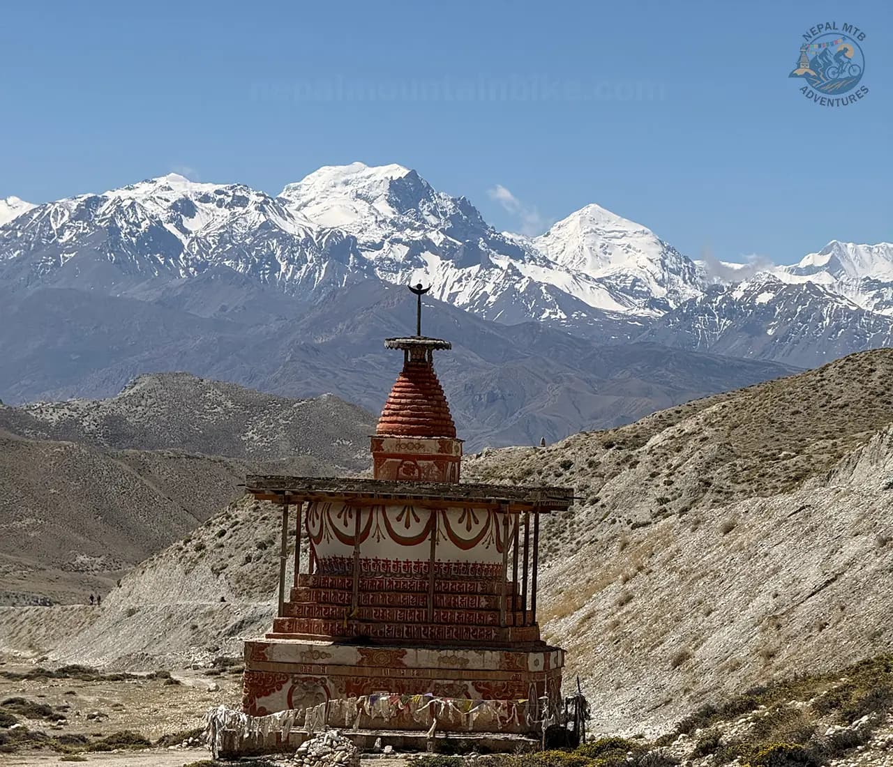
The cave dwellings cut into the cliff faces throughout the region date back over a thousand years. The caves were inhabited by communities that carved entire complexes into the rock at elevations of 4,000m or higher. Many of the caves still contain paintings and artefacts.
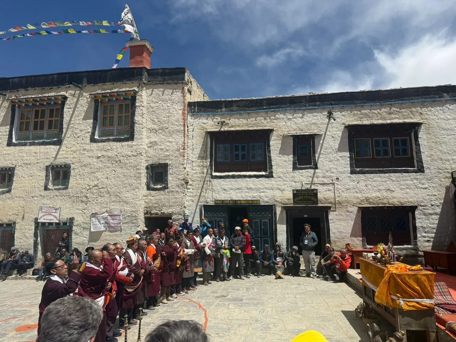
Lo Manthang's walled city is the cultural centrepiece of the route. The clay walls enclose a living medieval city. Residents still use the same alleyways and courtyards that existed when the kingdom was founded over six centuries ago.
Wildlife on the route includes Himalayan wolves, blue sheep (bharal), musk deer, and the rare snow leopard. Tibetan wild asses (kiang) are sometimes spotted on the high plateau sections. Himalayan griffon vultures are common above the passes.
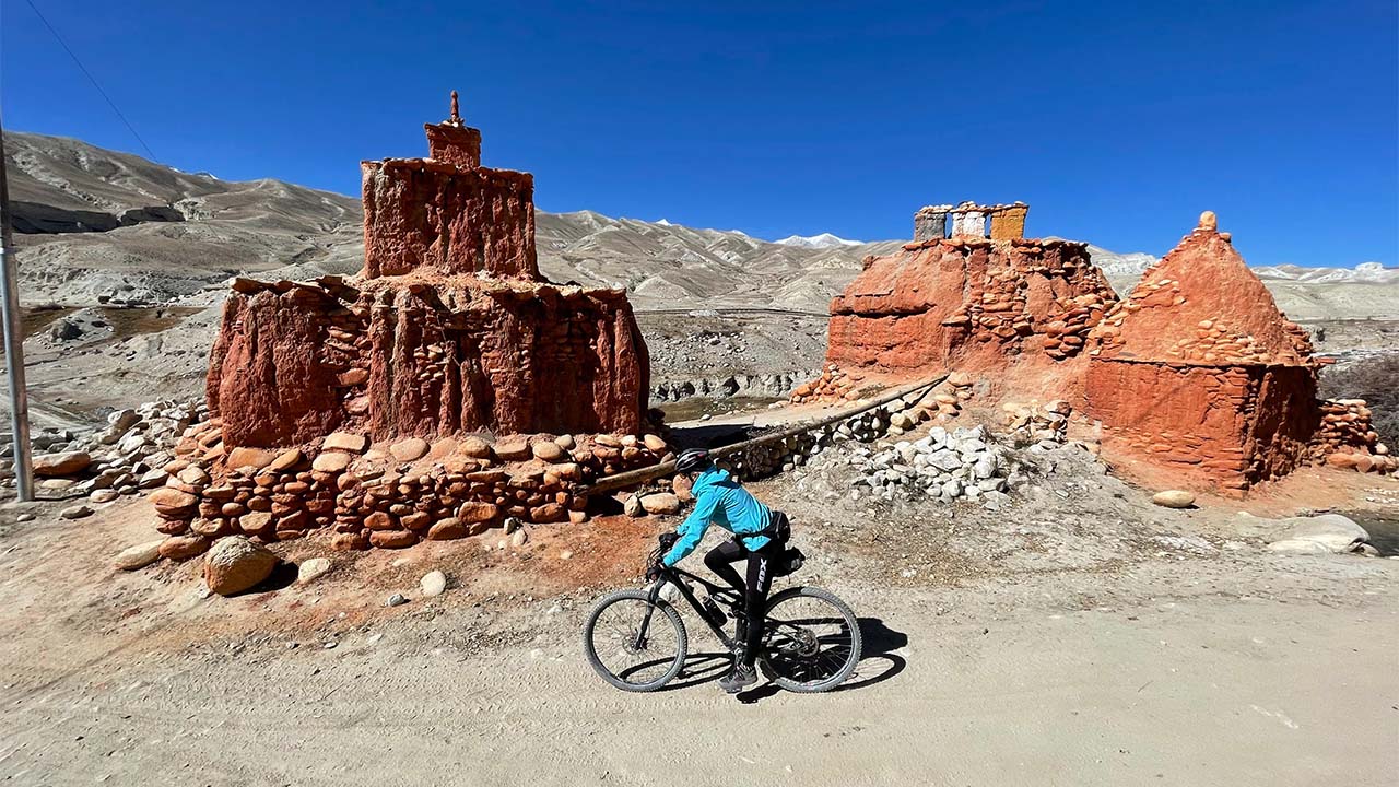
Mountain biking off-the-beaten trails in Upper Mustang
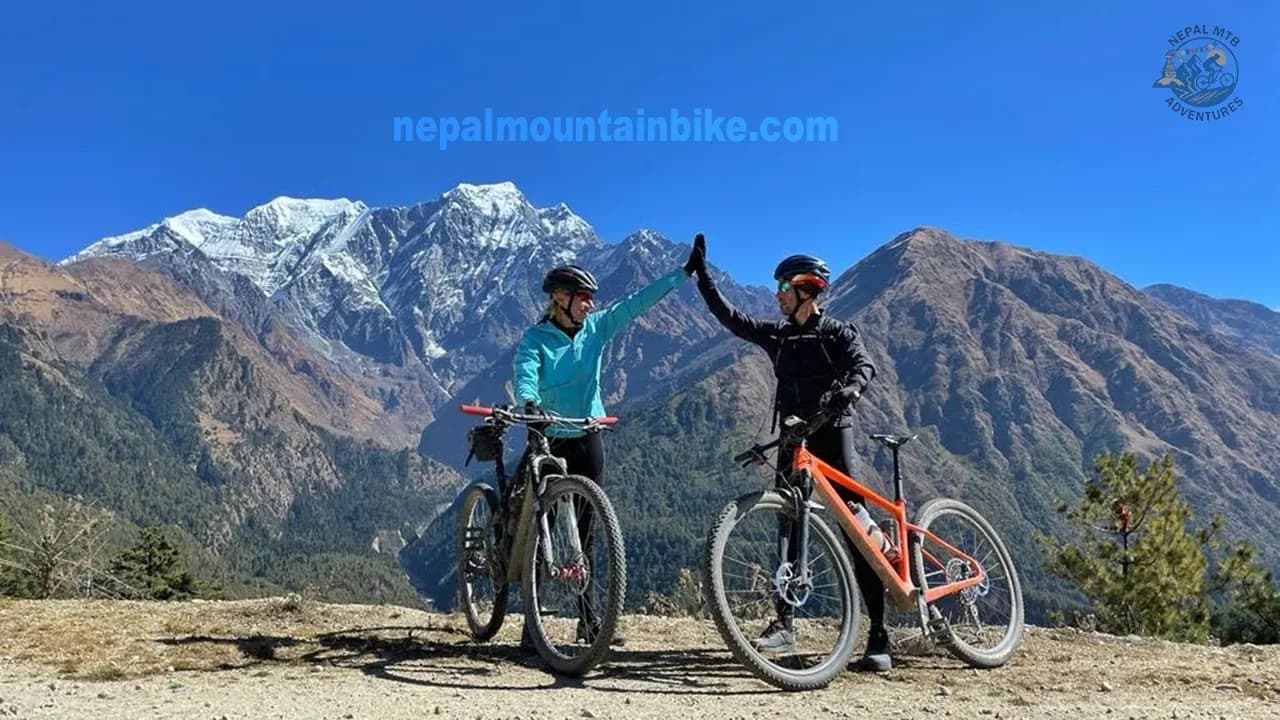
Upper Mustang has become a renowned destination for mountain biking enthusiasts, offering a truly authentic experience. As you pedal through this remarkable region, you'll encounter centuries-old monasteries, hidden caves, sacred shrines, fluttering prayer flags, and charming old village streets. The warm greetings of the locals will make you feel right at home.
Mountain biking in Mustang caters to riders of all skill levels, from beginners to intermediate and advanced riders. You'll find trails suitable for family rides, couples, and group biking tours. What makes these trails even more exciting is the option to choose between jeep tracks, dirt roads, or challenging and exhilarating single trails. Brace yourself for the exhilarating flow as you navigate through Yara Ghara, Luri Gumba, and Ghar Gumba.
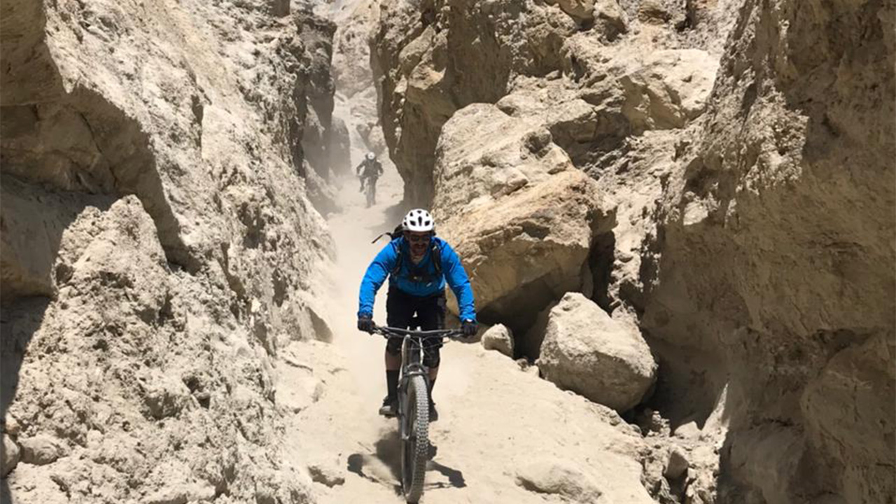
Essential Gear for Mountain Biking in Mustang
Before setting out on your mountain biking adventure in Mustang, it is essential to have the right gear to ensure your safety and comfort. Here are some must-have items:
A strongly built Mountain Bike: Choose a durable bike with excellent suspension to tackle the rugged terrains of Mustang.
Protective Gear: Do not forget to wear a fitting helmet, knee pads, elbow pads, and gloves to protect yourself in case of falls or accidents.
Proper Clothing: Dress in layers and wear moisture-wicking fabrics to adapt to changing weather conditions. Carry a rain jacket and a windproof outer layer for additional protection.
Repair Kit and Tools: Carry a basic repair kit, including a spare tube, tire levers, a multi-tool, and a portable pump to handle any mechanical issues during your ride.
Hydration System: Stay hydrated by carrying a camel bag or water bottles, along with energy bars or snacks to keep your energy levels up.
Navigation Tools: Carry a detailed map or a GPS device to navigate the trails effectively.
Challenges and Rewards of Mountain Biking in Mustang
Mountain biking in Mustang is not without its challenges, but the rewards are truly exceptional. Here are some aspects to consider:
High Altitude and Thin Air
Mustang is located at a high altitude, with certain trails reaching over 4,000 meters above sea level. The thin air can make pedaling more demanding and increase the risk of altitude-related illnesses. So, it is important to acclimatize, stay hydrated, and listen to your body.
Rough and Unpredictable Terrain
The rugged terrains of Mustang offer a thrilling experience but demand technical skills and focus. Be prepared for steep ascents, challenging descents, loose gravel, and rocky sections. It is advisable to ride within your skill level, maintain control, and be cautious while tackling the unpredictable terrain.
Cultural Immersion and Local Hospitality
One of the unique aspects of mountain biking in Mustang is the opportunity to immerse yourself in the local culture. Interact with friendly villagers, learn about their traditions, and experience their warm hospitality. Respect their customs, be mindful of local sensitivities, and make lasting memories with the locals.
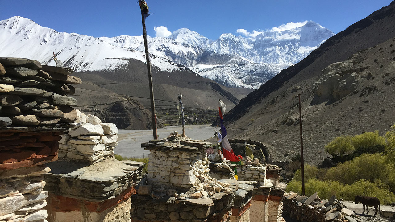
Safety Tips for an Enjoyable Mountain Biking Experience
Mountain biking in Mustang is an adventure of a lifetime; however, it is crucial to prioritize safety. Consider the following safety tips for a safe and joy-filled adventure:
Always wear protective gear, including a helmet, knee pads, elbow pads, and gloves.
Familiarize yourself with the trails and their difficulty levels before kicking off on the ride.
Ride with a group or a local guide who is familiar with the area.
Carry a first aid kit and know basic first aid techniques.
Stay hydrated and carry ample water and snacks.
Check weather conditions before setting out and be prepared for sudden changes.
Inform someone about your biking plans, including your expected route and return time.
What the Support Includes
All Nepal MTB Adventures Upper Mustang MTB tours operate with a 4WD backup vehicle throughout the route. The vehicle carries rider luggage, spare parts, and emergency supplies. On segments where a rider is unable to continue due to illness, injury, or altitude response, the support vehicle provides evacuation.
Accommodation throughout the route is in teahouses and mountain lodges in Kagbeni, Chele, Samar, Ghami, Charang, Lo Manthang, Chuksang, and Muktinath. All meals breakfast, lunch, and dinner are included. English speaking local guides accompany all riders.
Typical departure cities: Pokhara or Kathmandu. The full expedition cost varies depending on group size and departure package. Contact Nepal MTB Adventures directly for current pricing and available dates.
Frequently Asked Questions
What permit do I need to ride in Upper Mustang?
Foreign nationals need three permits: the Restricted Area Permit (RAP) at USD 50 per person per day (2026 rate), the Annapurna Conservation Area Permit (ACAP) at NPR 3,000, and the TIMS card at USD 16. The RAP must be arranged through a licensed Nepal tour operator. Nepal MTB Adventures handles all permit processing for riders on its Upper Mustang tours.
Can I ride Upper Mustang independently without a guide?
No. The Restricted Area Permit for Upper Mustang requires that foreign nationals travel with a licensed Nepal tour operator. Independent travel without a guide and licensed operator in the restricted zone is not permitted under current Nepal government regulations.
Is Upper Mustang rideable during monsoon season?
Yes, and it is one of the very few places in Nepal where this is true. Upper Mustang sits in the rain shadow of the Annapurna and Dhaulagiri ranges. These mountains block monsoon clouds from reaching the upper valley, which receives only approximately 250mm of rain per year. While the rest of Nepal experiences heavy rainfall from June to August, Upper Mustang stays dry. June, July, and August are legitimate riding months here, though temperatures at higher elevations drop to 3 to 8°C at night.
How many days does an Upper Mustang MTB trip take?
A full Upper Mustang mountain biking expedition takes 14 to 17 days including travel to and from Pokhara or Kathmandu. The riding itself covers 200 to 300km across the route. Shorter versions covering only the lower sections are possible but miss the most dramatic terrain around Lo Manthang and the northern plateau.
What is the highest point reached on the Upper Mustang MTB route?
The highest pass on the main route is Chogo La at 4,280m. Other significant passes include Paa Pass (4,180m), Mui La (4,170m), Gyu La (4,066m), and Nyi La (4,010m). Lo Manthang, the destination, sits at 3,840m.
Do I need previous mountain biking experience for Upper Mustang?
Yes. Upper Mustang is not suitable for beginners. The advanced segments have technical singletrack at altitude with significant elevation gain and descent. Riders should have at least two to three years of regular trail riding experience, comfortable with sustained off-road climbing and technical descents. The altitude compounds physical demands in ways that even experienced riders feel.
What type of bike is best for Upper Mustang?
Full suspension mountain bike with 140mm to 160mm of rear travel, hydraulic disc brakes, and a wide-range 12-speed drivetrain. The Trek Remedy 8 and Scott Genius 940 are the models Nepal MTB Adventures uses on this route. A hardtail can complete the route but significantly increases rider fatigue over the technical terrain and multi-day distance.
What is Lo Manthang and why is it significant?
Lo Manthang is the former capital of the Kingdom of Lo, an independent Himalayan kingdom that maintained its own royal court until the modern era. The walled city has been continuously inhabited for over 640 years. Its clay walls are 856 metres long, 6 metres high, and 1 metre thick. Inside the walls are the royal palace, four major monasteries including Jhampa Gompa (built 1387 AD), and a community of several hundred residents living much as they have for centuries. Reaching Lo Manthang by mountain bike on the full Upper Mustang circuit is one of the most significant physical and cultural achievements available in adventure cycling.
Is altitude sickness a risk on Upper Mustang?
Yes. Acute Mountain Sickness (AMS) becomes a real risk above 3,500m. Symptoms include headache, nausea, fatigue, and disrupted sleep. The Upper Mustang itinerary is designed with gradual elevation gain and mandatory rest days at Lo Manthang to allow acclimatisation. Riders should not ascend more than 400 to 500 vertical metres per day above 3,000m without a rest day. If symptoms of AMS appear, descending is always the correct response.
What is the best time of year to ride Upper Mustang?
Autumn (September to November) gives the best overall conditions: dry trails, stable weather, clear mountain views, and comfortable daytime temperatures of 15 to 20°C. Spring (March to May) is excellent and includes the Tiji Festival in Lo Manthang in late May or early June. The monsoon window (June to August) is unique to Upper Mustang and is a legitimate riding season when other Nepal routes are closed.
How do I get to the start of the Upper Mustang MTB route?
The most common access is a 15-minute scenic flight from Pokhara to Jomsom followed by a 10 to 15km ride to Kagbeni, the gateway to Upper Mustang. The Pokhara to Jomsom flight is weather-dependent, so early morning departures are standard to avoid afternoon winds. An alternative is the 6 to 8 hour road drive from Pokhara to Jomsom (155km).
What cultural experiences does Upper Mustang offer beyond the riding?
Upper Mustang has one of the most intact concentrations of Tibetan Buddhist culture anywhere outside Tibet. The route passes through the medieval walled city of Lo Manthang, Tsarang (the former capital of Lo), multiple 600- to 1,200-year-old monasteries, cave-dwelling complexes with ancient paintings, and traditional villages where polyandry is still practised and the Tibetan language and dress are everyday norms. The Tiji Festival in Lo Manthang is one of the most significant living Buddhist ceremonial events in the Himalayas. For riders who want a trip that is as culturally immersive as it is physically demanding, Upper Mustang delivers both simultaneously.