

 Tripadvisor
 Google
 Facebook
 Trustpilot
 hard
hard5(36 reviews)
Upper Mustang Mountain Biking Guided Expedition
Upper Mustang16 days
$ 3850
Price may vary according to your plan
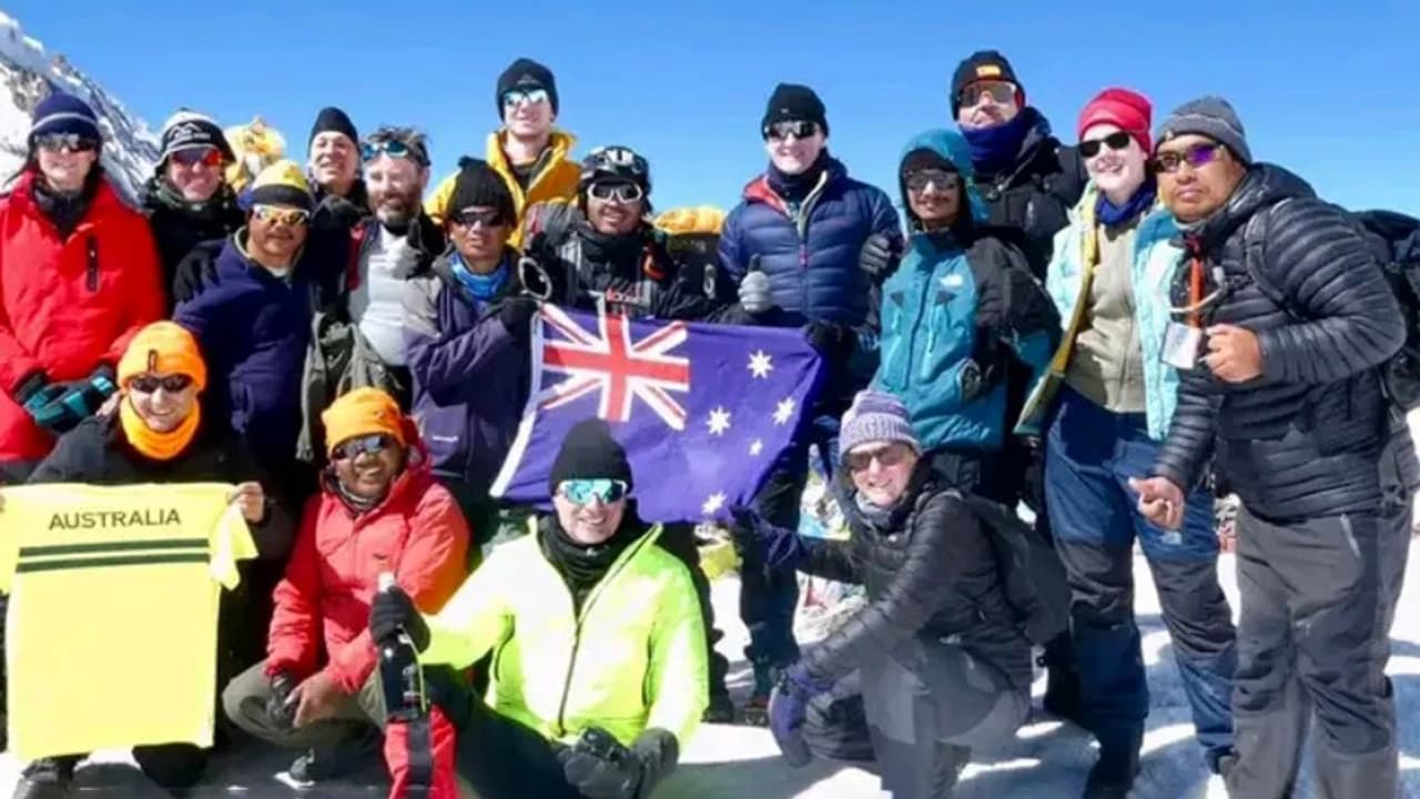
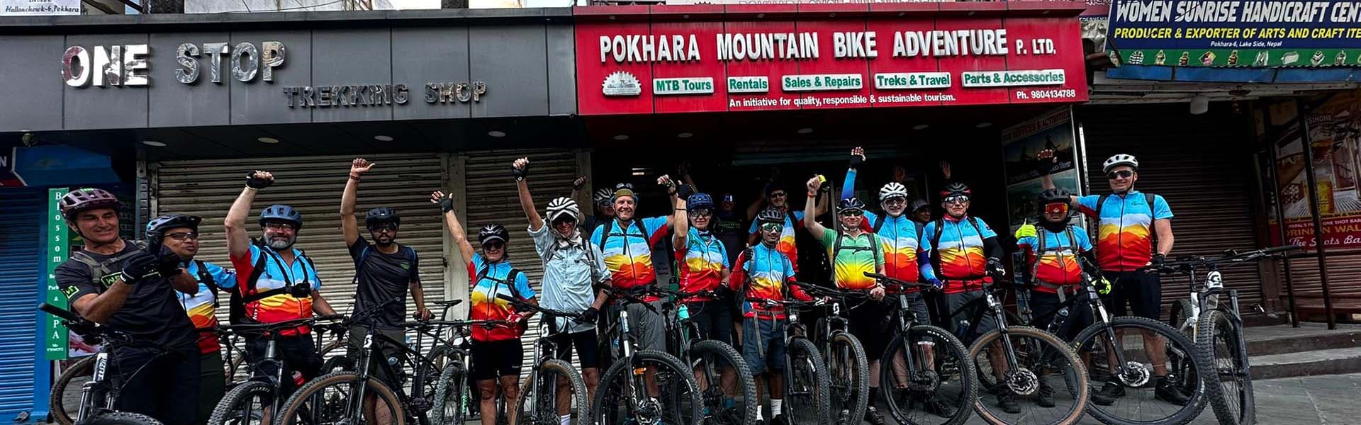
The Annapurna Circuit Mountain Biking Expedition is a 14-day, fully supported ride around the Annapurna massif, with 12 riding days, around 300 km of riding and a crossing of the Thorong La pass at 5,416 m.
This expedition is designed specifically for Australian mountain bike clubs, corporate group, private trail groups, and seasoned All-mountain and Cross-country riders who are looking for challenging and rewarding Himalayan ride with immersive cultural experience, this 14-day guided expedition combines big mountain vertical, technical rock gardens, Jeep and dirt tack, fast alpine flow, and deep cultural immersion across Brhamin, Dalit, Gurung, Manangi, and Thakali tea-house villages.
Backed by Nepal MTB Adventures with 20+ years of local trail pioneering, Wilderness First Responder (WFR) certified lead guides, satellite tracking, and dedicated summit porters, this is the definitive Himalayan ride for Australian mountain bikers planning their 2027 international expedition in Asia.
Metric | Expedition Specification |
Duration | 14 Days (12 Riding Days) |
Total Distance | 230+ km of off-road, countryside roads, and singletrack riding |
Total Elevation Gain | +7,480 m cumulative climbing |
Total Elevation Loss | −8,120 m of technical downhill and flow singletrack |
Highest Elevation | Thorong La Pass – 5,416 m (17,769 ft) |
Longest Continuous Descent | 1,600 m vertical drop (Thorong La → Muktinath) |
Terrain Breakdown | 35% Singletrack • 35% Alpine Dirt Roads • 25% Mountain Countryside Roads • 5% Carry/Push Sections |
Technical Difficulty | Grade 4–5 (Advanced All-Mountain / Cross-Country / Enduro / Technical Singletrack) |
Rental Fleet | 2026/2027 Trek Fuel EX, Scott Genius & Premium e-MTBs |
Guide & Safety Standards | WFR Lead Guides, Certified Mountain Bike Guides (Government of Nepal & MBC UK), Oxygen Saturation Monitoring, Satellite Communication & Emergency Support |
While Australia boasts world-class trail centers like Blue Derby, Maydena, and Bright, nothing in the Southern Hemisphere matches the sheer vertical drop of the Himalayas. You will tackle continuous descents exceeding 1,600 vertical meters through raw, unpaved high-altitude valleys.
No heavy bikepacking bags or frame packs required on technical trails. Our support crew, 4x4 chase vehicles, and dedicated summit porters transport all main luggage, tools, and spare parts.
Stay in cozy, locally owned mountain lodges (tea houses), sample fresh Dal Bhat power meals, pass ancient Buddhist gompas draped in prayer flags, and ride ancient salt-trading corridors untouched by commercial tourist buses.
The itinerary builds in an acclimatization day in Manang at 3,540 m, keeps Day 9 flexible so your guide can pick the overnight altitude that suits the group, and holds a buffer day in Pokhara on Day 13 to absorb weather delays. Lead guides carry a pulse oximeter and check oxygen saturation daily at altitude.
Club trips usually fail on spread. The committee books something the four strongest members will love, and the rest quietly stop replying. This one absorbs a mixed group instead of punishing it.
The Annapurna Circuit has legendary status among mountain bikers, and it earns it on variety as much as on difficulty. In two weeks you cross a 5,416 m pass, descend steep technical singletrack, and ride remote trails that very few travellers ever see.
It is also a deep cultural journey. You ride through the lands of the Gurung, Manangi and Thakali peoples, past temples and Buddhist monasteries, with time for quiet moments at sacred sites along the way. The everyday encounters with mountain life are as memorable as the riding.
With a full support team handling the guiding, the bikes, the logistics and the route-finding, you get to spend your energy on the trails and the scenery rather than on the admin.
For Australian riders, there is a practical case on top of the riding one. Nepal is the closest genuine high-altitude mountain range you can reach from Australia with the hassle-freevisa on arrival, at roughly half the flying time to the European Alps, and the two best riding windows here, March to May and September to November, fall across Australian autumn and spring. A Himalayan expedition costs you a shoulder season rather than your local summer.
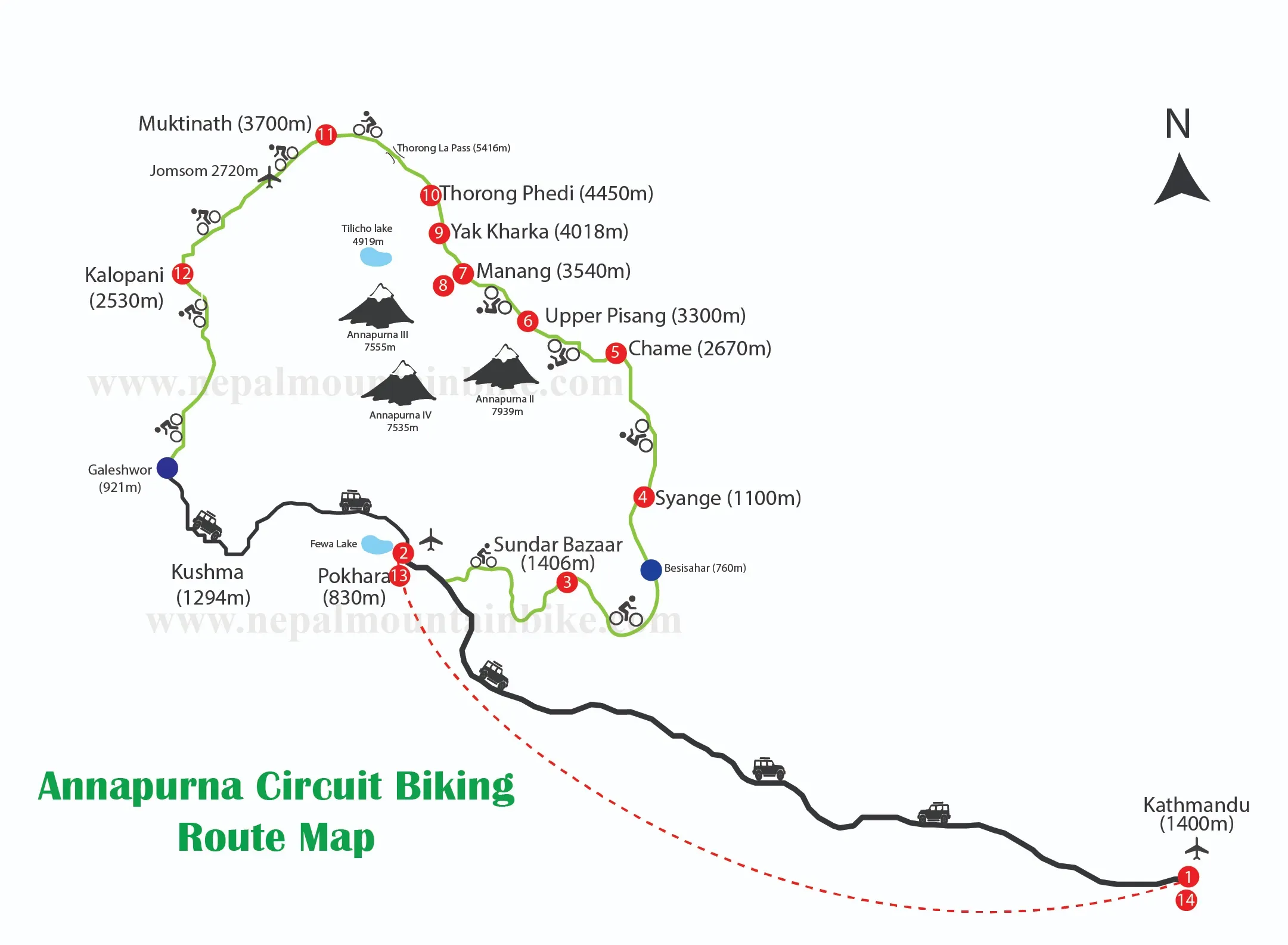
The circuit is a full loop around the Annapurna massif, and it changes completely as you go. It works in three stages.
Up the Marsyangdi valley, in Gurung country. From Besisahar you climb the gorge through forest, waterfalls and terraced fields. This is the homeland of the Gurung, who call themselves Tamu, known both as Gurkha soldiers and as Buddhist farmers and herders.
The high Manang valley, in Nyeshang. Above Pisang you enter Nyeshang, home of the Manangi people. Of Tibetan origin, they turned this harsh highland into wealth as long-distance traders, granted special trading rights by royal decree in 1784.
Over the pass and down the Kali Gandaki, in Thakali country. From Manang you climb through Yak Kharka, cross the Thorong La at 5,416 m, and drop to the temple of Muktinath. From there you descend the Kali Gandaki, the gorge between the 8,000 m giants of Dhaulagiri and Annapurna I that is often called the deepest on earth.
Day & Route | Distance & Elevation Change | Primary Trail Surfaces | Key Attractions & Photo Spots | Cultural & Ethnic Highlights |
Day 1: KTM | 0 km (+0m / -0m) | Workshop / Fitting | Thamel gear district, stupas | Newari culture & welcome feast |
Day 2: Pokhara | 25 km (+450m / -450m) | Dirt singletrack & clay | Phewa Lake & Machhapuchhre views | Gurung foothill hospitality |
Day 3: Besisahar | 35 km (+380m / -120m) | Jeep track & dirt road | Subtropical waterfalls & river gorges | Lowland Hindu farming villages |
Day 4: Tal | 28 km (+980m / -120m) | Rocky tracks & bridges | Tal waterfall bowl & cliff roads | Gurung & Tibetan Buddhist entry |
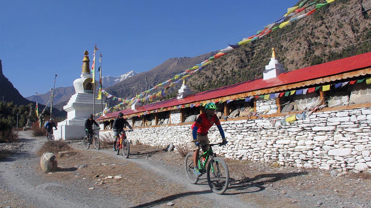
Day 5: Chame | 22 km (+1,050m / -80m) | Granite slabs & pine trail | Lamjung Himal & Brathang orchards | Timber villages & Mani walls |
Day 6: Pisang | 21 km (+680m / -150m) | Needle paths & flow tracks | Paungda Danda 1,500m granite wall | Upper Pisang Monastery blessing |
Day 7: Manang | 25 km (+850m / -510m) | High singletrack & switchbacks | Ghyaru panoramic lookout & Ngawal | Ancient Tibetan-Manangi culture |
Day 8: Rest Day | 15 km (+300m / -300m) | Moraine & alpine dirt | Gangapurna glacial lake & icefall | Himalayan yak herders & horsemen |
Day 9: High Camp | 10–18 km (+510m to +1,340m) | Alpine singletrack & scree | Flexible pacing (Yak Kharka/Thorong Phedi) | High-altitude teahouse living |
Day 10: Thorong La | 22 km (+536m / -1,616m) | Sub-zero push & loose scree | 5,416m summit & 1,600m descent | Sacred Muktinath 108 water spouts |
Day 11: Marpha | 32 km (+250m / -1,380m) | Canyon singletrack & sand | Lupra Valley canyon & Lubra Pass | Bon religion & Thakali apple brandy |
Day 12: Tatopani → Pokhara | 42 km Ride (+96 km Drive) | Downhill rock & dirt road | Deepest gorge & hot springs | Geothermal soak & transfer to Pokhara |
Day 13: Pokhara Buffer | 22 km (+100m / -470m) | Optional recovery ride | Lakeside relax, massages & shopping | Farewell feast & certificate night |
Day 14: KTM Flight | 0 km (+0m / -0m) | Airport Transfer | Himalayan flight vistas | Souvenir shopping & farewells |
The Annapurna Circuit is not one kind of trail. Here is what the ground is actually like as you ride around the loop.
Lower Marsyangdi Valley: Ride mostly dirt and jeep roads with traffic, suspension bridges, waterfalls, and occasional rocky sections. Guides use old singletrack where possible.
Ghyaru–Ngawal Traverse: A scenic high-altitude singletrack with switchbacks, rocky terrain, stream crossings, and exposed sections for confident riders.
Manang to Thorong Phedi: Narrow trekking trails, loose rocks, suspension bridges, and thin air make for a slow ride with some bike pushing.
Thorong La Pass: Carry your bike about 5 km to the 5,416 m summit, with porters assisting over this non-rideable section.
Thorong La Descent: A steep, technical 1,600 m descent to Muktinath on loose rock and tight switchbacks.
Lupra Valley: Enjoy flowing singletrack through a quiet valley, avoiding the dusty jeep road.
Kali Gandaki Gorge: Finish with a long descent through the world's deepest gorge, starting early to avoid strong afternoon winds.
Grade 4 to 5. Advanced all-mountain, cross-country and enduro riding on technical singletrack, at altitude, day after day. Across 12 riding days you climb around 7,040 m and descend around 6,430 m. It is the hardest trip we run.
The gap between riding in Australia and riding this
Australian riding prepares you well for the descending and badly for one thing: the climbing. Almost every good gravity trail in Australia is shuttled or uplift-served, so the average Australian rider descends far more than they climb. On the circuit, every metre is under your own power.
If you can already do this at home | You are ready for |
Finish a four-day stage race like Cape to Cape | Days 3 to 7, five hard days back to back with no rest |
Ride a 100 km marathon such as Otway Odyssey or Convict 100 | Day 5, the biggest climbing day at 1,050 m up and 80 m down |
Climb Maydena or Derby under your own power instead of taking the uplift | Sustained loose-surface climbing, the single biggest gap for Australian riders |
Ride steep, loose, exposed singletrack with real drop-offs | The Ghyaru to Ngawal traverse on Day 7 and the descent off the pass |
Carry your bike up a steep fire trail for an hour | The 5 km Thorong La carry, which is longer, colder and at 5,000 m |
The trip tops out at 5,416 m, so altitude is the single most important safety matter on it.
How we manage it:
Gradual height gain, with the acclimatization day in Manang at 3,540 m before the high country.
The climb high, sleep low principle used on Day 8.
A flexible Day 9 so your guide picks the overnight altitude that suits the group's condition.
Daily oxygen saturation checks at altitude using a pulse oximeter.
Wilderness First Responder certified lead guides, and guides licensed by the Government of Nepal.
A buffer day on Day 13 that absorbs weather delays instead of forcing a risky pass crossing.
The Himalayan Rescue Association post in Manang, which runs a free daily altitude talk and can check your blood oxygen.
Travel insurance covering mountain biking to 5,500 m and helicopter evacuation is required, not optional. Bring the policy number and the emergency contact number with you.
A serviced hardtail from the Trek Marlin 7 Gen 3, Scott Aspect or Scott Scale range, or a comparable bike, is included in the Standard package. Hardtails handle this route well. The majority of the circuit is jeep track, dirt road and moderate singletrack, and a lighter bike is easier to carry over the pass.
Trek Fuel EX, Scott Spark, Scott Genius or similar. The exact price depends on the model, availability, and the final itinerary. Worth it if you plan to attack the Ghyaru to Ngawal traverse and the Thorong La descent hard, and if you ride full suspension at home. Included as standard in the Premium package.
Availability and pricing depend on the model, battery and charging requirements, transport arrangements and the final itinerary. Charging at altitude needs planning, so contact us early for an accurate e-MTB quote.
You are welcome to bring your own bike. Depending on the bike, transport and logistics, we can usually adjust the package price. Contact us before booking so we can quote it properly.
Porter duffle limit: each rider gets 15 kg (33 lbs) of main luggage carried by the support team. Anything above that needs an extra porter.
Extra porter, horse or pony: if you want additional help carrying personal equipment or your bike through the hard high-altitude sections, this can usually be arranged locally. Indicative cost is around USD 100 per day, subject to availability and current local rates.
Australian passport holders get a Nepal tourist visa on arrival at Kathmandu airport. The riding permits are ours to deal with. We arrange the Annapurna Conservation Area Permit (ACAP), the TIMS card and any other required permits, plus local taxes and government fees. All of these are included in both packages, so there is no paperwork for you beyond sending us your passport details. The visa fee itself is the one thing you pay for yourself.
The whole route lies inside the Annapurna Conservation Area, Nepal's largest protected area, home to more than 100 mammal and 450 bird species.
The animal you are most likely to see is the blue sheep, or bharal, grazing the steep slopes above Manang and around Yak Kharka. Overhead you may spot Himalayan griffon vultures, the huge lammergeier, golden eagles and alpine choughs. Yaks and dzo, a yak-cattle cross, are herded through the high valleys, and monkeys live in the lower forests. Snow leopards live in this range but are almost never seen, so treat any sighting as extraordinary luck rather than something to expect.
We have guided riders across the Himalayas since 2004, more than 20 years pioneering trails in this terrain. We are a Nepal-based operator, so you book directly with the team on the ground rather than through a foreign reseller.
Local guides who grew up riding here and know this route, its weather and its villages.
Wilderness First Responder certified lead guides, licensed by the Government of Nepal.
Roughly one guide to four riders, and one to three where the group needs it.
Workshop-serviced bikes with mechanical support on the trail, where there are no bike shops.
Small private groups, on your own dates.
Safety and acclimatization first, with a buffer day built in rather than bolted on.
A rating of 4.9 out of 5 from more than 440 TripAdvisor reviews, with 99% of travellers recommending us.
Your money supports local guides, porters, mechanics and lodge families.
Book your Annapurna Circuit expedition
Ready to ride the full circuit? This is a bucket-list expedition, and our spring and autumn windows fill early. Send us your dates and your rider numbers, and we will match you to the right package and sort your bikes, flights, permits and pacing.
Related trips: the 15-day Annapurna Circuit Guided Tour, the Hike and Bike Annapurna Circuit, and the Annapurna Circuit and Upper Mustang combo. For the full route breakdown, read our Annapurna Circuit route guide on the blog.
Arrival in Kathmandu and bike fitting
Elevation 1,400 m. | No riding. | Overnight in a boutique hotel.
Your crew meets you at Kathmandu airport and transfers you to the hotel. Depending on your arrival time, spend the afternoon settling in, walking Thamel's gear shops and stupas, or building your own rig in our workshop. If you are renting from us, we fit your bike to you and set it up for the terrain rather than handing you a stock size.
In the evening, your lead guide runs the trip briefing, and you eat a proper welcome dinner of Nepali and Newari food together.
Attractions: Thamel's gear district and the old stupa architecture of the Kathmandu valley.
Culture and people: Newar valley culture, and your first meal with the crew who will ride the whole circuit with you.
Flight to Pokhara & Lakeside Trail Warmup
Elevation: 820 m | Gain: 450 m | Loss: 450 m | Distance: 200 km Overnight: Lakeside hotel, Pokhara
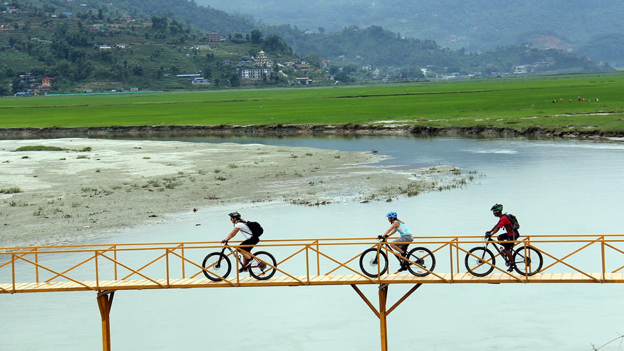
You'll fly this morning, and it's a flight worth waking up for. The route runs the full length of the snow-capped Himalayan chain, and if the skies are clear, you'll spend the whole way with your face against the window. Land in Pokhara, check into your hotel on the shores of Phewa Lake, and drop your bags, because by afternoon, you're back on the bike.
You'll ride out along the ridgelines and singletrack that wrap the Pokhara Valley: twenty-five kilometres, 450 m up and the same back down. It's exactly enough to loosen your legs after the flight, get a feel for your bike, and ease into the trip; nothing here will test you yet. The trails are soft and forgiving, so you can spend more time looking up than watching your front wheel.
Trail surface: Fast dirt singletrack, red clay trails, and natural rock roll-ins
Attractions: Machhapuchhre, the Fishtail, reflected in Phewa Lake
Culture & people: The Lakeside mountain biking community and Gurung foothill villages
Drive to Besisahar, Ride to Bhulbhule
Elevation: 840 m | Gain: 380 m | Loss: 120 m | Distance: 35 km | Overnight: Mountain lodge, Bhulbhule
This morning you'll board a private 4x4 convoy for the drive from Pokhara to Besisahar, the official gateway to the Annapurna Circuit. Once the bikes are unloaded, you start pedalling along the bank of the Marsyangdi, the river that will be your companion for the next four days.
You've got thirty-five kilometres ahead of you today: smooth jeep track, riverbed dirt and a handful of suspension bridges to cross. With only 380 m of climbing in the whole stage, it's a gentle enough day that you'll roll into Bhulbhule with plenty left in the legs for tomorrow.
Trail surface: Smooth jeep tracks, riverbed dirt paths and suspension bridge crossings
Attractions: Subtropical waterfalls, lush rice terraces and river gorge views
Culture and people: Lowland Hindu farming communities and roadside hospitality in Gurung hamlets
Bhulbhule to Tal, into the Marsyangdi Gorge
Elevation: 1,700 m | Gain: 980 m | Loss: 120 m | Distance: 28 km | Accommodation: Mountain lodge
Today the valley narrows into the dramatic Marsyangdi Gorge, where the riding becomes more technical. The route follows cliffside jeep tracks, rocky singletrack climbs, and suspension bridges crossing above white-water rapids.
This is the first significant climbing day of the tour, with 980 m of elevation gain before reaching Tal. The village sits on an ancient dried lakebed, with a waterfall dropping into the bowl behind it.
Trail surface: Chunky rock gardens, punchy dirt climbs, and technical singletrack.
Attractions: The waterfall bowl at Tal village.
Culture and people: The transition from Hindu culture to Tibetan-influenced Buddhist mountain communities, with prayer flags appearing at village entrances.
Tal to Chame
Elevation: 2,670 m | Gain: 1,050 m | Loss: 80 m | Distance: 22 km | Overnight: Mountain lodge, Chame
This is the biggest climbing day of the circuit. One thousand and fifty metres up, eighty back down, over just 22 km. There is nowhere to hide on this one.
What you get for it is the best transition on the trip. The subtropical growth thins out and vanishes, dense pine forest takes over, and the air turns crisp and cold and properly alpine. The riding switches with it: punchy technical ascents over rock steps and roots, then smooth granite slabs you can roll straight across, then fast bench trail running through the trees on firm mountain dirt.
You'll pass the organic apple orchards at Brathang with Lamjung Himal standing over them, and ride through Manangi and Gurung timber harvesting villages. When you come to the ancient mani prayer wheels, keep them on your left. It matters to the people who live here, and it costs you nothing.
Trail surface: Rock step and root climbs, granite slab rolls, and firm bench trail through pine forest
Attractions: Brathang's apple orchards beneath Lamjung Himal, ancient mani prayer wheels
Culture and people: Manangi and Gurung timber harvesting villages
Chame to Pisang
Elevation: 3,200 m | Distance: 21 km | Gain: 680 m | Loss: 150 m | Accommodation: Mountain lodge
Today's ride takes you beneath Paungda Danda, a towering curved rock face that rises 1,500 m above the valley floor. It is one of the most striking landmarks on the Annapurna Circuit and a popular place to stop.
The trail is more forgiving than yesterday, following flowing forest singletrack, quiet pine-needle paths, and open jeep tracks as the valley widens into high-alpine terrain. As you gain elevation, the thinner air becomes more noticeable.
After reaching Pisang, there is time to visit the ancient stone fort above Upper Pisang and the nearby gompa. This marks the heart of Tibetan Buddhist culture along the route, where many riders receive a traditional blessing before continuing towards Thorong La.
Trail Surface: Flowing forest singletrack, pine-needle paths, and open valley jeep tracks.
Attractions: The towering granite wall of Paungda Danda and the ancient stone fort of Upper Pisang.
Culture & People: Deep Tibetan Buddhist culture; visit Upper Pisang Gompa for a traditional Buddhist pre-pass blessing.
Pisang to Manang via Ghyaru and Ngawal
Elevation: 3,540 m | Gain: 850 m | Loss: -c510 m | Distance: 25 km | Overnight: Mountain lodge, Manang
The crown jewel. If you only remember one riding day from this trip, it'll be this one.
It opens with a hard switchback climb up to Ghyaru, a stone village stacked onto the high line above the valley. You get to the top, turn around, and there they are, Annapurna II, III, and IV, standing across the gorge at your eye level. Not above you. Level with you.
Then comes the traverse. The trail from Ghyaru through Ngawal is a natural bench cut into the mountainside, and honestly, it rides like something a trail builder would want credit for: technical rock step downs, tight switchbacks, long fast stretches of alpine flow. It's narrow, it's loose in places, and the exposure is real. That's exactly why riders who know what they're doing pick this route over the valley road.
Twenty-five kilometres, 850 m up, 510 m back down, through stone villages that have stood a thousand years, past stone archways the Manangi trading families built back when this was a trade route, not a trail.
Trail surface: Technical rock step downs, tight switchbacks and long stretches of alpine flow on a narrow mountainside bench trail
Attractions: Ghyaru village and its eye-level views of Annapurna II, III and IV; ancient Manangi trade archways
Culture and people: Stone villages of the high Manang valley, standing for a thousand years
Acclimatization and skills day in Manang
Elevation 3,540 m | Distance 15 km | Ganin: +300 m | Loss: -300 m | Mountain lodge
You are not resting today. You are adapting. This is the day that decides how the pass goes.
In the morning you ride up, either to the Chongkor viewpoint or onto the glacial moraine above Gangapurna Lake, on moraine singletrack and loose scree, and you make your lungs work at altitude. Then you come back down and sleep at exactly the height you woke up at. Three hundred metres up, three hundred straight back down. Climb high, sleep low. It is old advice because it works.
Above you are the icefalls of Gangapurna and Annapurna III and a glacial lake the colour of turquoise. Your guide takes the rest of the day for skills work at altitude, which is a polite way of saying you find out how differently a bike handles when there is a third less oxygen in the air.
Manang itself is worth your afternoon: cobblestone streets, horsemen and yak herders, and a town that has been trading up here for a very long time.
Trail Surface: Moraine singletrack and loose scree trails.
Attractions: Turquoise glacial lakes and towering icefalls of Gangapurna and Annapurna III.
Culture & People: Interact with local Himalayan horsemen and yak herders in Manang’s historic cobblestone center.
Manang to Yak Kharka, Thorong Phedi or High Camp
Elevation: 4,050 m, 4,450 m or 4,880 m | Gain: 510 m, 910 m or 1,340 m | Distance: 10 to 18 km | Overnight: Mountain lodge, Yak Kharka / Thorong Phedi / High Camp
Above Manang the trees stop. Everything past that point is rain shadow: barren, wind-scoured, and far more Tibet than Nepal.
The trail narrows to alpine singletrack and tilts up. Today is low-gear pedalling broken by short hike-a-bike pushes across scree fields, with suspension bridges hung over glacial gorges. Blue sheep graze the slopes above the trail, and Himalayan griffon vultures work the thermals over the desert canyons.
How far you go is your guide's call, made in the morning based on the weather and on how the group is breathing. Yak Kharka at 4,050 m is the cautious option. High Camp at 4,880 m makes tomorrow shorter. Either way, the climbing to the pass adds up to the same in the end.
The lodges up here are run by people living at the edge of where anyone can live. Dinner is early and so is bed, because tomorrow starts at four.
Trail surface: Narrow alpine singletrack, scree field hike-a-bike sections and high suspension bridges over glacial gorges
Attractions: Blue sheep on the slopes, Himalayan griffon vultures over the desert canyons
Culture and people: Remote high-altitude lodges at the edge of livable elevation
Thorong La (5,416 m) to Muktinath
Elevation 5,416 m down to 3,800 m | 22 km | +536 m to +1,366 m / -1,616 m | Lodge in Muktinath
The queen stage.
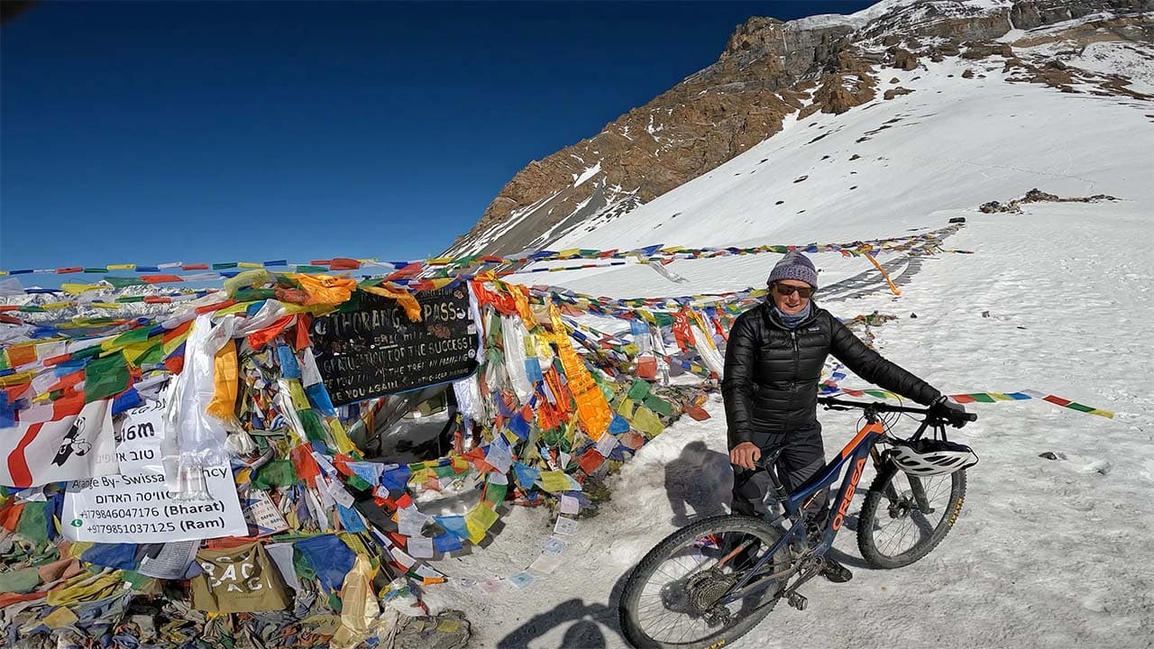
You leave at 4:00 am in the dark and the cold. The last 5 km to the pass cannot be ridden by anybody, so you push and you carry, and the summit porters take the bikes on the steepest of it. It is subzero, it is slow, and it is the hardest thing on this trip.
Then you come over the top at 5,416 m, into the prayer flags, with your bike.
And then you get the reason you came. Sixteen hundred and sixteen metres of continuous descent, one of the longest singletrack drops on earth. Steep switchbacks off the top, loose-over-hard rock that keeps you honest, scree bowls, and then fast alpine singletrack running all the way down into Muktinath. The landscape changes underneath you as you go, out of the snow and into the red and ochre desert of the old Tibetan kingdom of Mustang.
Muktinath is one of the few places on earth sacred to two religions at once. Hindus and Tibetan Buddhists both come here, for the 108 eternal water spouts and for the natural gas flame that burns over water. You will have ridden 22 km and earned the right to sit and look at it.
Trail Surface: Sub-zero snow/scree push upward; steep, loose-over-hard rock switchbacks and mega-flow descents downward.
Attractions: Standing at 5,416m with your bike; dramatic landscape contrast as you enter the Tibetan kingdom of Mustang.
Culture & People: Sacred Muktinath temple complex, venerated by both Hindus and Tibetan Buddhists for its 108 eternal water spouts and natural gas flame.
Muktinath to Marpha via the Lubra Valley
Elevation 2,670 m | 32 km | +250 m / -1,380 m | Lodge in Marpha
A short climb out of Muktinath over the Lubra pass, and then the best-kept secret on the circuit.
The Lubra valley is a remote canyon that circuit traffic never touches, and it rides like a bike park nobody built: sweeping natural earth berms, high-speed wall rides and dry riverbed rock gardens, with 1,380 m of descent to spend across 32 km. Loose alpine singletrack up top, dry canyon sand through the middle, then riverbed gravel that simply keeps flowing.
On the way through, you pass Lubra itself, one of the few untouched villages of the ancient Bon religion, before dropping onto the floor of the Kali Gandaki gorge.
Trail Surface: Loose alpine singletrack, dry canyon sand, and riverbed gravel flow.
Attractions: The untouched, ancient Bon religion village of Lupra and the dramatic Kali Gandaki gorge floor.
Culture & People: Thakali village culture in Marpha, famous for flat-roofed stone architecture and traditional apple brandy distillery.
Marpha to Tatopani, then drive to Pokhara
Elevation 2,670 m down to 1,190 m | 42 km ride plus 96 km drive | +120 m / -1,600 m | Pokhara hotel
The longest riding day, and the last one on dirt. Forty-two kilometres with 1,600 m of descent in them.
You ride down the deepest river gorge in the world with Dhaulagiri (8,167 m) on one side and Annapurna I (8,091 m) on the other, both over 8,000 m, both in view. It is fast technical singletrack, natural rock gardens, loose gravel, flowing pine forest trails, and suspension bridges strung over the Kali Gandaki with the river roaring underneath. Rupse waterfall comes off the cliff on the way down.
Then Tatopani, which means hot water, and it is exactly what it sounds like. The bikes get locked up for the last time, and you lower two weeks of riding into natural geothermal pools on the riverbank, with lunch afterwards.
The 4x4s take you and the bikes back to Pokhara, 96 km via Beni and the Baglung highway, three and a half to four and a half hours through lowland Thakali and Magar country.
Trail Surface: Loose gravel, technical rock gardens, forest singletrack detours, and unpaved mountain roads.
Attractions: Sweeping 8,000m peak views, Rupse Waterfall, Kali Gandaki Gorge, and Tatopani hot springs.
Culture & People: Lowland Thakali and Magar communities; geothermal relaxation and warm roadside hospitality.
Rest and buffer day in Pokhara
Elevation 820 m | Optional ride up to 22 km | Pokhara hotel
This day is in the itinerary for one reason: so that bad weather on the pass can never end your trip. If the crossing went to plan, it is simply a day you have earned.
Sleep in. Book the deep-tissue sports massage, because your legs will want it. Send the riding kit to the laundry. Clean or box your bike with the mechanics. If you genuinely want to ride, there is smooth lakeside road and gentle dirt out there, up to 22 km of it, at the pace of someone with nothing left to prove.
The afternoon is Lakeside Pokhara: cafes, the lake, boats out on the water, hand-crafted souvenirs to take home.
The evening is the Expedition Farewell Dinner and Certificate Ceremony, with the guides, the mechanics and the drivers who got you around the Annapurna massif. It is the best night of the trip, and it is not close.
Trail Surface: Smooth asphalt lakeside road or gentle dirt recovery paths.
Attractions: Lakeside Pokhara, Phewa Lake boating, and local artisan markets.
Culture & People: Vibrant urban Nepali culture and celebration feast with your local guides and mechanics.
Fly to Kathmandu and Departure
Elevation: 1,400 m | No riding today | Overnight: N/A (departure day)
The morning flight takes you back to Kathmandu, and it's worth getting a window seat one more time: the Himalaya is out there for the whole crossing, and after thirteen days on the ground looking up at these peaks, seeing them laid out below you hits differently.
Back in the city, there's time to breathe before your flight home. Our mechanics take your bike apart and box it properly for the journey, so you don't have to think about it. That leaves you free to wander Thamel for an hour or two, pick up the last souvenirs, grab a coffee that isn't instant, and let the trip settle in before we run you to the airport.
No reviews yet — be the first to share your ride.
It runs 14 days with 12 riding days, covers around 300 km, climbs around 7,040 m, crosses a 5,416 m pass, and travels with a full support crew including summit porters, mechanics, 4x4 support, and a buffer day. It is the complete circuit with proper expedition logistics behind it, rather than a sample of the route.
hard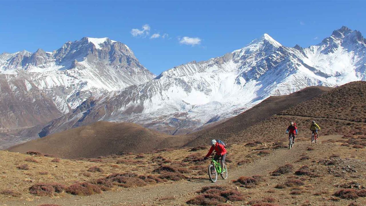 hard
hard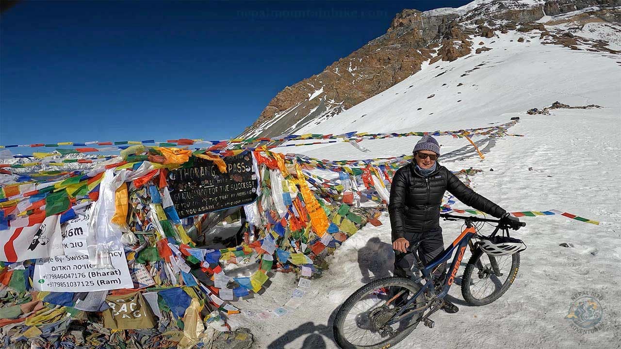 challenging
 challenging
 easy
easy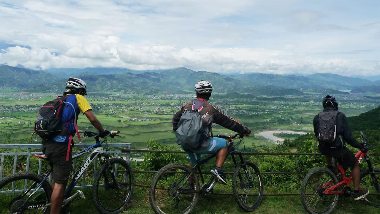 moderate
 moderate
Get trail updates, riding tips, and exclusive tour offers straight to your inbox